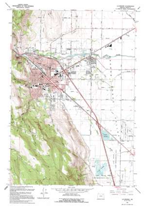
La Grande Topo Map Oregon
To zoom in, hover over the map of La Grande
USGS Topo Quad 45118c1 - 1:24,000 scale
| Topo Map Name: | La Grande |
| USGS Topo Quad ID: | 45118c1 |
| Print Size: | ca. 21 1/4" wide x 27" high |
| Southeast Coordinates: | 45.25° N latitude / 118° W longitude |
| Map Center Coordinates: | 45.3125° N latitude / 118.0625° W longitude |
| U.S. State: | OR |
| Filename: | o45118c1.jpg |
| Download Map JPG Image: | La Grande topo map 1:24,000 scale |
| Map Type: | Topographic |
| Topo Series: | 7.5´ |
| Map Scale: | 1:24,000 |
| Source of Map Images: | United States Geological Survey (USGS) |
| Alternate Map Versions: |
La Grande SE OR 1963, updated 1965 Download PDF Buy paper map La Grande SE OR 1963, updated 1977 Download PDF Buy paper map La Grande OR 1994, updated 1994 Download PDF Buy paper map La Grande OR 2011 Download PDF Buy paper map La Grande OR 2014 Download PDF Buy paper map |
| FStopo: | US Forest Service topo La Grande is available: Download FStopo PDF Download FStopo TIF |
1:24,000 Topo Quads surrounding La Grande
> Back to 45118a1 at 1:100,000 scale
> Back to 45118a1 at 1:250,000 scale
> Back to U.S. Topo Maps home
La Grande topo map: Gazetteer
La Grande: Airports
La Grande Municipal Airport elevation 825m 2706′Rambling Rotors Heliport elevation 830m 2723′
La Grande: Canals
Dobbin Ditch elevation 849m 2785′Gekeler Ditch elevation 828m 2716′
Grande Ronde Ditch elevation 828m 2716′
May Park Ditch elevation 840m 2755′
Nesley Ditch elevation 849m 2785′
La Grande: Cliffs
Devils Slide elevation 929m 3047′La Grande: Guts
Byron Slough elevation 832m 2729′La Grande: Parks
Benton Park elevation 852m 2795′Bernie Park elevation 862m 2828′
Candy Cane Park elevation 844m 2769′
Gangloff Park elevation 874m 2867′
Garden Club Park elevation 850m 2788′
Ladd Marsh Game Management Area elevation 826m 2709′
Pioneer Park elevation 854m 2801′
Riverside Park elevation 849m 2785′
Sunnyhill Park elevation 858m 2814′
La Grande: Populated Places
Island City elevation 835m 2739′La Grande elevation 846m 2775′
La Grande: Post Offices
Island City Post Office (historical) elevation 835m 2739′La Grande Post Office elevation 846m 2775′
Orodell Post Office (historical) elevation 858m 2814′
La Grande: Reservoirs
Byron Reservoir elevation 839m 2752′Spence Reservoir elevation 905m 2969′
La Grande: Springs
Paddy Lots Springs elevation 855m 2805′La Grande: Streams
Crooked Creek elevation 828m 2716′Deal Creek elevation 908m 2979′
Mill Creek elevation 858m 2814′
Mulholland Slough elevation 828m 2716′
Taylor Creek elevation 865m 2837′
La Grande: Summits
Rooster Peak elevation 1165m 3822′Table Mountain elevation 1087m 3566′
La Grande: Swamps
Ladd Marsh elevation 825m 2706′La Grande: Valleys
Haywire Canyon elevation 860m 2821′Owsley Canyon elevation 853m 2798′
La Grande digital topo map on disk
Buy this La Grande topo map showing relief, roads, GPS coordinates and other geographical features, as a high-resolution digital map file on DVD:


