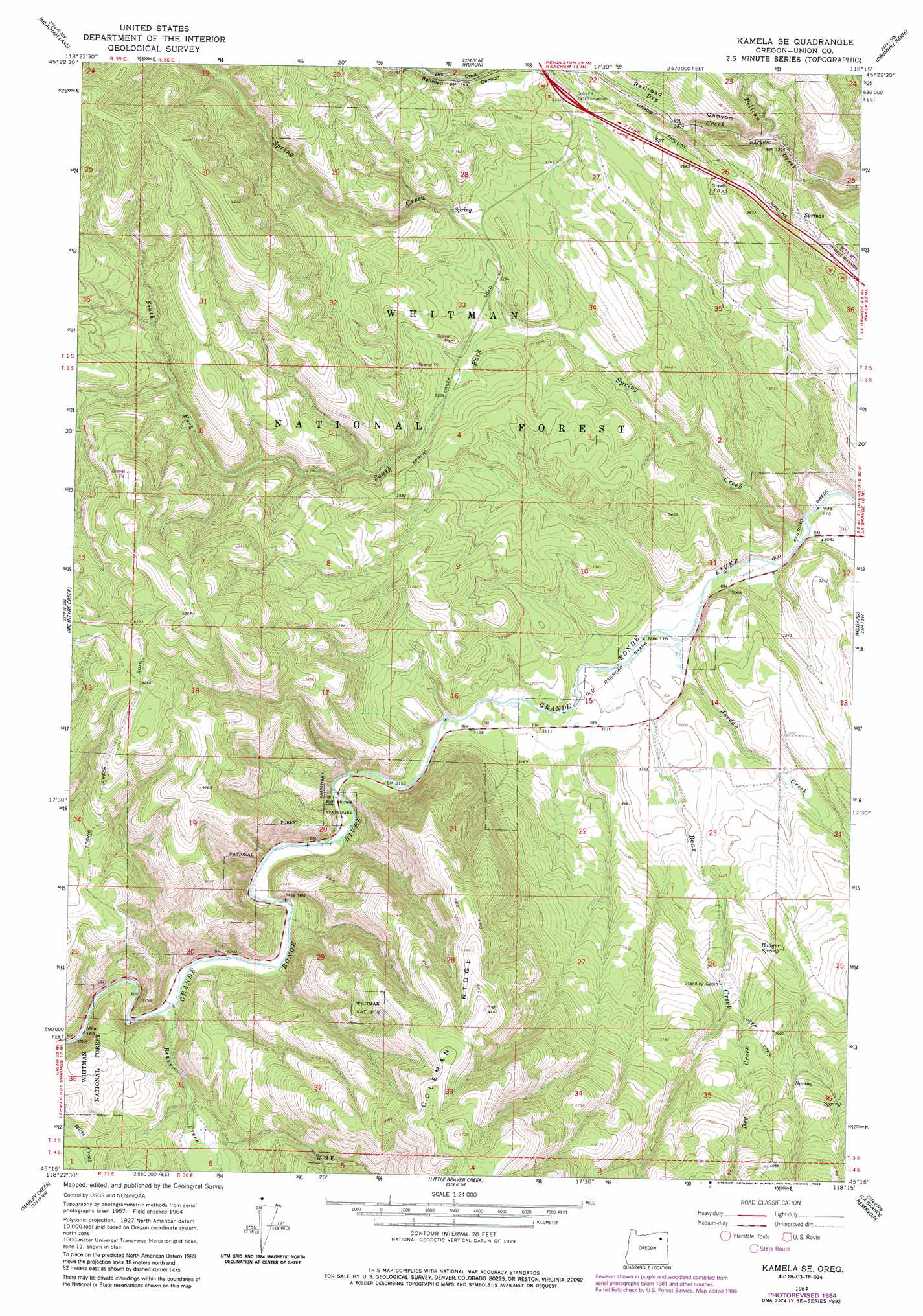
Kamela Se Topo Map Oregon
To zoom in, hover over the map of Kamela Se
USGS Topo Quad 45118c3 - 1:24,000 scale
| Topo Map Name: | Kamela Se |
| USGS Topo Quad ID: | 45118c3 |
| Print Size: | ca. 21 1/4" wide x 27" high |
| Southeast Coordinates: | 45.25° N latitude / 118.25° W longitude |
| Map Center Coordinates: | 45.3125° N latitude / 118.3125° W longitude |
| U.S. State: | OR |
| Filename: | o45118c3.jpg |
| Download Map JPG Image: | Kamela Se topo map 1:24,000 scale |
| Map Type: | Topographic |
| Topo Series: | 7.5´ |
| Map Scale: | 1:24,000 |
| Source of Map Images: | United States Geological Survey (USGS) |
| Alternate Map Versions: |
Kamela SE OR 1964, updated 1966 Download PDF Buy paper map Kamela SE OR 1964, updated 1977 Download PDF Buy paper map Kamela SE OR 1964, updated 1985 Download PDF Buy paper map Kamela SE OR 2011 Download PDF Buy paper map Kamela SE OR 2014 Download PDF Buy paper map |
| FStopo: | US Forest Service topo Kamela SE is available: Download FStopo PDF Download FStopo TIF |
1:24,000 Topo Quads surrounding Kamela Se
Cabbage Hill |
Meacham |
Duncan |
Thimbleberry Mountain |
Sanderson Spring |
Bassey Creek |
Meacham Lake |
Huron |
Drumhill Ridge |
Summerville |
Bally Mountain |
Mcintyre Creek |
Kamela Se |
Hilgard |
La Grande |
Sullivan Gulch |
Marley Creek |
Little Beaver Creek |
La Grande Reservoir |
Glass Hill |
Tower Mountain |
Fly Valley |
Limber Jim Creek |
Anthony Butte |
Tucker Flat |
> Back to 45118a1 at 1:100,000 scale
> Back to 45118a1 at 1:250,000 scale
> Back to U.S. Topo Maps home
Kamela Se topo map: Gazetteer
Kamela Se: Crossings
Glover Interchange elevation 1051m 3448′Kamela Se: Parks
Red Bridge State Park elevation 969m 3179′Kamela Se: Springs
Badger Spring elevation 1039m 3408′Kamela Se: Streams
Bear Creek elevation 942m 3090′Beaver Creek elevation 989m 3244′
Dog Creek elevation 1035m 3395′
Dry Creek elevation 978m 3208′
Jordan Creek elevation 937m 3074′
South Fork Spring Creek elevation 985m 3231′
Spring Creek elevation 930m 3051′
Kamela Se: Valleys
Railroad Canyon elevation 978m 3208′Kamela Se digital topo map on disk
Buy this Kamela Se topo map showing relief, roads, GPS coordinates and other geographical features, as a high-resolution digital map file on DVD: