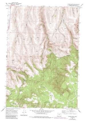
Carney Butte Topo Map Oregon
To zoom in, hover over the map of Carney Butte
USGS Topo Quad 45118c8 - 1:24,000 scale
| Topo Map Name: | Carney Butte |
| USGS Topo Quad ID: | 45118c8 |
| Print Size: | ca. 21 1/4" wide x 27" high |
| Southeast Coordinates: | 45.25° N latitude / 118.875° W longitude |
| Map Center Coordinates: | 45.3125° N latitude / 118.9375° W longitude |
| U.S. State: | OR |
| Filename: | o45118c8.jpg |
| Download Map JPG Image: | Carney Butte topo map 1:24,000 scale |
| Map Type: | Topographic |
| Topo Series: | 7.5´ |
| Map Scale: | 1:24,000 |
| Source of Map Images: | United States Geological Survey (USGS) |
| Alternate Map Versions: |
Carney Butte OR 1967, updated 1970 Download PDF Buy paper map Carney Butte OR 1967, updated 1984 Download PDF Buy paper map Carney Butte OR 1995, updated 1998 Download PDF Buy paper map Carney Butte OR 2011 Download PDF Buy paper map Carney Butte OR 2014 Download PDF Buy paper map |
| FStopo: | US Forest Service topo Carney Butte is available: Download FStopo PDF Download FStopo TIF |
1:24,000 Topo Quads surrounding Carney Butte
> Back to 45118a1 at 1:100,000 scale
> Back to 45118a1 at 1:250,000 scale
> Back to U.S. Topo Maps home
Carney Butte topo map: Gazetteer
Carney Butte: Flats
Swiss Flat elevation 1419m 4655′Carney Butte: Gaps
Battle Mountain Summit elevation 1306m 4284′Carney Butte: Parks
Battle Mountain Forest State Park elevation 1272m 4173′Battle Mountain Forest State Scenic Corridor elevation 1309m 4294′
Battle Mountain State Park (historical) elevation 1254m 4114′
Carney Butte: Reservoirs
Zinter Pond elevation 1338m 4389′Carney Butte: Springs
Willow Spring elevation 1118m 3667′Yellow Jacket Spring elevation 1392m 4566′
Carney Butte: Summits
Carney Butte elevation 1463m 4799′Carney Butte: Valleys
Arlie Canyon elevation 924m 3031′Campbell Canyon elevation 881m 2890′
Keen Canyon elevation 975m 3198′
Parker Canyon elevation 963m 3159′
Pedro Canyon elevation 874m 2867′
Ridenor Canyon elevation 1075m 3526′
Robinson Canyon elevation 1030m 3379′
Tinroof Canyon elevation 928m 3044′
Carney Butte digital topo map on disk
Buy this Carney Butte topo map showing relief, roads, GPS coordinates and other geographical features, as a high-resolution digital map file on DVD:


