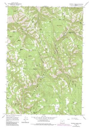
Drumhill Ridge Topo Map Oregon
To zoom in, hover over the map of Drumhill Ridge
USGS Topo Quad 45118d2 - 1:24,000 scale
| Topo Map Name: | Drumhill Ridge |
| USGS Topo Quad ID: | 45118d2 |
| Print Size: | ca. 21 1/4" wide x 27" high |
| Southeast Coordinates: | 45.375° N latitude / 118.125° W longitude |
| Map Center Coordinates: | 45.4375° N latitude / 118.1875° W longitude |
| U.S. State: | OR |
| Filename: | o45118d2.jpg |
| Download Map JPG Image: | Drumhill Ridge topo map 1:24,000 scale |
| Map Type: | Topographic |
| Topo Series: | 7.5´ |
| Map Scale: | 1:24,000 |
| Source of Map Images: | United States Geological Survey (USGS) |
| Alternate Map Versions: |
Drumhill Ridge OR 1964, updated 1966 Download PDF Buy paper map Drumhill Ridge OR 1964, updated 1986 Download PDF Buy paper map Drumhill Ridge OR 1995, updated 1998 Download PDF Buy paper map Drumhill Ridge OR 2011 Download PDF Buy paper map Drumhill Ridge OR 2014 Download PDF Buy paper map |
| FStopo: | US Forest Service topo Drumhill Ridge is available: Download FStopo PDF Download FStopo TIF |
1:24,000 Topo Quads surrounding Drumhill Ridge
> Back to 45118a1 at 1:100,000 scale
> Back to 45118a1 at 1:250,000 scale
> Back to U.S. Topo Maps home
Drumhill Ridge topo map: Gazetteer
Drumhill Ridge: Flats
Dixie Flat elevation 1212m 3976′Rocky Flat elevation 1330m 4363′
Standfield Meadow elevation 1267m 4156′
Drumhill Ridge: Lakes
Long Pond elevation 1224m 4015′Drumhill Ridge: Ridges
Carters Hog Ridge elevation 1299m 4261′Drumhill Ridge elevation 1474m 4835′
Herron Ridge elevation 1600m 5249′
Horse Ridge elevation 1516m 4973′
Long Ridge elevation 1443m 4734′
Smith Ridge elevation 1372m 4501′
Telephone Ridge elevation 1536m 5039′
Three Cabin Ridge elevation 1283m 4209′
Y Ridge elevation 1259m 4130′
Drumhill Ridge: Springs
Allen Spring elevation 1392m 4566′Cantrell Spring elevation 1199m 3933′
Daniel Spring elevation 1318m 4324′
Deer Lick Spring elevation 1404m 4606′
Dollar Spring elevation 1434m 4704′
End Spring elevation 1187m 3894′
Hoskins Spring elevation 1459m 4786′
Hugh Spring elevation 1325m 4347′
Indian Spring elevation 1471m 4826′
Lewis Spring elevation 1414m 4639′
Mouse Spring elevation 1185m 3887′
North Flat Spring elevation 1320m 4330′
Rock Spring elevation 1238m 4061′
S S Spring elevation 1525m 5003′
Sacajawea Spring elevation 1290m 4232′
Simerson Spring elevation 1314m 4311′
Summit Spring elevation 1423m 4668′
Tie Camp Spring elevation 1374m 4507′
Tie Spring elevation 1406m 4612′
Walker Spring elevation 1210m 3969′
Weed Spring elevation 1581m 5187′
Yarn Spring elevation 1548m 5078′
Drumhill Ridge: Streams
Knob Creek elevation 1181m 3874′Little John Day Creek elevation 1055m 3461′
Middle Fork Mount Emily Creek elevation 1319m 4327′
Mount Emily Creek elevation 1229m 4032′
Tie Creek elevation 1126m 3694′
Drumhill Ridge: Summits
Fox Hill elevation 1313m 4307′Green Mountain elevation 1662m 5452′
Spring Mountain elevation 1434m 4704′
Sugarloaf Mountain elevation 1439m 4721′
Drumhill Ridge: Trails
Five Points Trail elevation 1289m 4229′Summit Mount Emily Trail elevation 1496m 4908′
Drumhill Ridge: Valleys
Burnt Canyon elevation 1423m 4668′Fiddlers Hell elevation 1127m 3697′
Drumhill Ridge digital topo map on disk
Buy this Drumhill Ridge topo map showing relief, roads, GPS coordinates and other geographical features, as a high-resolution digital map file on DVD:


