Meacham Lake Topo Map Oregon
To zoom in, hover over the map of Meacham Lake
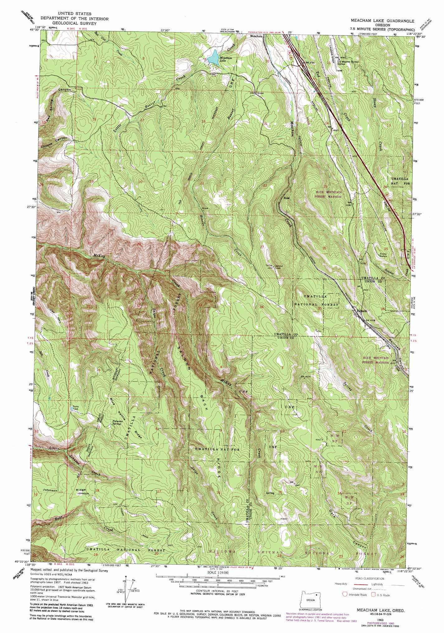
USGS Topo Quad 45118d4 - 1:24,000 scale
| Topo Map Name: | Meacham Lake |
| USGS Topo Quad ID: | 45118d4 |
| Print Size: | ca. 21 1/4" wide x 27" high |
| Southeast Coordinates: | 45.375° N latitude / 118.375° W longitude |
| Map Center Coordinates: | 45.4375° N latitude / 118.4375° W longitude |
| U.S. State: | OR |
| Filename: | o45118d4.jpg |
| Download Map JPG Image: | Meacham Lake topo map 1:24,000 scale |
| Map Type: | Topographic |
| Topo Series: | 7.5´ |
| Map Scale: | 1:24,000 |
| Source of Map Images: | United States Geological Survey (USGS) |
| Alternate Map Versions: |
Meacham Lake OR 1963, updated 1965 Download PDF Buy paper map Meacham Lake OR 1963, updated 1984 Download PDF Buy paper map Meacham Lake OR 1995, updated 1998 Download PDF Buy paper map Meacham Lake OR 2011 Download PDF Buy paper map Meacham Lake OR 2014 Download PDF Buy paper map |
| FStopo: | US Forest Service topo Meacham Lake is available: Download FStopo PDF Download FStopo TIF |
1:24,000 Topo Quads surrounding Meacham Lake
Mission |
Cayuse |
Thorn Hollow |
Gibbon |
Bingham Springs |
Table Rock |
Cabbage Hill |
Meacham |
Duncan |
Thimbleberry Mountain |
Sevenmile Creek |
Bassey Creek |
Meacham Lake |
Huron |
Drumhill Ridge |
Tamarack Gulch |
Bally Mountain |
Mcintyre Creek |
Kamela Se |
Hilgard |
Lehman Springs |
Sullivan Gulch |
Marley Creek |
Little Beaver Creek |
La Grande Reservoir |
> Back to 45118a1 at 1:100,000 scale
> Back to 45118a1 at 1:250,000 scale
> Back to U.S. Topo Maps home
Meacham Lake topo map: Gazetteer
Meacham Lake: Lakes
Meacham Lake elevation 1161m 3809′Meacham Lake: Parks
Blue Mountain Forest State Park elevation 1303m 4274′Meacham Lake: Post Offices
Kamela Post Office (historical) elevation 1280m 4199′Meacham Lake: Reservoirs
Forks Tank elevation 1327m 4353′Meacham Lake: Ridges
Blue Kettle Ridge elevation 1373m 4504′Salmon Back Ridge elevation 1334m 4376′
Meacham Lake: Springs
Folsoms Spring elevation 1345m 4412′Snipe Spring elevation 1389m 4557′
Meacham Lake: Streams
Little Beaver Creek elevation 1165m 3822′Snipe Creek elevation 909m 2982′
Meacham Lake digital topo map on disk
Buy this Meacham Lake topo map showing relief, roads, GPS coordinates and other geographical features, as a high-resolution digital map file on DVD: