Sevenmile Creek Topo Map Oregon
To zoom in, hover over the map of Sevenmile Creek
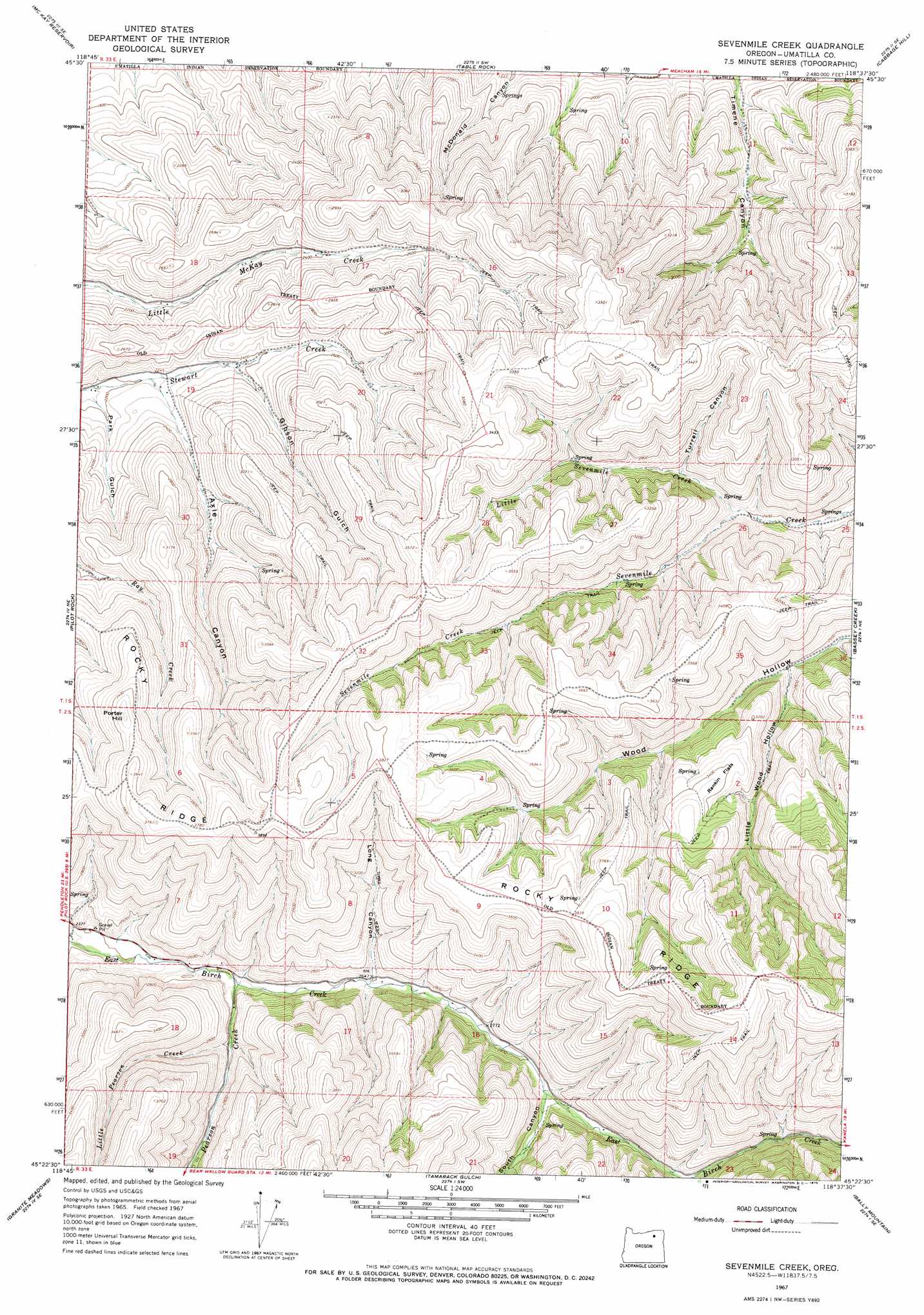
USGS Topo Quad 45118d6 - 1:24,000 scale
| Topo Map Name: | Sevenmile Creek |
| USGS Topo Quad ID: | 45118d6 |
| Print Size: | ca. 21 1/4" wide x 27" high |
| Southeast Coordinates: | 45.375° N latitude / 118.625° W longitude |
| Map Center Coordinates: | 45.4375° N latitude / 118.6875° W longitude |
| U.S. State: | OR |
| Filename: | o45118d6.jpg |
| Download Map JPG Image: | Sevenmile Creek topo map 1:24,000 scale |
| Map Type: | Topographic |
| Topo Series: | 7.5´ |
| Map Scale: | 1:24,000 |
| Source of Map Images: | United States Geological Survey (USGS) |
| Alternate Map Versions: |
Sevenmile Creek OR 1967, updated 1970 Download PDF Buy paper map Sevenmile Creek OR 1996, updated 1998 Download PDF Buy paper map Sevenmile Creek OR 2011 Download PDF Buy paper map Sevenmile Creek OR 2014 Download PDF Buy paper map |
| FStopo: | US Forest Service topo Sevenmile Creek is available: Download FStopo PDF Download FStopo TIF |
1:24,000 Topo Quads surrounding Sevenmile Creek
Barnhart |
Pendleton |
Mission |
Cayuse |
Thorn Hollow |
Coombs Canyon |
Mckay Reservoir |
Table Rock |
Cabbage Hill |
Meacham |
Nye |
Pilot Rock |
Sevenmile Creek |
Bassey Creek |
Meacham Lake |
Carney Butte |
Granite Meadows |
Tamarack Gulch |
Bally Mountain |
Mcintyre Creek |
Ukiah |
Owens Butte |
Lehman Springs |
Sullivan Gulch |
Marley Creek |
> Back to 45118a1 at 1:100,000 scale
> Back to 45118a1 at 1:250,000 scale
> Back to U.S. Topo Maps home
Sevenmile Creek topo map: Gazetteer
Sevenmile Creek: Flats
Rankin Flats elevation 1039m 3408′Sevenmile Creek: Ridges
Rocky Ridge elevation 1150m 3772′Sevenmile Creek: Streams
Little Pearson Creek elevation 787m 2582′Little Sevenmile Creek elevation 740m 2427′
Pearson Creek elevation 764m 2506′
Sevenmile Creek: Summits
Porter Hill elevation 1076m 3530′Sevenmile Creek: Valleys
Axle Canyon elevation 676m 2217′Gibson Gulch elevation 709m 2326′
Little Wood Hollow elevation 794m 2604′
Long Canyon elevation 802m 2631′
Park Gulch elevation 663m 2175′
South Canyon elevation 868m 2847′
Turrell Canyon elevation 772m 2532′
Sevenmile Creek digital topo map on disk
Buy this Sevenmile Creek topo map showing relief, roads, GPS coordinates and other geographical features, as a high-resolution digital map file on DVD: