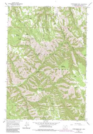
Thimbleberry Mountain Topo Map Oregon
To zoom in, hover over the map of Thimbleberry Mountain
USGS Topo Quad 45118e2 - 1:24,000 scale
| Topo Map Name: | Thimbleberry Mountain |
| USGS Topo Quad ID: | 45118e2 |
| Print Size: | ca. 21 1/4" wide x 27" high |
| Southeast Coordinates: | 45.5° N latitude / 118.125° W longitude |
| Map Center Coordinates: | 45.5625° N latitude / 118.1875° W longitude |
| U.S. State: | OR |
| Filename: | o45118e2.jpg |
| Download Map JPG Image: | Thimbleberry Mountain topo map 1:24,000 scale |
| Map Type: | Topographic |
| Topo Series: | 7.5´ |
| Map Scale: | 1:24,000 |
| Source of Map Images: | United States Geological Survey (USGS) |
| Alternate Map Versions: |
Thimbleberry Mtn OR 1964, updated 1966 Download PDF Buy paper map Thimbleberry Mtn OR 1964, updated 1984 Download PDF Buy paper map Thimbleberry Mountain OR 1995, updated 1998 Download PDF Buy paper map Thimbleberry Mountain OR 2011 Download PDF Buy paper map Thimbleberry Mountain OR 2014 Download PDF Buy paper map |
| FStopo: | US Forest Service topo Thimbleberry Mountain is available: Download FStopo PDF Download FStopo TIF |
1:24,000 Topo Quads surrounding Thimbleberry Mountain
> Back to 45118e1 at 1:100,000 scale
> Back to 45118a1 at 1:250,000 scale
> Back to U.S. Topo Maps home
Thimbleberry Mountain topo map: Gazetteer
Thimbleberry Mountain: Gaps
Dusty Saddle elevation 1490m 4888′Pileup Saddle elevation 1508m 4947′
Thimbleberry Mountain: Ridges
Goodman Ridge elevation 1490m 4888′Little Goodman Ridge elevation 1529m 5016′
McDonald Ridge elevation 1524m 5000′
Thimbleberry Mountain: Springs
Banjo Spring elevation 1486m 4875′Bear Camp Spring elevation 1489m 4885′
Black Mountain Spring elevation 1542m 5059′
Cold Spring elevation 1527m 5009′
Creek Spring elevation 1488m 4881′
Dead Horse Spring elevation 1690m 5544′
End Spring elevation 1630m 5347′
Farley Spring elevation 1696m 5564′
Huckleberry Spring elevation 1551m 5088′
North Side Spring elevation 1550m 5085′
Pole Spring elevation 1706m 5597′
Thimbleberry Mountain: Streams
Bear Creek elevation 837m 2746′Canyon Creek elevation 1019m 3343′
Hellhole Creek elevation 939m 3080′
Hoskins Creek elevation 900m 2952′
Jake Creek elevation 828m 2716′
Pot Creek elevation 915m 3001′
Slusher Creek elevation 1023m 3356′
Trap Creek elevation 866m 2841′
Thimbleberry Mountain: Summits
Black Mountain elevation 1660m 5446′Gray Rock elevation 1550m 5085′
Huckleberry Mountain elevation 1564m 5131′
Rocky Bedground elevation 1613m 5291′
The Knob elevation 1565m 5134′
Thimbleberry Mountain elevation 1697m 5567′
Wilbur Mountain elevation 1477m 4845′
Thimbleberry Mountain: Valleys
Dusty Saddle Canyon elevation 1115m 3658′Thimbleberry Mountain digital topo map on disk
Buy this Thimbleberry Mountain topo map showing relief, roads, GPS coordinates and other geographical features, as a high-resolution digital map file on DVD:


