Duncan Topo Map Oregon
To zoom in, hover over the map of Duncan
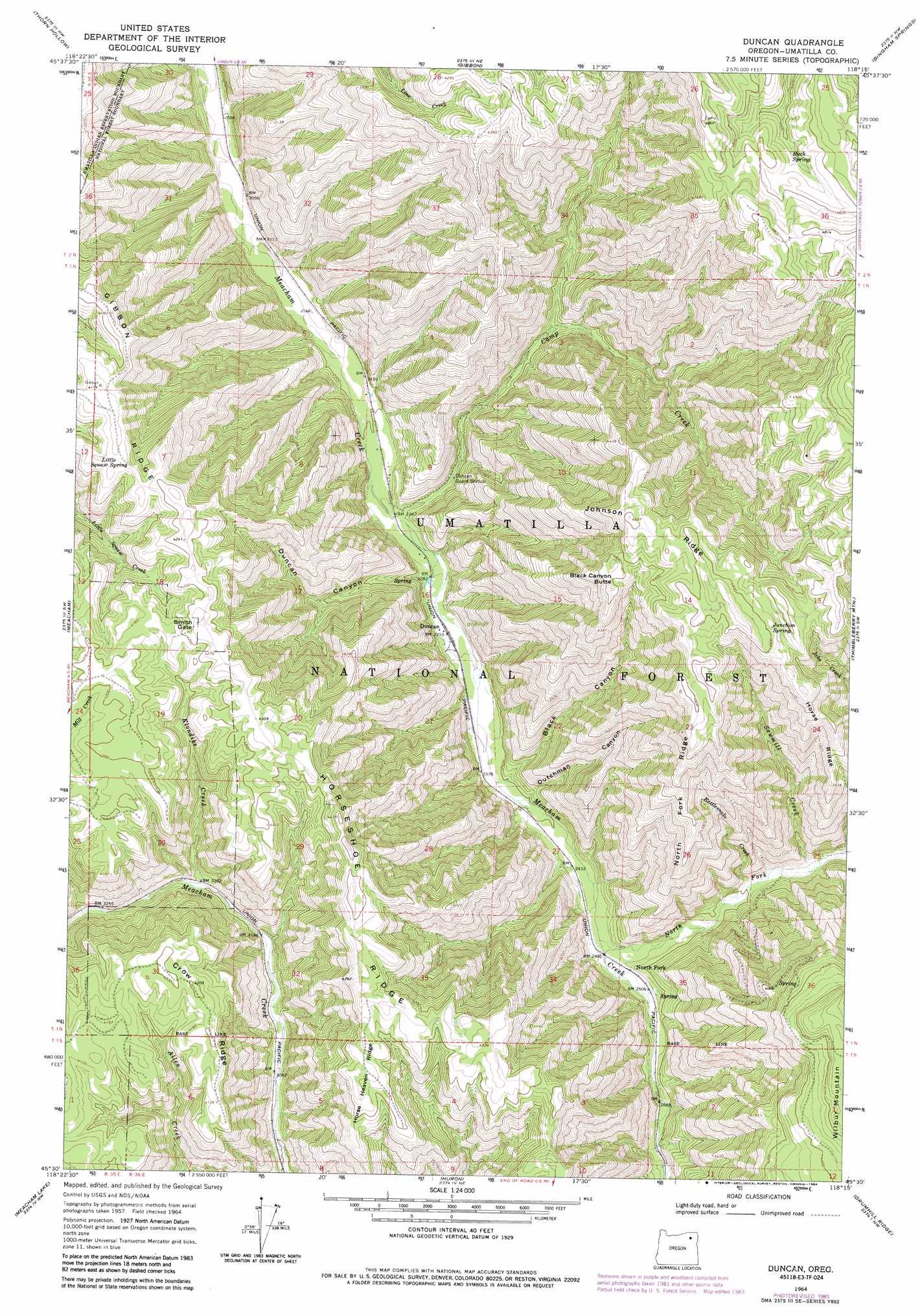
USGS Topo Quad 45118e3 - 1:24,000 scale
| Topo Map Name: | Duncan |
| USGS Topo Quad ID: | 45118e3 |
| Print Size: | ca. 21 1/4" wide x 27" high |
| Southeast Coordinates: | 45.5° N latitude / 118.25° W longitude |
| Map Center Coordinates: | 45.5625° N latitude / 118.3125° W longitude |
| U.S. State: | OR |
| Filename: | o45118e3.jpg |
| Download Map JPG Image: | Duncan topo map 1:24,000 scale |
| Map Type: | Topographic |
| Topo Series: | 7.5´ |
| Map Scale: | 1:24,000 |
| Source of Map Images: | United States Geological Survey (USGS) |
| Alternate Map Versions: |
Duncan OR 1964, updated 1966 Download PDF Buy paper map Duncan OR 1964, updated 1978 Download PDF Buy paper map Duncan OR 1964, updated 1984 Download PDF Buy paper map Duncan OR 1995, updated 1998 Download PDF Buy paper map Duncan OR 2011 Download PDF Buy paper map Duncan OR 2014 Download PDF Buy paper map |
| FStopo: | US Forest Service topo Duncan is available: Download FStopo PDF Download FStopo TIF |
1:24,000 Topo Quads surrounding Duncan
Adams |
Athena |
Weston Mountain |
Blalock Mountain |
Tollgate |
Cayuse |
Thorn Hollow |
Gibbon |
Bingham Springs |
Andies Prairie |
Cabbage Hill |
Meacham |
Duncan |
Thimbleberry Mountain |
Sanderson Spring |
Bassey Creek |
Meacham Lake |
Huron |
Drumhill Ridge |
Summerville |
Bally Mountain |
Mcintyre Creek |
Kamela Se |
Hilgard |
La Grande |
> Back to 45118e1 at 1:100,000 scale
> Back to 45118a1 at 1:250,000 scale
> Back to U.S. Topo Maps home
Duncan topo map: Gazetteer
Duncan: Airports
Sawalish Airstrip elevation 670m 2198′Duncan: Gaps
Smith Gate elevation 1297m 4255′Duncan: Populated Places
Duncan elevation 705m 2312′Duncan: Post Offices
Duncan Post Office (historical) elevation 705m 2312′Swart Post Office (historical) elevation 695m 2280′
Duncan: Ridges
Crow Ridge elevation 1283m 4209′Horse Heaven Ridge elevation 1309m 4294′
Horse Ridge elevation 1203m 3946′
Horseshoe Ridge elevation 1355m 4445′
Johnson Ridge elevation 1405m 4609′
North Fork Ridge elevation 1289m 4229′
Duncan: Springs
Buck Spring elevation 1351m 4432′Junction Spring elevation 1403m 4603′
Little Isqúulktpe Spring elevation 1254m 4114′
Duncan: Streams
Camp Creek elevation 685m 2247′Klondike Creek elevation 980m 3215′
North Fork Meacham Creek elevation 751m 2463′
Rattlesnake Creek elevation 786m 2578′
Sawmill Creek elevation 806m 2644′
Tie Creek elevation 698m 2290′
Duncan: Summits
Black Canyon Butte elevation 1356m 4448′Duncan: Valleys
Black Canyon elevation 724m 2375′Duncan Canyon elevation 698m 2290′
Dutchman Canyon elevation 730m 2395′
Duncan digital topo map on disk
Buy this Duncan topo map showing relief, roads, GPS coordinates and other geographical features, as a high-resolution digital map file on DVD: