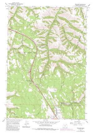
Meacham Topo Map Oregon
To zoom in, hover over the map of Meacham
USGS Topo Quad 45118e4 - 1:24,000 scale
| Topo Map Name: | Meacham |
| USGS Topo Quad ID: | 45118e4 |
| Print Size: | ca. 21 1/4" wide x 27" high |
| Southeast Coordinates: | 45.5° N latitude / 118.375° W longitude |
| Map Center Coordinates: | 45.5625° N latitude / 118.4375° W longitude |
| U.S. State: | OR |
| Filename: | o45118e4.jpg |
| Download Map JPG Image: | Meacham topo map 1:24,000 scale |
| Map Type: | Topographic |
| Topo Series: | 7.5´ |
| Map Scale: | 1:24,000 |
| Source of Map Images: | United States Geological Survey (USGS) |
| Alternate Map Versions: |
Meacham OR 1964, updated 1966 Download PDF Buy paper map Meacham OR 1964, updated 1980 Download PDF Buy paper map Meacham OR 1964, updated 1984 Download PDF Buy paper map Meacham OR 1995, updated 1998 Download PDF Buy paper map Meacham OR 2011 Download PDF Buy paper map Meacham OR 2014 Download PDF Buy paper map |
| FStopo: | US Forest Service topo Meacham is available: Download FStopo PDF Download FStopo TIF |
1:24,000 Topo Quads surrounding Meacham
> Back to 45118e1 at 1:100,000 scale
> Back to 45118a1 at 1:250,000 scale
> Back to U.S. Topo Maps home
Meacham topo map: Gazetteer
Meacham: Parks
Emigrant Springs State Park elevation 1160m 3805′Meacham: Populated Places
Meacham elevation 1126m 3694′Meacham: Post Offices
Meacham Post Office elevation 1126m 3694′Meacham: Ridges
Light Ridge elevation 1173m 3848′Telephone Ridge elevation 1123m 3684′
Meacham: Streams
Beaver Creek elevation 1127m 3697′Little Isqúulktpe Creek elevation 701m 2299′
Mill Creek elevation 1057m 3467′
Sheep Creek elevation 1059m 3474′
Tod Creek elevation 1122m 3681′
Twomile Creek elevation 1113m 3651′
Meacham digital topo map on disk
Buy this Meacham topo map showing relief, roads, GPS coordinates and other geographical features, as a high-resolution digital map file on DVD:


