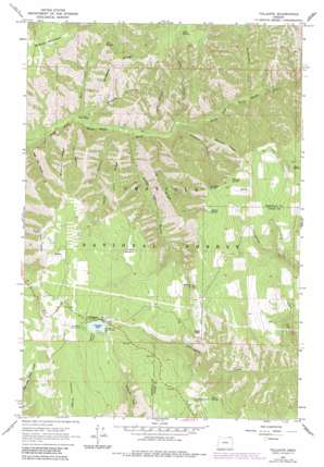
Tollgate Topo Map Oregon
To zoom in, hover over the map of Tollgate
USGS Topo Quad 45118g1 - 1:24,000 scale
| Topo Map Name: | Tollgate |
| USGS Topo Quad ID: | 45118g1 |
| Print Size: | ca. 21 1/4" wide x 27" high |
| Southeast Coordinates: | 45.75° N latitude / 118° W longitude |
| Map Center Coordinates: | 45.8125° N latitude / 118.0625° W longitude |
| U.S. State: | OR |
| Filename: | o45118g1.jpg |
| Download Map JPG Image: | Tollgate topo map 1:24,000 scale |
| Map Type: | Topographic |
| Topo Series: | 7.5´ |
| Map Scale: | 1:24,000 |
| Source of Map Images: | United States Geological Survey (USGS) |
| Alternate Map Versions: |
Tollgate OR 1963, updated 1965 Download PDF Buy paper map Tollgate OR 1963, updated 1975 Download PDF Buy paper map Tollgate OR 1963, updated 1984 Download PDF Buy paper map Tollgate OR 1995, updated 1998 Download PDF Buy paper map Tollgate OR 2011 Download PDF Buy paper map Tollgate OR 2014 Download PDF Buy paper map |
| FStopo: | US Forest Service topo Tollgate is available: Download FStopo PDF Download FStopo TIF |
1:24,000 Topo Quads surrounding Tollgate
> Back to 45118e1 at 1:100,000 scale
> Back to 45118a1 at 1:250,000 scale
> Back to U.S. Topo Maps home
Tollgate topo map: Gazetteer
Tollgate: Dams
Langdon Lake Dam elevation 1494m 4901′Tollgate: Flats
Table Glade elevation 1589m 5213′Target Meadows elevation 1445m 4740′
Tollgate: Populated Places
Tollgate elevation 1487m 4878′Tollgate: Post Offices
Tollgate Post Office (historical) elevation 1487m 4878′Tollgate: Reservoirs
Langdon Lake elevation 1494m 4901′Tollgate: Ridges
Boulder Ridge elevation 1409m 4622′Coyote Ridge elevation 1575m 5167′
Low Ridge elevation 1203m 3946′
Rimrock Ridge elevation 1235m 4051′
Rodgers Ridge elevation 1303m 4274′
Trail Ridge elevation 1274m 4179′
Tollgate: Springs
Bryson Spring elevation 1506m 4940′Cub Spring elevation 1249m 4097′
Deadman Spring elevation 1615m 5298′
Gabriel Spring elevation 1608m 5275′
Lodgepole Spring elevation 1502m 4927′
Lodgepole Spring elevation 1512m 4960′
Spout Spring elevation 1643m 5390′
Sugar Spring elevation 1629m 5344′
Swede Spring elevation 1223m 4012′
Table Spring elevation 1521m 4990′
Whisky Spring elevation 1607m 5272′
Wild Woman Spring elevation 1614m 5295′
Tollgate: Streams
Bear Creek elevation 746m 2447′Lookingglass Creek elevation 1486m 4875′
Morning Creek elevation 1486m 4875′
Skiphorton Creek elevation 900m 2952′
Table Creek elevation 837m 2746′
Tollgate: Summits
Bald Mountain elevation 1599m 5246′Tollgate: Valleys
Bear Trap Canyon elevation 715m 2345′Box Canyon elevation 927m 3041′
Burnt Cabin Gulch elevation 795m 2608′
Deadman Gulch elevation 850m 2788′
Kees Canyon elevation 780m 2559′
Rodgers Gulch elevation 766m 2513′
Swede Canyon elevation 803m 2634′
Tye Canyon elevation 750m 2460′
Tollgate digital topo map on disk
Buy this Tollgate topo map showing relief, roads, GPS coordinates and other geographical features, as a high-resolution digital map file on DVD:


