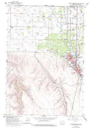
Milton-Freewater Topo Map Oregon
To zoom in, hover over the map of Milton-Freewater
USGS Topo Quad 45118h4 - 1:24,000 scale
| Topo Map Name: | Milton-Freewater |
| USGS Topo Quad ID: | 45118h4 |
| Print Size: | ca. 21 1/4" wide x 27" high |
| Southeast Coordinates: | 45.875° N latitude / 118.375° W longitude |
| Map Center Coordinates: | 45.9375° N latitude / 118.4375° W longitude |
| U.S. State: | OR |
| Filename: | o45118h4.jpg |
| Download Map JPG Image: | Milton-Freewater topo map 1:24,000 scale |
| Map Type: | Topographic |
| Topo Series: | 7.5´ |
| Map Scale: | 1:24,000 |
| Source of Map Images: | United States Geological Survey (USGS) |
| Alternate Map Versions: |
Milton-Freewater OR 1964, updated 1965 Download PDF Buy paper map Milton-Freewater OR 2011 Download PDF Buy paper map Milton-Freewater OR 2014 Download PDF Buy paper map |
1:24,000 Topo Quads surrounding Milton-Freewater
> Back to 45118e1 at 1:100,000 scale
> Back to 45118a1 at 1:250,000 scale
> Back to U.S. Topo Maps home
Milton-Freewater topo map: Gazetteer
Milton-Freewater: Airports
Kings Airstrip elevation 289m 948′Oregon Sky Ranch elevation 407m 1335′
Milton-Freewater: Areas
Hudson Bay (historical) elevation 274m 898′Milton-Freewater: Canals
Hudson Bay Canal elevation 250m 820′Milton Ditch elevation 330m 1082′
Pleasant View Canal elevation 296m 971′
Milton-Freewater: Parks
Freewater Park elevation 326m 1069′Yantis Park elevation 316m 1036′
Milton-Freewater: Populated Places
Cobb elevation 289m 948′Crockett elevation 265m 869′
Ferndale elevation 257m 843′
Milton-Freewater elevation 318m 1043′
Sunnyside elevation 278m 912′
Umapine elevation 208m 682′
Milton-Freewater: Post Offices
Milton-Freewater Post Office elevation 318m 1043′South Post Office (historical) elevation 329m 1079′
Umapine Post Office (historical) elevation 208m 682′
Milton-Freewater: Streams
East Crockett Branch elevation 267m 875′East Ford elevation 277m 908′
Ford Branch elevation 277m 908′
Goodman Spring Branch elevation 226m 741′
Johnson Creek elevation 212m 695′
Little Walla Walla River elevation 302m 990′
Middle Mud Creek elevation 226m 741′
West Branch West Crockett Branch elevation 249m 816′
West Crockett Branch elevation 267m 875′
West Ford elevation 277m 908′
Milton-Freewater: Summits
Columbia Heights elevation 403m 1322′Milton Hill elevation 448m 1469′
Milton-Freewater: Valleys
Dry Hollow elevation 326m 1069′Nichols Canyon elevation 341m 1118′
Milton-Freewater digital topo map on disk
Buy this Milton-Freewater topo map showing relief, roads, GPS coordinates and other geographical features, as a high-resolution digital map file on DVD:


