Waterman Topo Map Oregon
To zoom in, hover over the map of Waterman
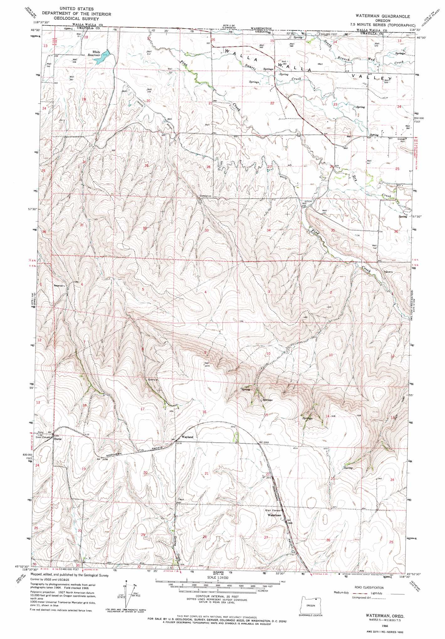
USGS Topo Quad 45118h5 - 1:24,000 scale
| Topo Map Name: | Waterman |
| USGS Topo Quad ID: | 45118h5 |
| Print Size: | ca. 21 1/4" wide x 27" high |
| Southeast Coordinates: | 45.875° N latitude / 118.5° W longitude |
| Map Center Coordinates: | 45.9375° N latitude / 118.5625° W longitude |
| U.S. State: | OR |
| Filename: | o45118h5.jpg |
| Download Map JPG Image: | Waterman topo map 1:24,000 scale |
| Map Type: | Topographic |
| Topo Series: | 7.5´ |
| Map Scale: | 1:24,000 |
| Source of Map Images: | United States Geological Survey (USGS) |
| Alternate Map Versions: |
Waterman OR 1966, updated 1967 Download PDF Buy paper map Waterman OR 2011 Download PDF Buy paper map Waterman OR 2014 Download PDF Buy paper map |
1:24,000 Topo Quads surrounding Waterman
Slater |
Welland |
Rulo |
Hadley |
Valley Grove |
Zangar Junction |
Touchet |
Lowden |
College Place |
Walla Walla |
Ring |
Smeltz |
Waterman |
Milton-Freewater |
Bowlus Hill |
Holdman Se |
Helix |
Adams |
Athena |
Weston Mountain |
Pendleton |
Mission |
Cayuse |
Thorn Hollow |
Gibbon |
> Back to 45118e1 at 1:100,000 scale
> Back to 45118a1 at 1:250,000 scale
> Back to U.S. Topo Maps home
Waterman topo map: Gazetteer
Waterman: Canals
Love Loney Ditch elevation 164m 538′White Ditch elevation 194m 636′
Waterman: Populated Places
Waterman elevation 602m 1975′Waterman: Reservoirs
White Reservoir elevation 159m 521′Waterman: Springs
Swartz Spring elevation 198m 649′Waterman: Streams
Burley Creek elevation 189m 620′Dry Creek elevation 184m 603′
Dugger Creek elevation 208m 682′
Swartz Creek elevation 154m 505′
Waterman digital topo map on disk
Buy this Waterman topo map showing relief, roads, GPS coordinates and other geographical features, as a high-resolution digital map file on DVD: