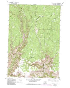
Thompson Flat Topo Map Oregon
To zoom in, hover over the map of Thompson Flat
USGS Topo Quad 45119a2 - 1:24,000 scale
| Topo Map Name: | Thompson Flat |
| USGS Topo Quad ID: | 45119a2 |
| Print Size: | ca. 21 1/4" wide x 27" high |
| Southeast Coordinates: | 45° N latitude / 119.125° W longitude |
| Map Center Coordinates: | 45.0625° N latitude / 119.1875° W longitude |
| U.S. State: | OR |
| Filename: | o45119a2.jpg |
| Download Map JPG Image: | Thompson Flat topo map 1:24,000 scale |
| Map Type: | Topographic |
| Topo Series: | 7.5´ |
| Map Scale: | 1:24,000 |
| Source of Map Images: | United States Geological Survey (USGS) |
| Alternate Map Versions: |
Thompson Flat OR 1969, updated 1973 Download PDF Buy paper map Thompson Flat OR 1969, updated 1984 Download PDF Buy paper map Thompson Flat OR 1995, updated 1998 Download PDF Buy paper map Thompson Flat OR 2011 Download PDF Buy paper map Thompson Flat OR 2014 Download PDF Buy paper map |
| FStopo: | US Forest Service topo Thompson Flat is available: Download FStopo PDF Download FStopo TIF |
1:24,000 Topo Quads surrounding Thompson Flat
> Back to 45119a1 at 1:100,000 scale
> Back to 45118a1 at 1:250,000 scale
> Back to U.S. Topo Maps home
Thompson Flat topo map: Gazetteer
Thompson Flat: Cliffs
Potamus Point elevation 1360m 4461′Thompson Flat: Falls
Thompson Falls elevation 1251m 4104′Thompson Flat: Flats
Thompson Flat elevation 1350m 4429′Thompson Flat: Lakes
Matlock Waterhole elevation 1423m 4668′West Gopher Pond elevation 1488m 4881′
Thompson Flat: Ridges
Zion Scope elevation 1087m 3566′Thompson Flat: Springs
Bonita Spring elevation 1305m 4281′Hunter Spring elevation 1490m 4888′
Thompson Falls Spring elevation 1281m 4202′
Thompson Flat: Streams
Brush Creek elevation 1351m 4432′Deep Creek elevation 1349m 4425′
Dry Matlock Creek elevation 1348m 4422′
Ellis Creek elevation 1153m 3782′
Gilbert Creek elevation 920m 3018′
Matlock Creek elevation 1104m 3622′
No Name Creek elevation 1337m 4386′
Pole Creek elevation 1423m 4668′
Rush Creek elevation 933m 3061′
Scaffold Creek elevation 1266m 4153′
Thompson Creek elevation 898m 2946′
Thompson Flat: Trails
Groshen Trail elevation 1358m 4455′Section Line Trail elevation 1384m 4540′
Thompson Flat: Wells
Divide Well elevation 1438m 4717′Thompson Flat Well elevation 1333m 4373′
Thompson Flat digital topo map on disk
Buy this Thompson Flat topo map showing relief, roads, GPS coordinates and other geographical features, as a high-resolution digital map file on DVD:


