Buttermilk Canyon Topo Map Oregon
To zoom in, hover over the map of Buttermilk Canyon
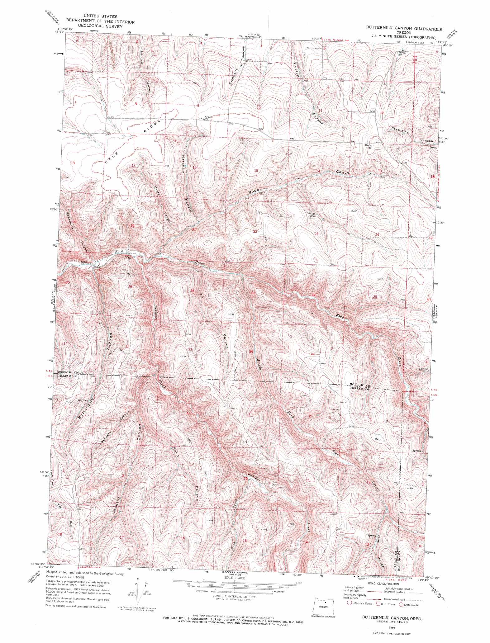
USGS Topo Quad 45119b7 - 1:24,000 scale
| Topo Map Name: | Buttermilk Canyon |
| USGS Topo Quad ID: | 45119b7 |
| Print Size: | ca. 21 1/4" wide x 27" high |
| Southeast Coordinates: | 45.125° N latitude / 119.75° W longitude |
| Map Center Coordinates: | 45.1875° N latitude / 119.8125° W longitude |
| U.S. State: | OR |
| Filename: | o45119b7.jpg |
| Download Map JPG Image: | Buttermilk Canyon topo map 1:24,000 scale |
| Map Type: | Topographic |
| Topo Series: | 7.5´ |
| Map Scale: | 1:24,000 |
| Source of Map Images: | United States Geological Survey (USGS) |
| Alternate Map Versions: |
Buttermilk Canyon OR 1969, updated 1973 Download PDF Buy paper map Buttermilk Canyon OR 2011 Download PDF Buy paper map Buttermilk Canyon OR 2014 Download PDF Buy paper map |
1:24,000 Topo Quads surrounding Buttermilk Canyon
Wolf Hollow Falls |
Utts Butte |
Ione South |
Lexington |
Swaggart Buttes |
Devils Gap |
Gooseberry |
Eightmile |
Ruggs |
Heppner |
Matney Flat |
Lone Rock Creek |
Buttermilk Canyon |
Hardman |
Balm Canyon |
Salmon Fork |
Lonerock |
Lefevre Prairie |
Chapin Creek |
Big Rock Flat |
Kinzua |
Wheeler Point |
Collins Butte |
Whitetail Butte |
Turner Mountain |
> Back to 45119a1 at 1:100,000 scale
> Back to 45118a1 at 1:250,000 scale
> Back to U.S. Topo Maps home
Buttermilk Canyon topo map: Gazetteer
Buttermilk Canyon: Post Offices
Davidson Post Office (historical) elevation 942m 3090′Buttermilk Canyon: Ridges
Hale Ridge elevation 978m 3208′Buttermilk Canyon: Streams
Juniper Creek elevation 710m 2329′Middle Fork Rock Creek elevation 744m 2440′
Wick Creek elevation 836m 2742′
Buttermilk Canyon: Summits
Rood Hill elevation 1021m 3349′Buttermilk Canyon: Valleys
Bennett Canyon elevation 818m 2683′Buttermilk Canyon elevation 697m 2286′
Dexter Canyon elevation 750m 2460′
Fichter Canyon elevation 785m 2575′
Hahn Canyon elevation 855m 2805′
Harshman Canyon elevation 780m 2559′
Long Hollow elevation 920m 3018′
Rood Canyon elevation 723m 2372′
TT Canyon elevation 731m 2398′
Buttermilk Canyon digital topo map on disk
Buy this Buttermilk Canyon topo map showing relief, roads, GPS coordinates and other geographical features, as a high-resolution digital map file on DVD: