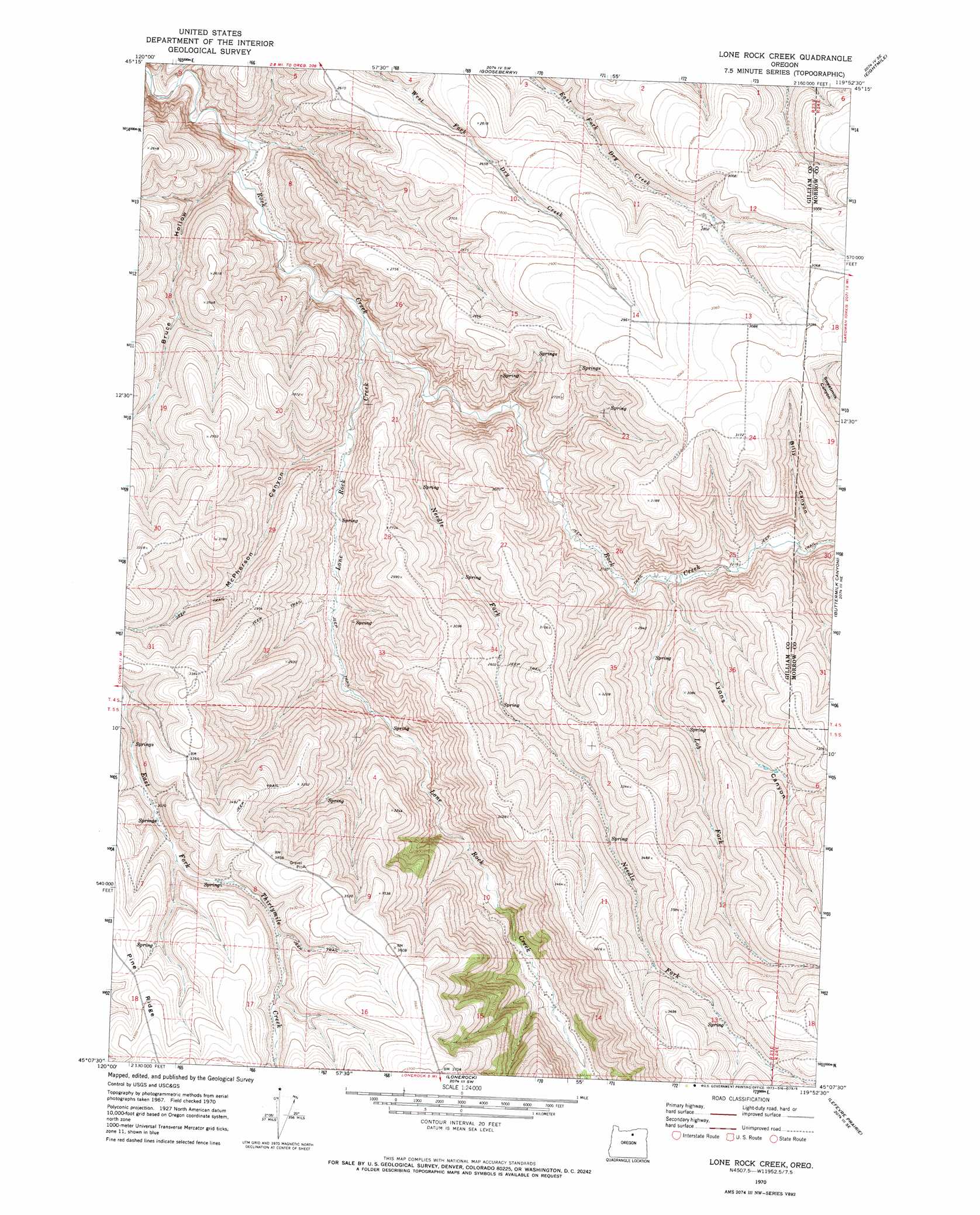
Lone Rock Creek Topo Map Oregon
To zoom in, hover over the map of Lone Rock Creek
USGS Topo Quad 45119b8 - 1:24,000 scale
| Topo Map Name: | Lone Rock Creek |
| USGS Topo Quad ID: | 45119b8 |
| Print Size: | ca. 21 1/4" wide x 27" high |
| Southeast Coordinates: | 45.125° N latitude / 119.875° W longitude |
| Map Center Coordinates: | 45.1875° N latitude / 119.9375° W longitude |
| U.S. State: | OR |
| Filename: | o45119b8.jpg |
| Download Map JPG Image: | Lone Rock Creek topo map 1:24,000 scale |
| Map Type: | Topographic |
| Topo Series: | 7.5´ |
| Map Scale: | 1:24,000 |
| Source of Map Images: | United States Geological Survey (USGS) |
| Alternate Map Versions: |
Lone Rock Creek OR 1970, updated 1973 Download PDF Buy paper map Lone Rock Creek OR 2011 Download PDF Buy paper map Lone Rock Creek OR 2014 Download PDF Buy paper map |
1:24,000 Topo Quads surrounding Lone Rock Creek
Mikkalo |
Wolf Hollow Falls |
Utts Butte |
Ione South |
Lexington |
Gwendolen |
Devils Gap |
Gooseberry |
Eightmile |
Ruggs |
Condon |
Matney Flat |
Lone Rock Creek |
Buttermilk Canyon |
Hardman |
Fossil North |
Salmon Fork |
Lonerock |
Lefevre Prairie |
Chapin Creek |
Fossil South |
Kinzua |
Wheeler Point |
Collins Butte |
Whitetail Butte |
> Back to 45119a1 at 1:100,000 scale
> Back to 45118a1 at 1:250,000 scale
> Back to U.S. Topo Maps home
Lone Rock Creek topo map: Gazetteer
Lone Rock Creek: Ridges
Pine Ridge elevation 1076m 3530′Lone Rock Creek: Streams
Lob Fork elevation 662m 2171′Lone Rock Creek elevation 595m 1952′
Needle Fork elevation 606m 1988′
Lone Rock Creek: Valleys
Billy Canyon elevation 681m 2234′Bruce Hollow elevation 574m 1883′
Lyons Canyon elevation 710m 2329′
McPherson Canyon elevation 625m 2050′
Sweetmilk Canyon elevation 858m 2814′
Lone Rock Creek digital topo map on disk
Buy this Lone Rock Creek topo map showing relief, roads, GPS coordinates and other geographical features, as a high-resolution digital map file on DVD: