Hoodlum Canyon Topo Map Oregon
To zoom in, hover over the map of Hoodlum Canyon
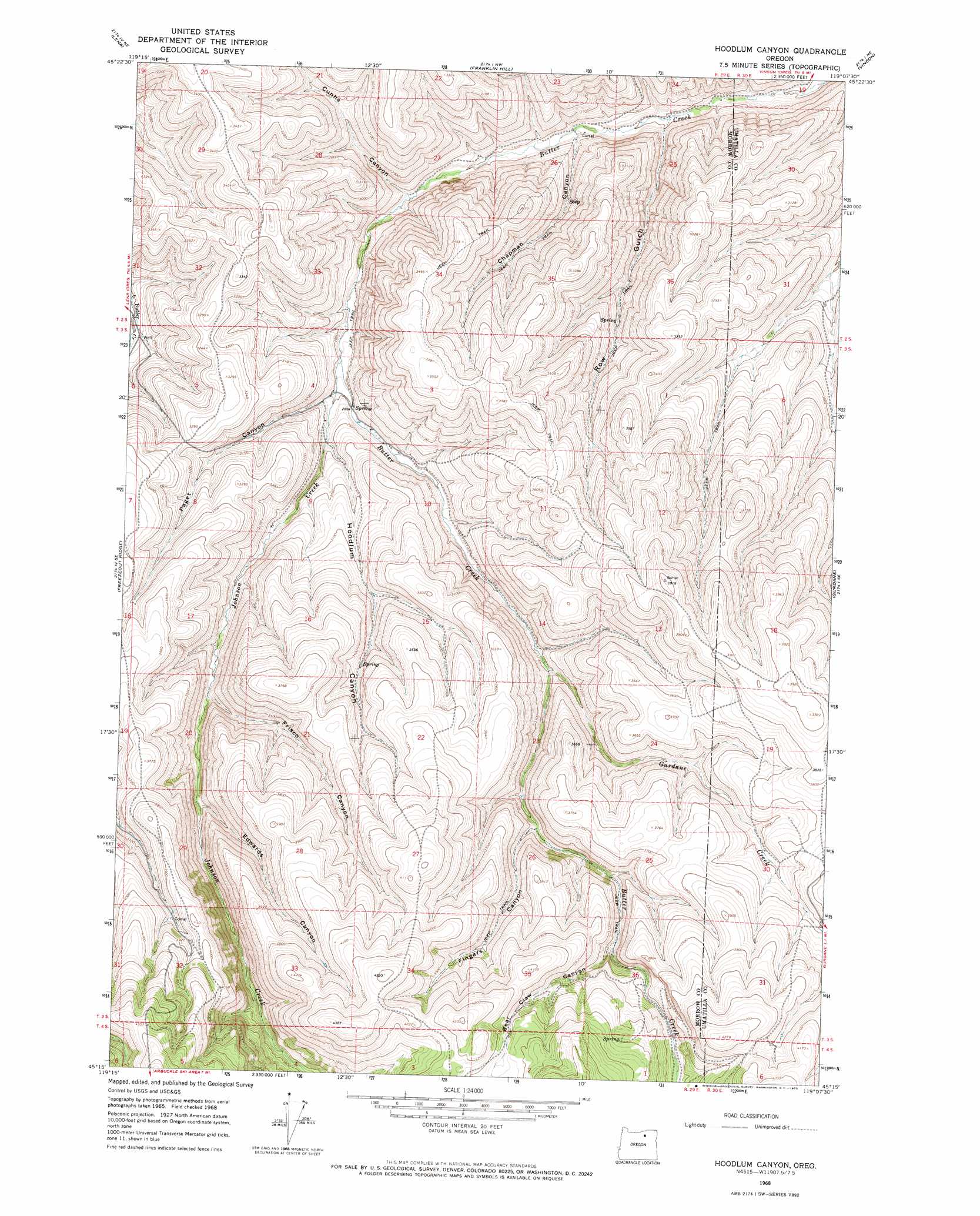
USGS Topo Quad 45119c2 - 1:24,000 scale
| Topo Map Name: | Hoodlum Canyon |
| USGS Topo Quad ID: | 45119c2 |
| Print Size: | ca. 21 1/4" wide x 27" high |
| Southeast Coordinates: | 45.25° N latitude / 119.125° W longitude |
| Map Center Coordinates: | 45.3125° N latitude / 119.1875° W longitude |
| U.S. State: | OR |
| Filename: | o45119c2.jpg |
| Download Map JPG Image: | Hoodlum Canyon topo map 1:24,000 scale |
| Map Type: | Topographic |
| Topo Series: | 7.5´ |
| Map Scale: | 1:24,000 |
| Source of Map Images: | United States Geological Survey (USGS) |
| Alternate Map Versions: |
Hoodlum Canyon OR 1968, updated 1970 Download PDF Buy paper map Hoodlum Canyon OR 2011 Download PDF Buy paper map Hoodlum Canyon OR 2014 Download PDF Buy paper map |
1:24,000 Topo Quads surrounding Hoodlum Canyon
Butter Creek Junction |
Vey Ranch |
Echo Sw |
Echo Se |
Coombs Canyon |
Gleason Butte |
Lena |
Franklin Hill |
Vinson |
Nye |
Skinners Fork |
Freezeout Ridge |
Hoodlum Canyon |
Gurdane |
Carney Butte |
Summerfield Ridge |
Arbuckle Mountain |
Matlock Prairie |
Sugarbowl Creek |
Ukiah |
Madison Butte |
Lake Penland |
Thompson Flat |
Deerhorn Creek |
Bridge Creek |
> Back to 45119a1 at 1:100,000 scale
> Back to 45118a1 at 1:250,000 scale
> Back to U.S. Topo Maps home
Hoodlum Canyon topo map: Gazetteer
Hoodlum Canyon: Streams
Gurdane Creek elevation 950m 3116′Johnson Creek elevation 844m 2769′
Hoodlum Canyon: Valleys
Bear Claw Canyon elevation 1099m 3605′Chapman Canyon elevation 772m 2532′
Cunha Canyon elevation 811m 2660′
Edwards Canyon elevation 1004m 3293′
Fingers Canyon elevation 1034m 3392′
Frisco Canyon elevation 963m 3159′
Hoodlum Canyon elevation 871m 2857′
Paget Canyon elevation 858m 2814′
Row Gulch elevation 758m 2486′
Hoodlum Canyon digital topo map on disk
Buy this Hoodlum Canyon topo map showing relief, roads, GPS coordinates and other geographical features, as a high-resolution digital map file on DVD: