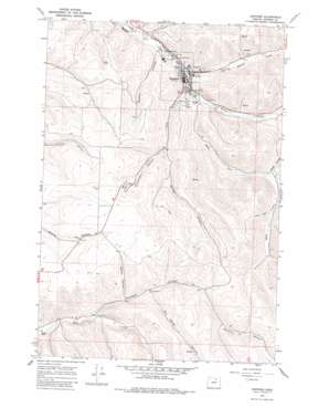
Heppner Topo Map Oregon
To zoom in, hover over the map of Heppner
USGS Topo Quad 45119c5 - 1:24,000 scale
| Topo Map Name: | Heppner |
| USGS Topo Quad ID: | 45119c5 |
| Print Size: | ca. 21 1/4" wide x 27" high |
| Southeast Coordinates: | 45.25° N latitude / 119.5° W longitude |
| Map Center Coordinates: | 45.3125° N latitude / 119.5625° W longitude |
| U.S. State: | OR |
| Filename: | o45119c5.jpg |
| Download Map JPG Image: | Heppner topo map 1:24,000 scale |
| Map Type: | Topographic |
| Topo Series: | 7.5´ |
| Map Scale: | 1:24,000 |
| Source of Map Images: | United States Geological Survey (USGS) |
| Alternate Map Versions: |
Heppner OR 1968, updated 1970 Download PDF Buy paper map Heppner OR 1968, updated 1982 Download PDF Buy paper map Heppner OR 2011 Download PDF Buy paper map Heppner OR 2014 Download PDF Buy paper map |
1:24,000 Topo Quads surrounding Heppner
> Back to 45119a1 at 1:100,000 scale
> Back to 45118a1 at 1:250,000 scale
> Back to U.S. Topo Maps home
Heppner topo map: Gazetteer
Heppner: Dams
Willow Creek Dam elevation 607m 1991′Heppner: Parks
City Park elevation 590m 1935′Hager Park elevation 601m 1971′
Heritage Park elevation 588m 1929′
Veterans Mini Park elevation 589m 1932′
Heppner: Populated Places
Heppner elevation 668m 2191′Heppner: Post Offices
Heppner Post Office elevation 668m 2191′Heppner: Reservoirs
Willow Creek Reservoir elevation 607m 1991′Heppner: Streams
Balm Fork elevation 608m 1994′Hinton Creek elevation 589m 1932′
Shobe Creek elevation 600m 1968′
Heppner: Valleys
Basey Canyon elevation 769m 2522′Donaldson Canyon elevation 697m 2286′
Dutton Canyon elevation 600m 1968′
Sanford Canyon elevation 727m 2385′
Shobe Canyon elevation 695m 2280′
Six Dollar Canyon elevation 794m 2604′
Soocup Canyon elevation 720m 2362′
Stalter Canyon elevation 714m 2342′
Heppner digital topo map on disk
Buy this Heppner topo map showing relief, roads, GPS coordinates and other geographical features, as a high-resolution digital map file on DVD:


