Eightmile Topo Map Oregon
To zoom in, hover over the map of Eightmile
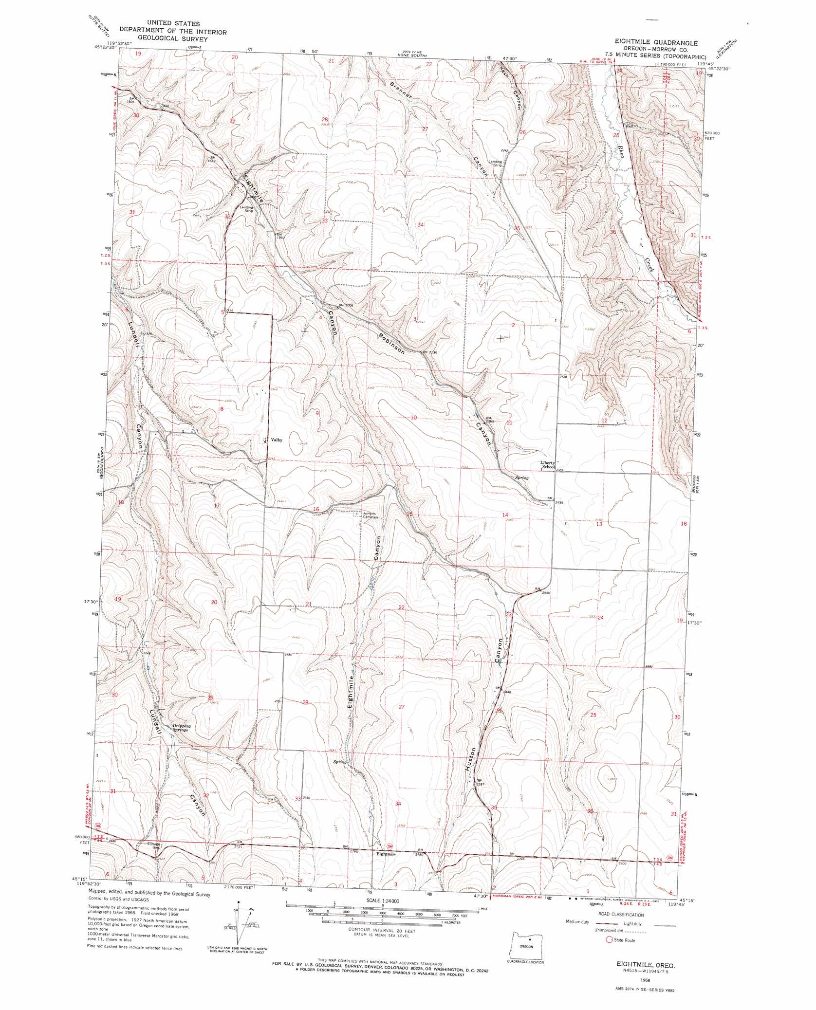
USGS Topo Quad 45119c7 - 1:24,000 scale
| Topo Map Name: | Eightmile |
| USGS Topo Quad ID: | 45119c7 |
| Print Size: | ca. 21 1/4" wide x 27" high |
| Southeast Coordinates: | 45.25° N latitude / 119.75° W longitude |
| Map Center Coordinates: | 45.3125° N latitude / 119.8125° W longitude |
| U.S. State: | OR |
| Filename: | o45119c7.jpg |
| Download Map JPG Image: | Eightmile topo map 1:24,000 scale |
| Map Type: | Topographic |
| Topo Series: | 7.5´ |
| Map Scale: | 1:24,000 |
| Source of Map Images: | United States Geological Survey (USGS) |
| Alternate Map Versions: |
Eightmile OR 1968, updated 1970 Download PDF Buy paper map Eightmile OR 2011 Download PDF Buy paper map Eightmile OR 2014 Download PDF Buy paper map |
1:24,000 Topo Quads surrounding Eightmile
Hickland Butte |
Cecil |
Ione North |
Strawberry Canyon Sw |
Strawberry Canyon Se |
Wolf Hollow Falls |
Utts Butte |
Ione South |
Lexington |
Swaggart Buttes |
Devils Gap |
Gooseberry |
Eightmile |
Ruggs |
Heppner |
Matney Flat |
Lone Rock Creek |
Buttermilk Canyon |
Hardman |
Balm Canyon |
Salmon Fork |
Lonerock |
Lefevre Prairie |
Chapin Creek |
Big Rock Flat |
> Back to 45119a1 at 1:100,000 scale
> Back to 45118a1 at 1:250,000 scale
> Back to U.S. Topo Maps home
Eightmile topo map: Gazetteer
Eightmile: Lakes
Petersons Ponds elevation 704m 2309′Rills Pond elevation 735m 2411′
Eightmile: Populated Places
Eightmile elevation 829m 2719′Valby elevation 728m 2388′
Eightmile: Post Offices
Eightmile Post Office (historical) elevation 829m 2719′Eightmile: Reservoirs
Bruce Reservoir elevation 737m 2417′Eightmile: Springs
Dripping Springs elevation 725m 2378′Eightmile: Valleys
Huston Canyon elevation 673m 2208′Robinson Canyon elevation 605m 1984′
Eightmile digital topo map on disk
Buy this Eightmile topo map showing relief, roads, GPS coordinates and other geographical features, as a high-resolution digital map file on DVD: