Lena Topo Map Oregon
To zoom in, hover over the map of Lena
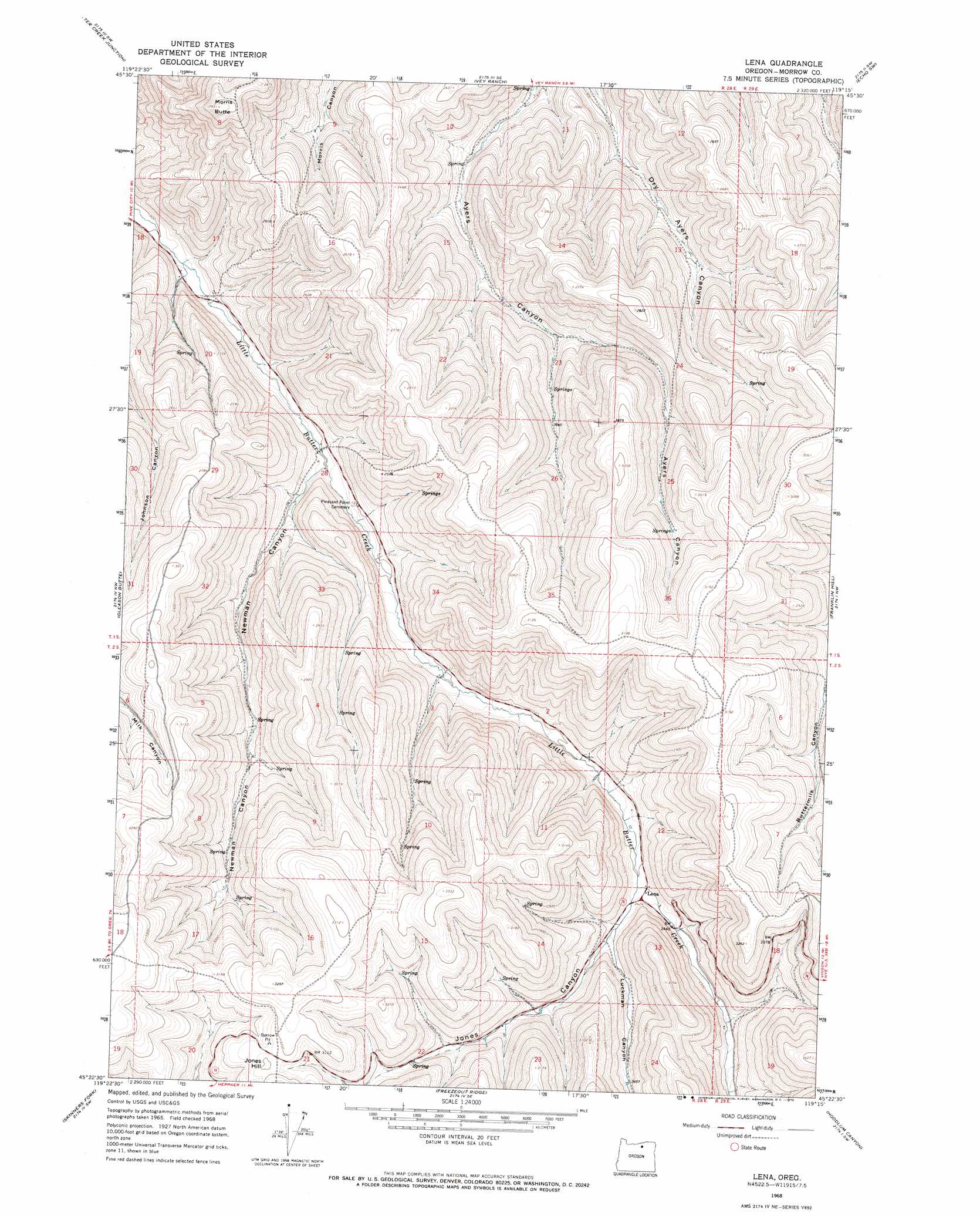
USGS Topo Quad 45119d3 - 1:24,000 scale
| Topo Map Name: | Lena |
| USGS Topo Quad ID: | 45119d3 |
| Print Size: | ca. 21 1/4" wide x 27" high |
| Southeast Coordinates: | 45.375° N latitude / 119.25° W longitude |
| Map Center Coordinates: | 45.4375° N latitude / 119.3125° W longitude |
| U.S. State: | OR |
| Filename: | o45119d3.jpg |
| Download Map JPG Image: | Lena topo map 1:24,000 scale |
| Map Type: | Topographic |
| Topo Series: | 7.5´ |
| Map Scale: | 1:24,000 |
| Source of Map Images: | United States Geological Survey (USGS) |
| Alternate Map Versions: |
Lena OR 1968, updated 1970 Download PDF Buy paper map Lena OR 2011 Download PDF Buy paper map Lena OR 2014 Download PDF Buy paper map |
1:24,000 Topo Quads surrounding Lena
Strawberry Canyon Ne |
Ward Butte |
Service Buttes |
Echo |
Nolin |
Strawberry Canyon Se |
Butter Creek Junction |
Vey Ranch |
Echo Sw |
Echo Se |
Swaggart Buttes |
Gleason Butte |
Lena |
Franklin Hill |
Vinson |
Heppner |
Skinners Fork |
Freezeout Ridge |
Hoodlum Canyon |
Gurdane |
Balm Canyon |
Summerfield Ridge |
Arbuckle Mountain |
Matlock Prairie |
Sugarbowl Creek |
> Back to 45119a1 at 1:100,000 scale
> Back to 45118a1 at 1:250,000 scale
> Back to U.S. Topo Maps home
Lena topo map: Gazetteer
Lena: Gaps
Jones Hill Summit elevation 972m 3188′Lena: Populated Places
Lena elevation 737m 2417′Lena: Post Offices
Lena Post Office (historical) elevation 737m 2417′Lena: Summits
Jones Hill elevation 977m 3205′Morris Butte elevation 893m 2929′
Lena: Valleys
Jones Canyon elevation 735m 2411′Luckman Canyon elevation 748m 2454′
Newman Canyon elevation 610m 2001′
Lena digital topo map on disk
Buy this Lena topo map showing relief, roads, GPS coordinates and other geographical features, as a high-resolution digital map file on DVD: