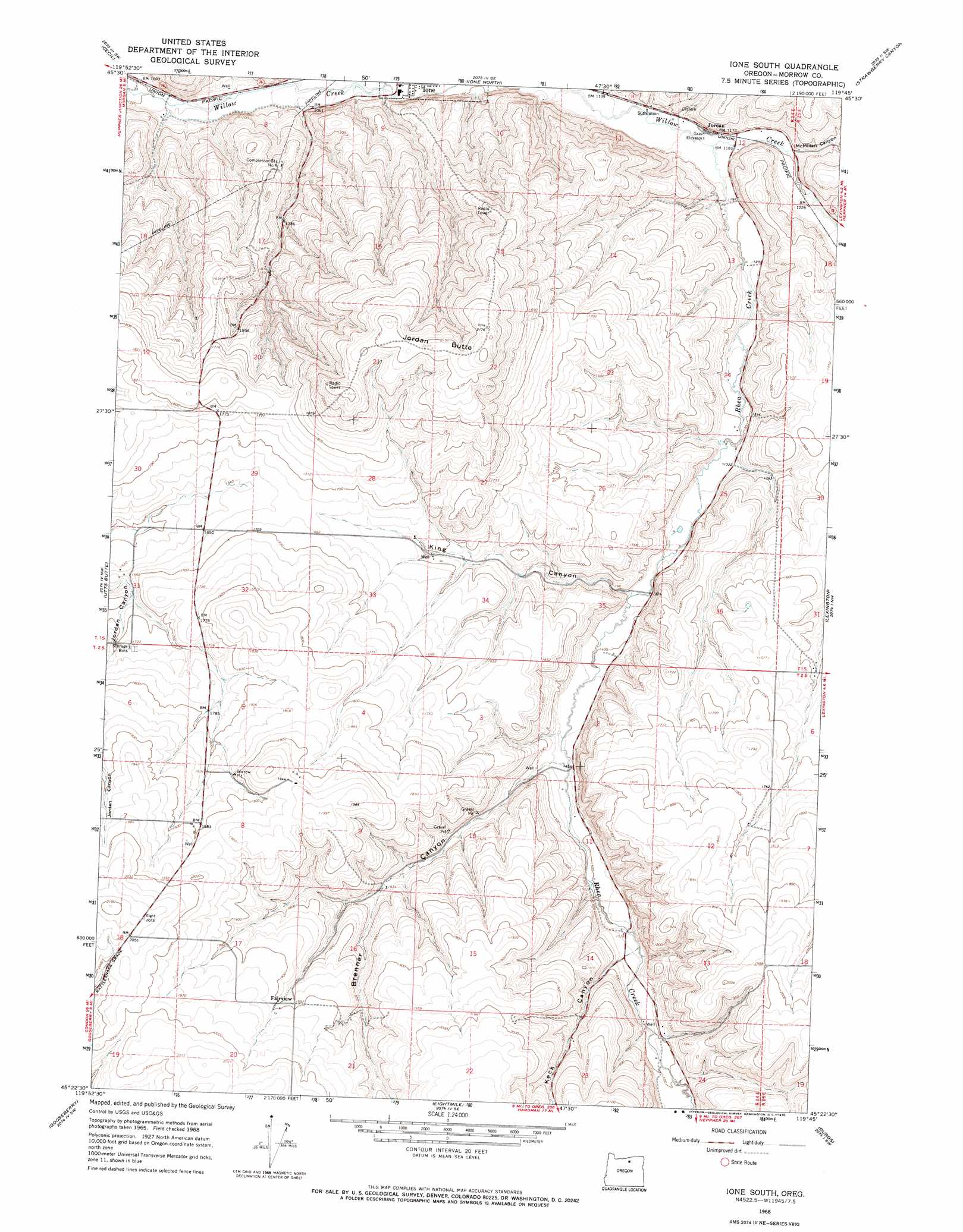
Ione South Topo Map Oregon
To zoom in, hover over the map of Ione South
USGS Topo Quad 45119d7 - 1:24,000 scale
| Topo Map Name: | Ione South |
| USGS Topo Quad ID: | 45119d7 |
| Print Size: | ca. 21 1/4" wide x 27" high |
| Southeast Coordinates: | 45.375° N latitude / 119.75° W longitude |
| Map Center Coordinates: | 45.4375° N latitude / 119.8125° W longitude |
| U.S. State: | OR |
| Filename: | o45119d7.jpg |
| Download Map JPG Image: | Ione South topo map 1:24,000 scale |
| Map Type: | Topographic |
| Topo Series: | 7.5´ |
| Map Scale: | 1:24,000 |
| Source of Map Images: | United States Geological Survey (USGS) |
| Alternate Map Versions: |
Ione South OR 1968, updated 1970 Download PDF Buy paper map Ione South OR 2011 Download PDF Buy paper map Ione South OR 2014 Download PDF Buy paper map |
1:24,000 Topo Quads surrounding Ione South
Horn Butte |
Dalreed Butte |
Ella |
Well Spring |
Strawberry Canyon Ne |
Hickland Butte |
Cecil |
Ione North |
Strawberry Canyon Sw |
Strawberry Canyon Se |
Wolf Hollow Falls |
Utts Butte |
Ione South |
Lexington |
Swaggart Buttes |
Devils Gap |
Gooseberry |
Eightmile |
Ruggs |
Heppner |
Matney Flat |
Lone Rock Creek |
Buttermilk Canyon |
Hardman |
Balm Canyon |
> Back to 45119a1 at 1:100,000 scale
> Back to 45118a1 at 1:250,000 scale
> Back to U.S. Topo Maps home
Ione South topo map: Gazetteer
Ione South: Post Offices
Willow Forks Post Office (historical) elevation 383m 1256′Ione South: Streams
Rhea Creek elevation 356m 1167′Ione South: Summits
Jordan Butte elevation 651m 2135′Ione South: Valleys
Brenner Canyon elevation 437m 1433′Keck Canyon elevation 463m 1519′
King Canyon elevation 417m 1368′
McMillan Canyon elevation 362m 1187′
Ione South digital topo map on disk
Buy this Ione South topo map showing relief, roads, GPS coordinates and other geographical features, as a high-resolution digital map file on DVD: