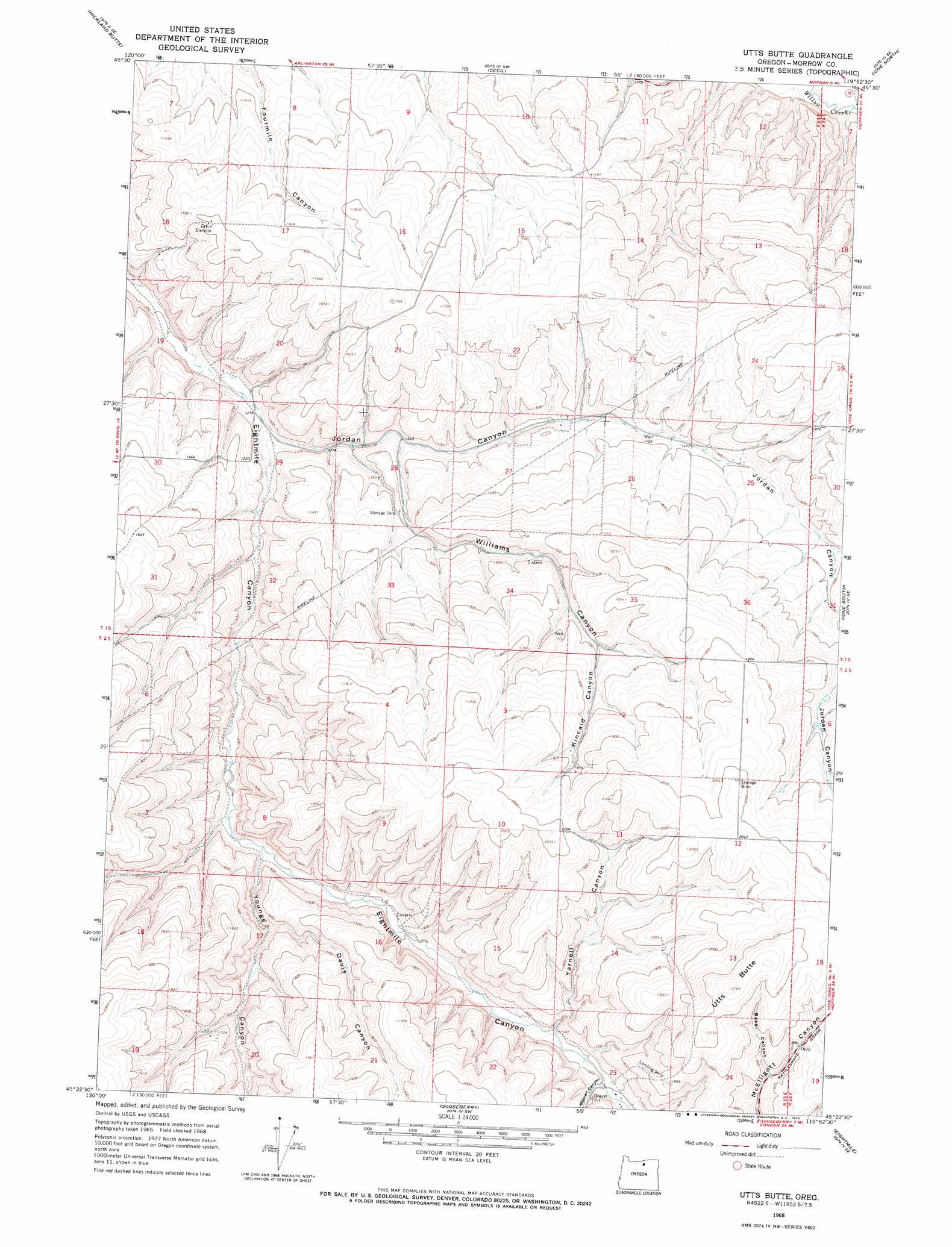
Utts Butte Topo Map Oregon
To zoom in, hover over the map of Utts Butte
USGS Topo Quad 45119d8 - 1:24,000 scale
| Topo Map Name: | Utts Butte |
| USGS Topo Quad ID: | 45119d8 |
| Print Size: | ca. 21 1/4" wide x 27" high |
| Southeast Coordinates: | 45.375° N latitude / 119.875° W longitude |
| Map Center Coordinates: | 45.4375° N latitude / 119.9375° W longitude |
| U.S. State: | OR |
| Filename: | o45119d8.jpg |
| Download Map JPG Image: | Utts Butte topo map 1:24,000 scale |
| Map Type: | Topographic |
| Topo Series: | 7.5´ |
| Map Scale: | 1:24,000 |
| Source of Map Images: | United States Geological Survey (USGS) |
| Alternate Map Versions: |
Utts Butte OR 1968, updated 1970 Download PDF Buy paper map Utts Butte OR 2011 Download PDF Buy paper map Utts Butte OR 2014 Download PDF Buy paper map |
1:24,000 Topo Quads surrounding Utts Butte
Arlington |
Horn Butte |
Dalreed Butte |
Ella |
Well Spring |
Shutler Flat |
Hickland Butte |
Cecil |
Ione North |
Strawberry Canyon Sw |
Mikkalo |
Wolf Hollow Falls |
Utts Butte |
Ione South |
Lexington |
Gwendolen |
Devils Gap |
Gooseberry |
Eightmile |
Ruggs |
Condon |
Matney Flat |
Lone Rock Creek |
Buttermilk Canyon |
Hardman |
> Back to 45119a1 at 1:100,000 scale
> Back to 45118a1 at 1:250,000 scale
> Back to U.S. Topo Maps home
Utts Butte topo map: Gazetteer
Utts Butte: Slopes
Rattlesnake Grade elevation 577m 1893′Utts Butte: Summits
Utts Butte elevation 667m 2188′Utts Butte: Valleys
Baker Canyon elevation 568m 1863′Davis Canyon elevation 469m 1538′
Kincaid Canyon elevation 513m 1683′
Warren Canyon elevation 489m 1604′
Williams Canyon elevation 397m 1302′
Yarnell Canyon elevation 483m 1584′
Youngs Canyon elevation 439m 1440′
Utts Butte digital topo map on disk
Buy this Utts Butte topo map showing relief, roads, GPS coordinates and other geographical features, as a high-resolution digital map file on DVD: