Vey Ranch Topo Map Oregon
To zoom in, hover over the map of Vey Ranch
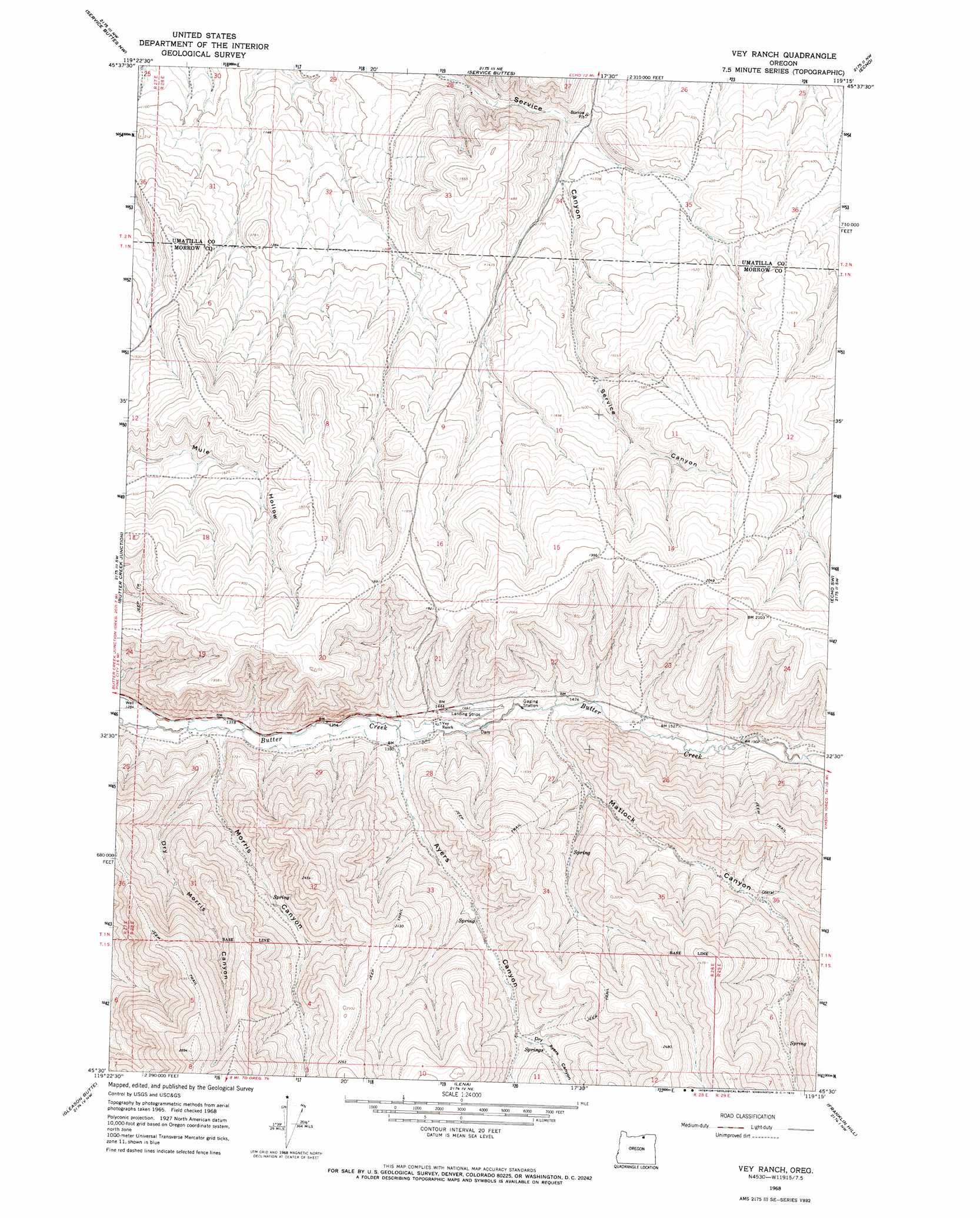
USGS Topo Quad 45119e3 - 1:24,000 scale
| Topo Map Name: | Vey Ranch |
| USGS Topo Quad ID: | 45119e3 |
| Print Size: | ca. 21 1/4" wide x 27" high |
| Southeast Coordinates: | 45.5° N latitude / 119.25° W longitude |
| Map Center Coordinates: | 45.5625° N latitude / 119.3125° W longitude |
| U.S. State: | OR |
| Filename: | o45119e3.jpg |
| Download Map JPG Image: | Vey Ranch topo map 1:24,000 scale |
| Map Type: | Topographic |
| Topo Series: | 7.5´ |
| Map Scale: | 1:24,000 |
| Source of Map Images: | United States Geological Survey (USGS) |
| Alternate Map Versions: |
Vey Ranch OR 1968, updated 1970 Download PDF Buy paper map Vey Ranch OR 2011 Download PDF Buy paper map Vey Ranch OR 2014 Download PDF Buy paper map |
1:24,000 Topo Quads surrounding Vey Ranch
Clarke |
Ordnance |
Hermiston |
Stanfield |
Stanfield Se |
Strawberry Canyon Ne |
Ward Butte |
Service Buttes |
Echo |
Nolin |
Strawberry Canyon Se |
Butter Creek Junction |
Vey Ranch |
Echo Sw |
Echo Se |
Swaggart Buttes |
Gleason Butte |
Lena |
Franklin Hill |
Vinson |
Heppner |
Skinners Fork |
Freezeout Ridge |
Hoodlum Canyon |
Gurdane |
> Back to 45119e1 at 1:100,000 scale
> Back to 45118a1 at 1:250,000 scale
> Back to U.S. Topo Maps home
Vey Ranch topo map: Gazetteer
Vey Ranch: Valleys
Ayers Canyon elevation 415m 1361′Dry Ayers Canyon elevation 519m 1702′
Dry Morris Canyon elevation 421m 1381′
Matlock Canyon elevation 433m 1420′
Morris Canyon elevation 402m 1318′
Vey Ranch digital topo map on disk
Buy this Vey Ranch topo map showing relief, roads, GPS coordinates and other geographical features, as a high-resolution digital map file on DVD: