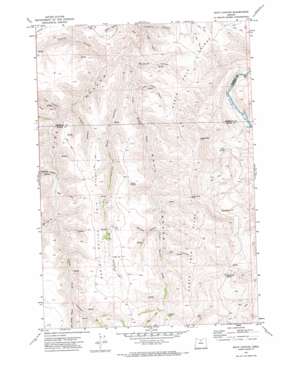
Bath Canyon Topo Map Oregon
To zoom in, hover over the map of Bath Canyon
USGS Topo Quad 45120a5 - 1:24,000 scale
| Topo Map Name: | Bath Canyon |
| USGS Topo Quad ID: | 45120a5 |
| Print Size: | ca. 21 1/4" wide x 27" high |
| Southeast Coordinates: | 45° N latitude / 120.5° W longitude |
| Map Center Coordinates: | 45.0625° N latitude / 120.5625° W longitude |
| U.S. State: | OR |
| Filename: | o45120a5.jpg |
| Download Map JPG Image: | Bath Canyon topo map 1:24,000 scale |
| Map Type: | Topographic |
| Topo Series: | 7.5´ |
| Map Scale: | 1:24,000 |
| Source of Map Images: | United States Geological Survey (USGS) |
| Alternate Map Versions: |
Bath Canyon OR 1971, updated 1973 Download PDF Buy paper map Bath Canyon OR 2011 Download PDF Buy paper map Bath Canyon OR 2014 Download PDF Buy paper map |
1:24,000 Topo Quads surrounding Bath Canyon
> Back to 45120a1 at 1:100,000 scale
> Back to 45120a1 at 1:250,000 scale
> Back to U.S. Topo Maps home
Bath Canyon topo map: Gazetteer
Bath Canyon: Gaps
Butte Creek Pass elevation 947m 3106′Bath Canyon: Ridges
Little Pine Hollow Ridge elevation 981m 3218′North Pole Ridge elevation 856m 2808′
Bath Canyon: Springs
Duncan Spring elevation 492m 1614′Heany Spring elevation 827m 2713′
Rattlesnake Spring elevation 792m 2598′
Rock Spring elevation 737m 2417′
Scott Spring elevation 549m 1801′
Bath Canyon: Streams
Long Hollow Creek elevation 512m 1679′Pole Creek elevation 864m 2834′
Bath Canyon: Summits
Sugarloaf elevation 952m 3123′Bath Canyon: Valleys
Bath Canyon elevation 512m 1679′Big Pine Hollow elevation 642m 2106′
Cold Spring Canyon elevation 805m 2641′
Cramer Canyon elevation 520m 1706′
Dove Hollow elevation 523m 1715′
Joes Camp Canyon elevation 550m 1804′
Little Pine Hollow elevation 642m 2106′
McGilvery Canyon elevation 614m 2014′
McLennan Canyon elevation 525m 1722′
O'Leary Canyon elevation 554m 1817′
Owl Canyon elevation 777m 2549′
Pole Canyon elevation 578m 1896′
Telephone Canyon elevation 462m 1515′
Whitten Canyon elevation 747m 2450′
Bath Canyon digital topo map on disk
Buy this Bath Canyon topo map showing relief, roads, GPS coordinates and other geographical features, as a high-resolution digital map file on DVD:


