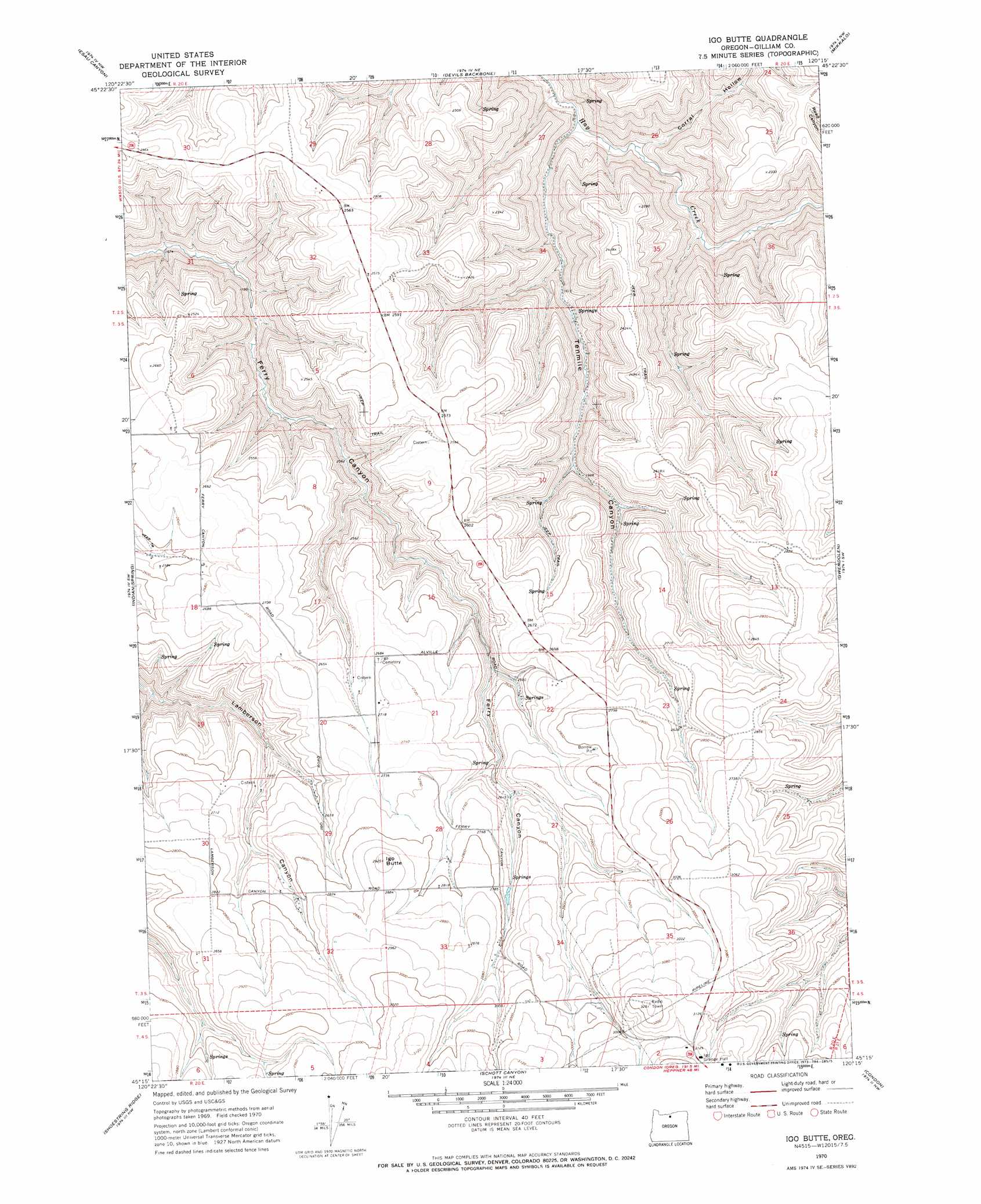
Igo Butte Topo Map Oregon
To zoom in, hover over the map of Igo Butte
USGS Topo Quad 45120c3 - 1:24,000 scale
| Topo Map Name: | Igo Butte |
| USGS Topo Quad ID: | 45120c3 |
| Print Size: | ca. 21 1/4" wide x 27" high |
| Southeast Coordinates: | 45.25° N latitude / 120.25° W longitude |
| Map Center Coordinates: | 45.3125° N latitude / 120.3125° W longitude |
| U.S. State: | OR |
| Filename: | o45120c3.jpg |
| Download Map JPG Image: | Igo Butte topo map 1:24,000 scale |
| Map Type: | Topographic |
| Topo Series: | 7.5´ |
| Map Scale: | 1:24,000 |
| Source of Map Images: | United States Geological Survey (USGS) |
| Alternate Map Versions: |
Igo Butte OR 1970, updated 1973 Download PDF Buy paper map Igo Butte OR 2011 Download PDF Buy paper map Igo Butte OR 2014 Download PDF Buy paper map |
1:24,000 Topo Quads surrounding Igo Butte
Klondike |
Mcdonald |
Turner Butte |
Shutler Flat |
Hickland Butte |
Harmony |
Esau Canyon |
Devils Backbone |
Mikkalo |
Wolf Hollow Falls |
Indian Cove |
Indian Spring |
Igo Butte |
Gwendolen |
Devils Gap |
Horseshoe Bend |
Shoestring Ridge |
Schott Canyon |
Condon |
Matney Flat |
Bath Canyon |
Chimney Springs |
Buckhorn Canyon |
Fossil North |
Salmon Fork |
> Back to 45120a1 at 1:100,000 scale
> Back to 45120a1 at 1:250,000 scale
> Back to U.S. Topo Maps home
Igo Butte topo map: Gazetteer
Igo Butte: Populated Places
Alville (historical) elevation 827m 2713′Igo (historical) elevation 953m 3126′
Igo Butte: Post Offices
Alville Post Office (historical) elevation 797m 2614′Igo Post Office (historical) elevation 953m 3126′
Igo Butte: Summits
Igo Butte elevation 895m 2936′Igo Butte: Valleys
Corral Hollow elevation 416m 1364′Tenmile Canyon elevation 427m 1400′
Igo Butte digital topo map on disk
Buy this Igo Butte topo map showing relief, roads, GPS coordinates and other geographical features, as a high-resolution digital map file on DVD: