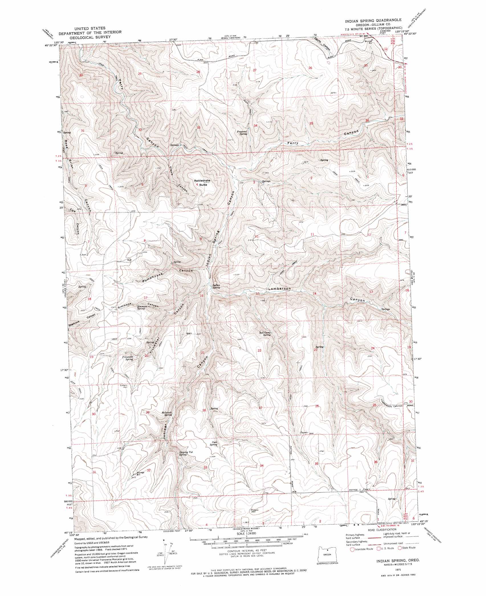
Indian Spring Topo Map Oregon
To zoom in, hover over the map of Indian Spring
USGS Topo Quad 45120c4 - 1:24,000 scale
| Topo Map Name: | Indian Spring |
| USGS Topo Quad ID: | 45120c4 |
| Print Size: | ca. 21 1/4" wide x 27" high |
| Southeast Coordinates: | 45.25° N latitude / 120.375° W longitude |
| Map Center Coordinates: | 45.3125° N latitude / 120.4375° W longitude |
| U.S. State: | OR |
| Filename: | o45120c4.jpg |
| Download Map JPG Image: | Indian Spring topo map 1:24,000 scale |
| Map Type: | Topographic |
| Topo Series: | 7.5´ |
| Map Scale: | 1:24,000 |
| Source of Map Images: | United States Geological Survey (USGS) |
| Alternate Map Versions: |
Indian Spring OR 1971, updated 1973 Download PDF Buy paper map Indian Spring OR 2011 Download PDF Buy paper map Indian Spring OR 2014 Download PDF Buy paper map |
1:24,000 Topo Quads surrounding Indian Spring
Wasco |
Klondike |
Mcdonald |
Turner Butte |
Shutler Flat |
Moro |
Harmony |
Esau Canyon |
Devils Backbone |
Mikkalo |
Rosebush |
Indian Cove |
Indian Spring |
Igo Butte |
Gwendolen |
Kent |
Horseshoe Bend |
Shoestring Ridge |
Schott Canyon |
Condon |
Macken Canyon |
Bath Canyon |
Chimney Springs |
Buckhorn Canyon |
Fossil North |
> Back to 45120a1 at 1:100,000 scale
> Back to 45120a1 at 1:250,000 scale
> Back to U.S. Topo Maps home
Indian Spring topo map: Gazetteer
Indian Spring: Post Offices
Ajax Post Office (historical) elevation 680m 2230′Indian Spring: Springs
Bell Camp Spring elevation 577m 1893′Cook Spring elevation 701m 2299′
Dipping Vat Spring elevation 636m 2086′
Fitzwater Spring elevation 664m 2178′
Freezeout Spring elevation 503m 1650′
Indian Spring elevation 433m 1420′
McIntosh Spring elevation 584m 1916′
Simmons Spring elevation 655m 2148′
Willows Spring elevation 569m 1866′
Indian Spring: Summits
Rattlesnake Butte elevation 705m 2312′Indian Spring: Valleys
Buck Hollow elevation 248m 813′Elbow Canyon elevation 367m 1204′
Fitzwater Canyon elevation 471m 1545′
Freezeout Canyon elevation 378m 1240′
Indian Spring Canyon elevation 369m 1210′
Juniper Canyon elevation 460m 1509′
Lamberson Canyon elevation 471m 1545′
Pumphouse Canyon elevation 456m 1496′
Simmons Canyon elevation 537m 1761′
Indian Spring digital topo map on disk
Buy this Indian Spring topo map showing relief, roads, GPS coordinates and other geographical features, as a high-resolution digital map file on DVD: