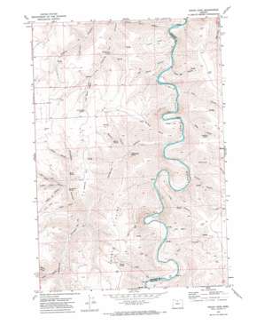
Indian Cove Topo Map Oregon
To zoom in, hover over the map of Indian Cove
USGS Topo Quad 45120c5 - 1:24,000 scale
| Topo Map Name: | Indian Cove |
| USGS Topo Quad ID: | 45120c5 |
| Print Size: | ca. 21 1/4" wide x 27" high |
| Southeast Coordinates: | 45.25° N latitude / 120.5° W longitude |
| Map Center Coordinates: | 45.3125° N latitude / 120.5625° W longitude |
| U.S. State: | OR |
| Filename: | o45120c5.jpg |
| Download Map JPG Image: | Indian Cove topo map 1:24,000 scale |
| Map Type: | Topographic |
| Topo Series: | 7.5´ |
| Map Scale: | 1:24,000 |
| Source of Map Images: | United States Geological Survey (USGS) |
| Alternate Map Versions: |
Indian Cove OR 1970, updated 1973 Download PDF Buy paper map Indian Cove OR 2011 Download PDF Buy paper map Indian Cove OR 2014 Download PDF Buy paper map |
1:24,000 Topo Quads surrounding Indian Cove
> Back to 45120a1 at 1:100,000 scale
> Back to 45120a1 at 1:250,000 scale
> Back to U.S. Topo Maps home
Indian Cove topo map: Gazetteer
Indian Cove: Basins
Bull Basin elevation 376m 1233′Minton Cove elevation 232m 761′
Indian Cove: Flats
Lon Eakin Flat elevation 228m 748′Indian Cove: Ridges
Peddicord Point elevation 737m 2417′Indian Cove: Springs
Cottonwood Spring elevation 341m 1118′Dipping Vat Spring elevation 458m 1502′
Gooseberry Spring elevation 488m 1601′
Hawkins Spring elevation 560m 1837′
Lucy Payne Spring elevation 735m 2411′
Marlin Spring elevation 641m 2103′
Penny Spring elevation 597m 1958′
Warm Spring elevation 555m 1820′
Indian Cove: Summits
Sproul Point elevation 747m 2450′Wilson Point elevation 640m 2099′
Indian Cove: Valleys
Barnet Canyon elevation 530m 1738′Brown Canyon elevation 601m 1971′
Cow Canyon elevation 216m 708′
Dipping Vat Canyon elevation 335m 1099′
Dunlap Canyon elevation 548m 1797′
Fern Hollow elevation 253m 830′
Grass Canyon elevation 240m 787′
Hayes Canyon elevation 485m 1591′
Indian Cove elevation 248m 813′
Jackknife Canyon elevation 237m 777′
Little Ferry Canyon elevation 233m 764′
Long Hollow elevation 250m 820′
Lucy Payne Canyon elevation 590m 1935′
Marlin Canyon elevation 316m 1036′
Nat Wheat Canyon elevation 238m 780′
North Canyon elevation 487m 1597′
Pearson Canyon elevation 234m 767′
Piano Box Canyon elevation 220m 721′
Rutledge Canyon elevation 388m 1272′
S A Canyon elevation 244m 800′
Shellrock Canyon elevation 241m 790′
Sproul Canyon elevation 441m 1446′
Steers Canyon elevation 529m 1735′
Turner Canyon elevation 525m 1722′
Indian Cove digital topo map on disk
Buy this Indian Cove topo map showing relief, roads, GPS coordinates and other geographical features, as a high-resolution digital map file on DVD:


