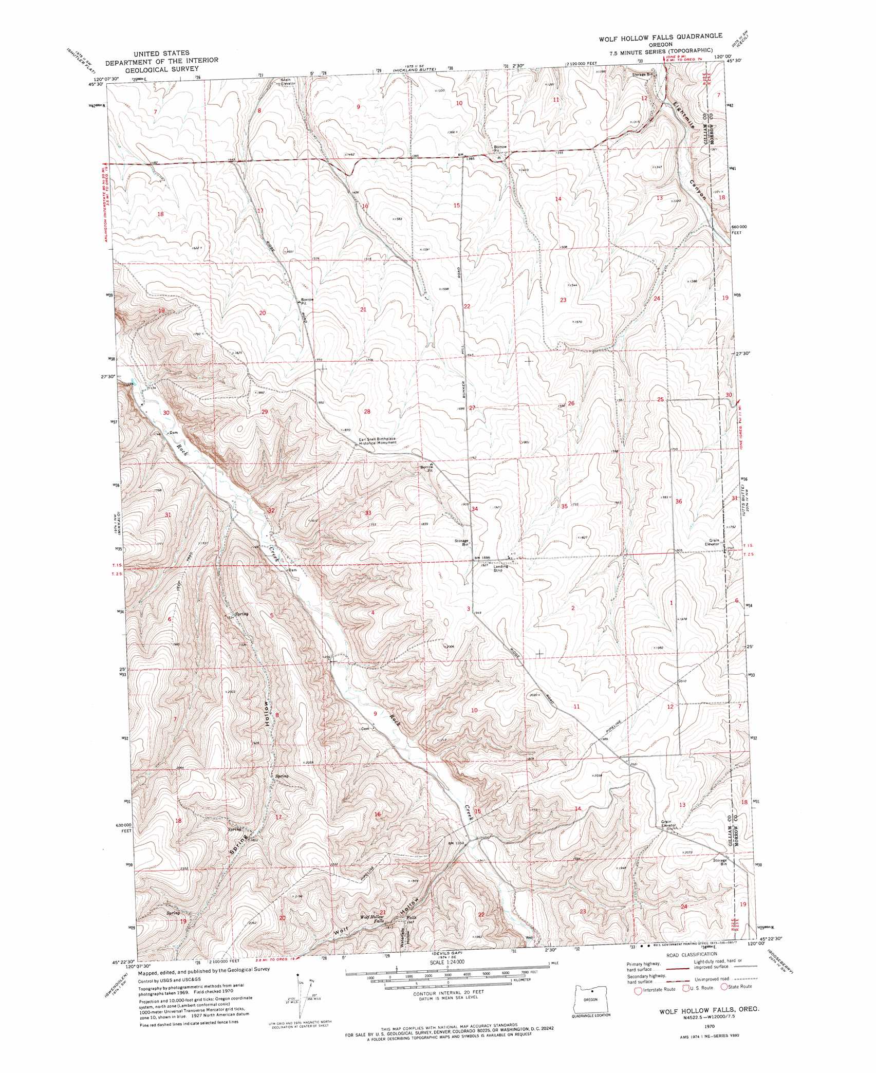
Wolf Hollow Falls Topo Map Oregon
To zoom in, hover over the map of Wolf Hollow Falls
USGS Topo Quad 45120d1 - 1:24,000 scale
| Topo Map Name: | Wolf Hollow Falls |
| USGS Topo Quad ID: | 45120d1 |
| Print Size: | ca. 21 1/4" wide x 27" high |
| Southeast Coordinates: | 45.375° N latitude / 120° W longitude |
| Map Center Coordinates: | 45.4375° N latitude / 120.0625° W longitude |
| U.S. State: | OR |
| Filename: | o45120d1.jpg |
| Download Map JPG Image: | Wolf Hollow Falls topo map 1:24,000 scale |
| Map Type: | Topographic |
| Topo Series: | 7.5´ |
| Map Scale: | 1:24,000 |
| Source of Map Images: | United States Geological Survey (USGS) |
| Alternate Map Versions: |
Wolf Hollow Falls OR 1970, updated 1973 Download PDF Buy paper map Wolf Hollow Falls OR 2011 Download PDF Buy paper map Wolf Hollow Falls OR 2014 Download PDF Buy paper map |
1:24,000 Topo Quads surrounding Wolf Hollow Falls
Sundale |
Arlington |
Horn Butte |
Dalreed Butte |
Ella |
Turner Butte |
Shutler Flat |
Hickland Butte |
Cecil |
Ione North |
Devils Backbone |
Mikkalo |
Wolf Hollow Falls |
Utts Butte |
Ione South |
Igo Butte |
Gwendolen |
Devils Gap |
Gooseberry |
Eightmile |
Schott Canyon |
Condon |
Matney Flat |
Lone Rock Creek |
Buttermilk Canyon |
> Back to 45120a1 at 1:100,000 scale
> Back to 45120a1 at 1:250,000 scale
> Back to U.S. Topo Maps home
Wolf Hollow Falls topo map: Gazetteer
Wolf Hollow Falls: Airports
Circle W Ranch-Condon Airstrip elevation 595m 1952′Wolf Hollow Falls: Falls
Wolf Hollow Falls elevation 495m 1624′Wolf Hollow Falls: Parks
Earl Snell Birthplace Historical Monument elevation 553m 1814′Wolf Hollow Falls: Post Offices
Fletts Post Office (historical) elevation 407m 1335′Legality Post Office (historical) elevation 363m 1190′
Shelby Post Office (historical) elevation 400m 1312′
Wolf Hollow Falls: Reservoirs
Irby Reservoir elevation 348m 1141′Wolf Hollow Falls: Valleys
Jordan Canyon elevation 365m 1197′Spring Hollow elevation 369m 1210′
Waterfalls Hollow elevation 476m 1561′
Wolf Hollow elevation 410m 1345′
Wolf Hollow Falls digital topo map on disk
Buy this Wolf Hollow Falls topo map showing relief, roads, GPS coordinates and other geographical features, as a high-resolution digital map file on DVD: