Erskine Topo Map Oregon
To zoom in, hover over the map of Erskine
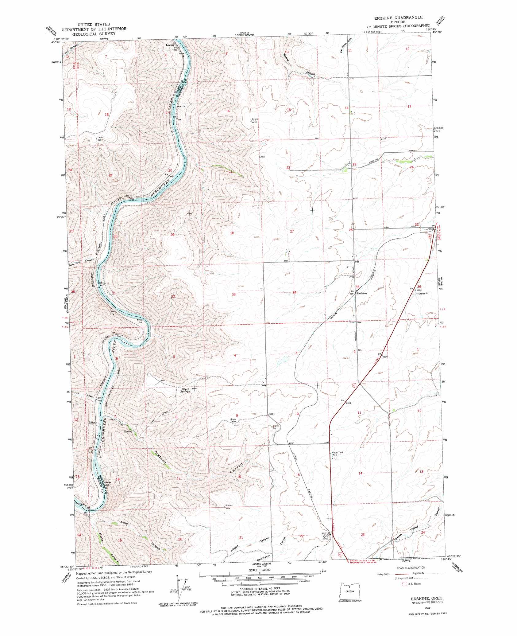
USGS Topo Quad 45120d7 - 1:24,000 scale
| Topo Map Name: | Erskine |
| USGS Topo Quad ID: | 45120d7 |
| Print Size: | ca. 21 1/4" wide x 27" high |
| Southeast Coordinates: | 45.375° N latitude / 120.75° W longitude |
| Map Center Coordinates: | 45.4375° N latitude / 120.8125° W longitude |
| U.S. State: | OR |
| Filename: | o45120d7.jpg |
| Download Map JPG Image: | Erskine topo map 1:24,000 scale |
| Map Type: | Topographic |
| Topo Series: | 7.5´ |
| Map Scale: | 1:24,000 |
| Source of Map Images: | United States Geological Survey (USGS) |
| Alternate Map Versions: |
Erskine OR 1962, updated 1964 Download PDF Buy paper map Erskine OR 1962, updated 1978 Download PDF Buy paper map Erskine OR 2011 Download PDF Buy paper map Erskine OR 2014 Download PDF Buy paper map |
1:24,000 Topo Quads surrounding Erskine
Stacker Butte |
Wishram |
Biggs Junction |
Rufus |
Quinton |
Petersburg |
Emerson |
Locust Grove |
Wasco |
Klondike |
Dufur East |
Summit Ridge |
Erskine |
Moro |
Harmony |
Sherars Bridge |
Sinamox |
Grass Valley |
Rosebush |
Indian Cove |
Maupin |
Dead Dog Canyon |
Bronx Canyon |
Kent |
Horseshoe Bend |
> Back to 45120a1 at 1:100,000 scale
> Back to 45120a1 at 1:250,000 scale
> Back to U.S. Topo Maps home
Erskine topo map: Gazetteer
Erskine: Populated Places
Erskine elevation 659m 2162′Erskine: Post Offices
Erskineville Post Office (historical) elevation 659m 2162′Erskine: Reservoirs
Powell Reservoir elevation 703m 2306′Erskine: Springs
Sheep Springs elevation 637m 2089′Erskine: Summits
Negro Ridge elevation 727m 2385′Erskine: Valleys
Allison Canyon elevation 157m 515′Bull Run Canyon elevation 119m 390′
Dry Canyon elevation 148m 485′
Macks Canyon elevation 144m 472′
Negro Hollow elevation 619m 2030′
Sixteen Canyon elevation 145m 475′
Erskine digital topo map on disk
Buy this Erskine topo map showing relief, roads, GPS coordinates and other geographical features, as a high-resolution digital map file on DVD: