Summit Ridge Topo Map Oregon
To zoom in, hover over the map of Summit Ridge
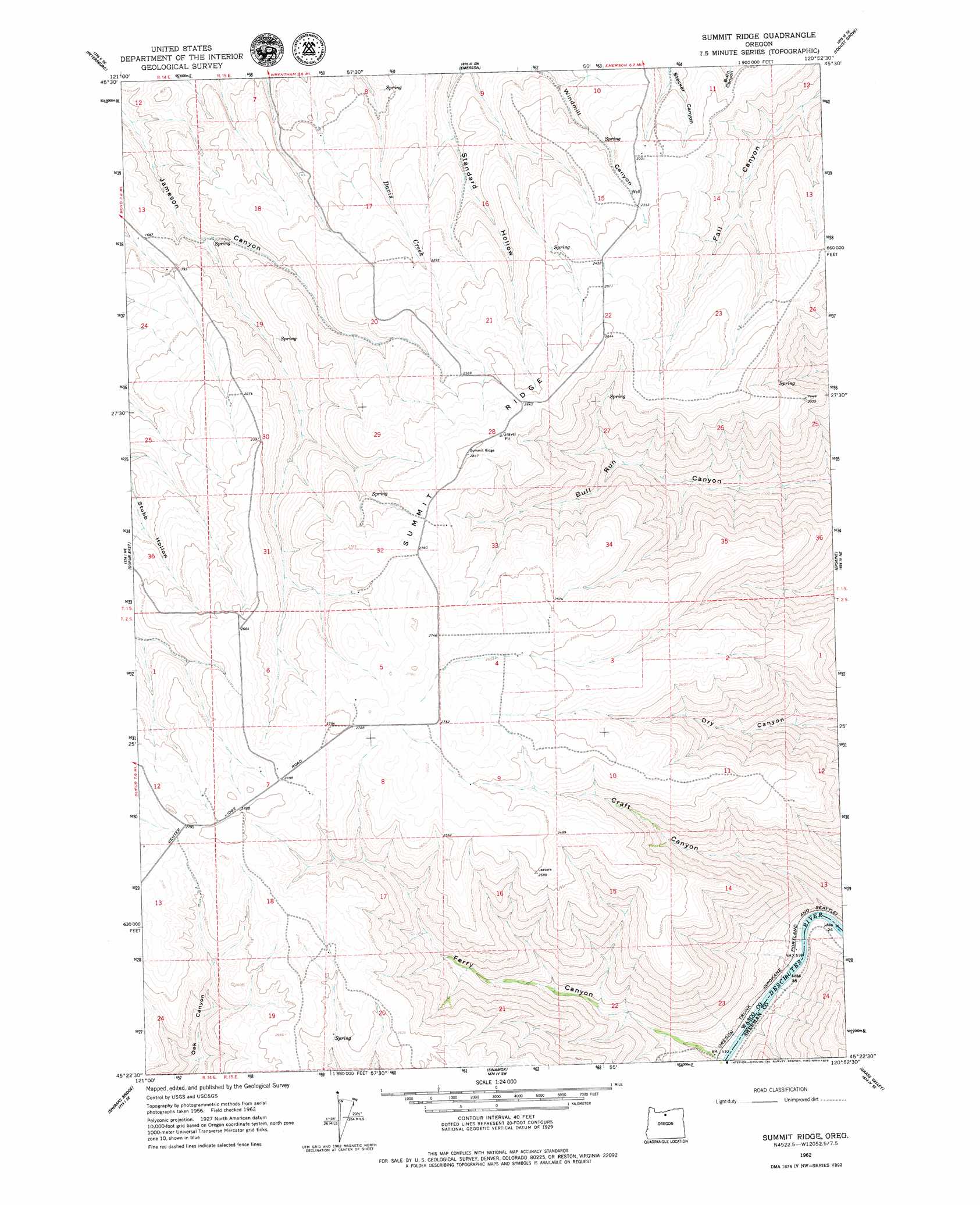
USGS Topo Quad 45120d8 - 1:24,000 scale
| Topo Map Name: | Summit Ridge |
| USGS Topo Quad ID: | 45120d8 |
| Print Size: | ca. 21 1/4" wide x 27" high |
| Southeast Coordinates: | 45.375° N latitude / 120.875° W longitude |
| Map Center Coordinates: | 45.4375° N latitude / 120.9375° W longitude |
| U.S. State: | OR |
| Filename: | o45120d8.jpg |
| Download Map JPG Image: | Summit Ridge topo map 1:24,000 scale |
| Map Type: | Topographic |
| Topo Series: | 7.5´ |
| Map Scale: | 1:24,000 |
| Source of Map Images: | United States Geological Survey (USGS) |
| Alternate Map Versions: |
Summit Ridge OR 1962, updated 1964 Download PDF Buy paper map Summit Ridge OR 2011 Download PDF Buy paper map Summit Ridge OR 2014 Download PDF Buy paper map |
1:24,000 Topo Quads surrounding Summit Ridge
The Dalles North |
Stacker Butte |
Wishram |
Biggs Junction |
Rufus |
The Dalles South |
Petersburg |
Emerson |
Locust Grove |
Wasco |
Dufur West |
Dufur East |
Summit Ridge |
Erskine |
Moro |
Postage Stamp Butte |
Sherars Bridge |
Sinamox |
Grass Valley |
Rosebush |
Tygh Valley |
Maupin |
Dead Dog Canyon |
Bronx Canyon |
Kent |
> Back to 45120a1 at 1:100,000 scale
> Back to 45120a1 at 1:250,000 scale
> Back to U.S. Topo Maps home
Summit Ridge topo map: Gazetteer
Summit Ridge: Ridges
Summit Ridge elevation 857m 2811′Summit Ridge: Valleys
Craft Canyon elevation 152m 498′Summit Ridge digital topo map on disk
Buy this Summit Ridge topo map showing relief, roads, GPS coordinates and other geographical features, as a high-resolution digital map file on DVD: