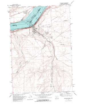
Arlington Topo Map Oregon
To zoom in, hover over the map of Arlington
USGS Topo Quad 45120f2 - 1:24,000 scale
| Topo Map Name: | Arlington |
| USGS Topo Quad ID: | 45120f2 |
| Print Size: | ca. 21 1/4" wide x 27" high |
| Southeast Coordinates: | 45.625° N latitude / 120.125° W longitude |
| Map Center Coordinates: | 45.6875° N latitude / 120.1875° W longitude |
| U.S. States: | OR, WA |
| Filename: | o45120f2.jpg |
| Download Map JPG Image: | Arlington topo map 1:24,000 scale |
| Map Type: | Topographic |
| Topo Series: | 7.5´ |
| Map Scale: | 1:24,000 |
| Source of Map Images: | United States Geological Survey (USGS) |
| Alternate Map Versions: |
Arlington OR 1971 Download PDF Buy paper map Arlington OR 1971, updated 1972 Download PDF Buy paper map Arlington OR 2011 Download PDF Buy paper map Arlington OR 2014 Download PDF Buy paper map |
1:24,000 Topo Quads surrounding Arlington
> Back to 45120e1 at 1:100,000 scale
> Back to 45120a1 at 1:250,000 scale
> Back to U.S. Topo Maps home
Arlington topo map: Gazetteer
Arlington: Airports
Arlington Municipal Airport elevation 263m 862′Arlington: Canals
China Ditch elevation 88m 288′Arlington: Flats
Hurlburt Flats elevation 241m 790′Arlington: Parks
Alkali Park elevation 94m 308′Arlington State Park elevation 92m 301′
Earl Snell Memorial Park elevation 87m 285′
Arlington: Populated Places
Arlington elevation 92m 301′Eddy (historical) elevation 127m 416′
Roosevelt elevation 111m 364′
Arlington: Post Offices
Arlington Post Office elevation 92m 301′Shutler Post Office (historical) elevation 217m 711′
Arlington: Rapids
Owyhee Rapids (historical) elevation 82m 269′Arlington: Streams
East Fork Shutler Creek elevation 223m 731′Nonose Creek elevation 171m 561′
West Fork Shutler Creek elevation 223m 731′
Arlington: Valleys
Alkali Canyon elevation 86m 282′Jones Canyon elevation 84m 275′
Arlington digital topo map on disk
Buy this Arlington topo map showing relief, roads, GPS coordinates and other geographical features, as a high-resolution digital map file on DVD:


