Quinton Topo Map Oregon
To zoom in, hover over the map of Quinton
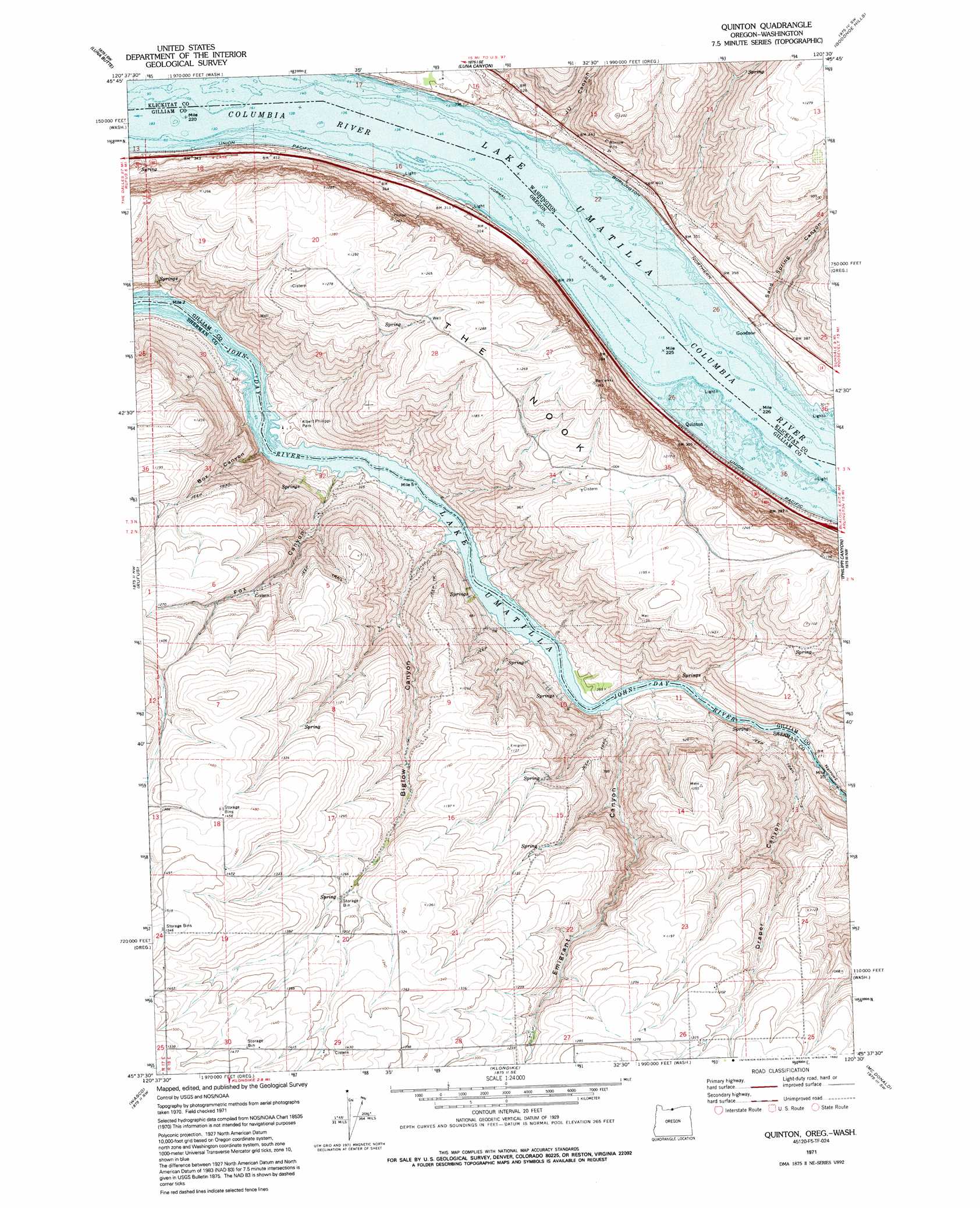
USGS Topo Quad 45120f5 - 1:24,000 scale
| Topo Map Name: | Quinton |
| USGS Topo Quad ID: | 45120f5 |
| Print Size: | ca. 21 1/4" wide x 27" high |
| Southeast Coordinates: | 45.625° N latitude / 120.5° W longitude |
| Map Center Coordinates: | 45.6875° N latitude / 120.5625° W longitude |
| U.S. States: | OR, WA |
| Filename: | o45120f5.jpg |
| Download Map JPG Image: | Quinton topo map 1:24,000 scale |
| Map Type: | Topographic |
| Topo Series: | 7.5´ |
| Map Scale: | 1:24,000 |
| Source of Map Images: | United States Geological Survey (USGS) |
| Alternate Map Versions: |
Quinton OR 1971, updated 1973 Download PDF Buy paper map Quinton OR 1971, updated 1992 Download PDF Buy paper map Quinton OR 2011 Download PDF Buy paper map Quinton OR 2014 Download PDF Buy paper map |
1:24,000 Topo Quads surrounding Quinton
Indian Rock |
Status Pass |
Lone Pine Butte |
Bickleton Nw |
Bickleton |
Goldendale |
Luna Butte |
Luna Gulch |
Goodnoe Hills |
Dot |
Biggs Junction |
Rufus |
Quinton |
Sundale Nw |
Sundale |
Locust Grove |
Wasco |
Klondike |
Mcdonald |
Turner Butte |
Erskine |
Moro |
Harmony |
Esau Canyon |
Devils Backbone |
> Back to 45120e1 at 1:100,000 scale
> Back to 45120a1 at 1:250,000 scale
> Back to U.S. Topo Maps home
Quinton topo map: Gazetteer
Quinton: Falls
Tumwater Falls elevation 101m 331′Quinton: Parks
Albert Philippi Park elevation 90m 295′Quinton: Populated Places
Early (historical) elevation 82m 269′Goodnoe elevation 96m 314′
Quinton: Post Offices
Biglow Post Office (historical) elevation 398m 1305′Early Post Office (historical) elevation 82m 269′
Quinook Post Office (historical) elevation 87m 285′
Quinton: Rapids
Indian Rapids (historical) elevation 82m 269′Squally Hook Rapids elevation 82m 269′
Quinton: Ridges
The Nook elevation 387m 1269′Quinton: Valleys
Biglow Canyon elevation 91m 298′Box Canyon elevation 85m 278′
Draper Canyon elevation 88m 288′
Emigrant Canyon elevation 84m 275′
Fox Canyon elevation 83m 272′
J U Canyon elevation 100m 328′
Narrows elevation 86m 282′
Sand Spring Canyon elevation 95m 311′
Quinton digital topo map on disk
Buy this Quinton topo map showing relief, roads, GPS coordinates and other geographical features, as a high-resolution digital map file on DVD: