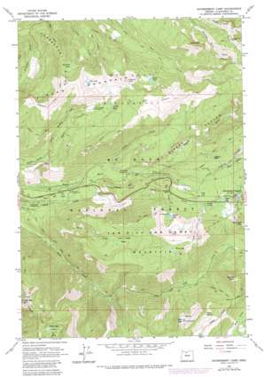
Government Camp Topo Map Oregon
To zoom in, hover over the map of Government Camp
USGS Topo Quad 45121c7 - 1:24,000 scale
| Topo Map Name: | Government Camp |
| USGS Topo Quad ID: | 45121c7 |
| Print Size: | ca. 21 1/4" wide x 27" high |
| Southeast Coordinates: | 45.25° N latitude / 121.75° W longitude |
| Map Center Coordinates: | 45.3125° N latitude / 121.8125° W longitude |
| U.S. State: | OR |
| Filename: | o45121c7.jpg |
| Download Map JPG Image: | Government Camp topo map 1:24,000 scale |
| Map Type: | Topographic |
| Topo Series: | 7.5´ |
| Map Scale: | 1:24,000 |
| Source of Map Images: | United States Geological Survey (USGS) |
| Alternate Map Versions: |
Government Camp OR 1962, updated 1964 Download PDF Buy paper map Government Camp OR 1962, updated 1972 Download PDF Buy paper map Government Camp OR 1962, updated 1980 Download PDF Buy paper map Government Camp OR 1962, updated 1980 Download PDF Buy paper map Government Camp OR 1980, updated 1980 Download PDF Buy paper map Government Camp OR 1997, updated 1999 Download PDF Buy paper map Government Camp OR 2011 Download PDF Buy paper map Government Camp OR 2014 Download PDF Buy paper map |
| FStopo: | US Forest Service topo Government Camp is available: Download FStopo PDF Download FStopo TIF |
1:24,000 Topo Quads surrounding Government Camp
> Back to 45121a1 at 1:100,000 scale
> Back to 45120a1 at 1:250,000 scale
> Back to U.S. Topo Maps home
Government Camp topo map: Gazetteer
Government Camp: Basins
Wind Creek Basin elevation 1211m 3973′Government Camp: Falls
Yocum Falls elevation 1017m 3336′Government Camp: Forests
Mount Hood National Forest elevation 1083m 3553′Government Camp: Lakes
Burnt Lake elevation 1252m 4107′Cast Lake elevation 1351m 4432′
Collins Lake elevation 1153m 3782′
Devils Lake elevation 1198m 3930′
Dumbbell Lake elevation 1255m 4117′
Enid Lake elevation 1103m 3618′
Hidden Lake elevation 1168m 3832′
Kinzel Lake elevation 1303m 4274′
Mirror Lake elevation 1252m 4107′
Veda Lake elevation 1289m 4229′
Wind Lake elevation 1415m 4642′
Government Camp: Parks
Bruin Run Campground (historical) elevation 708m 2322′Government Camp: Populated Places
Government Camp elevation 1183m 3881′Government Camp: Post Offices
Government Camp Post Office elevation 1183m 3881′Pompeii Post Office (historical) elevation 1182m 3877′
Government Camp: Ridges
Horseshoe Ridge elevation 1322m 4337′Laurel Hill elevation 978m 3208′
Government Camp: Streams
Bruin Run Creek elevation 643m 2109′Lady Creek elevation 767m 2516′
Wind Creek elevation 674m 2211′
Government Camp: Summits
Eureka Peak elevation 1482m 4862′Multorpor Mountain elevation 1415m 4642′
Slide Mountain elevation 1478m 4849′
Tom Dick and Harry Mountain elevation 1527m 5009′
Veda Butte elevation 1518m 4980′
Zigzag Mountain elevation 1526m 5006′
Government Camp: Trails
Burnt Lake Trail elevation 927m 3041′Cast Creek Trail elevation 1109m 3638′
Cool Creek Trail elevation 1246m 4087′
Devils Canyon Trail elevation 1291m 4235′
East Zigzag Mountain Trail elevation 1414m 4639′
Eureka Peak Trail elevation 1168m 3832′
Hidden Lake Trail elevation 1293m 4242′
Horseshoe Ridge Trail elevation 1403m 4603′
Mirror Lake Trail elevation 1127m 3697′
Paradise Park Trail elevation 1281m 4202′
Pioneer Bridle Trail elevation 966m 3169′
Still Creek Trail elevation 693m 2273′
Tom Dick Trail elevation 1427m 4681′
Wind Creek Trail elevation 1340m 4396′
Government Camp: Valleys
Devil Canyon elevation 657m 2155′Little Zigzag Canyon elevation 936m 3070′
Sand Canyon elevation 1164m 3818′
Zigzag Canyon elevation 868m 2847′
Government Camp digital topo map on disk
Buy this Government Camp topo map showing relief, roads, GPS coordinates and other geographical features, as a high-resolution digital map file on DVD:


