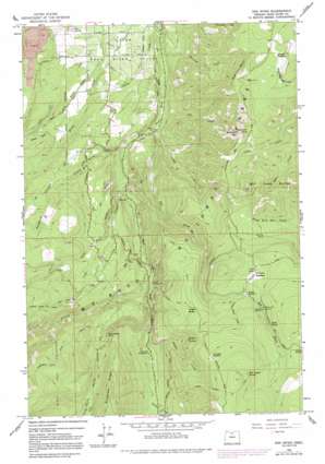
Dog River Topo Map Oregon
To zoom in, hover over the map of Dog River
USGS Topo Quad 45121d5 - 1:24,000 scale
| Topo Map Name: | Dog River |
| USGS Topo Quad ID: | 45121d5 |
| Print Size: | ca. 21 1/4" wide x 27" high |
| Southeast Coordinates: | 45.375° N latitude / 121.5° W longitude |
| Map Center Coordinates: | 45.4375° N latitude / 121.5625° W longitude |
| U.S. State: | OR |
| Filename: | o45121d5.jpg |
| Download Map JPG Image: | Dog River topo map 1:24,000 scale |
| Map Type: | Topographic |
| Topo Series: | 7.5´ |
| Map Scale: | 1:24,000 |
| Source of Map Images: | United States Geological Survey (USGS) |
| Alternate Map Versions: |
Dog River OR 1962, updated 1964 Download PDF Buy paper map Dog River OR 1962, updated 1977 Download PDF Buy paper map Dog River OR 1962, updated 1980 Download PDF Buy paper map Dog River OR 1962, updated 1991 Download PDF Buy paper map Dog River OR 1996, updated 1998 Download PDF Buy paper map Dog River OR 2011 Download PDF Buy paper map Dog River OR 2014 Download PDF Buy paper map |
| FStopo: | US Forest Service topo Dog River is available: Download FStopo PDF Download FStopo TIF |
1:24,000 Topo Quads surrounding Dog River
> Back to 45121a1 at 1:100,000 scale
> Back to 45120a1 at 1:250,000 scale
> Back to U.S. Topo Maps home
Dog River topo map: Gazetteer
Dog River: Canals
Glacier Ditch elevation 816m 2677′Volmer Ditch elevation 828m 2716′
Dog River: Falls
Tamanawas Falls elevation 1070m 3510′Dog River: Flats
Bottle Prairie elevation 1401m 4596′Brooks Meadow elevation 1313m 4307′
Cooks Meadow elevation 1281m 4202′
Gibson Prairie elevation 1180m 3871′
Horkelia Meadow elevation 1471m 4826′
Dog River: Parks
Polallie Campground (historical) elevation 873m 2864′Routson County Park elevation 748m 2454′
Dog River: Ridges
Mill Creek Buttes elevation 1297m 4255′Rim Rock elevation 1287m 4222′
Dog River: Springs
Agnes Spring elevation 1374m 4507′Blue Bucket Spring elevation 1515m 4970′
Clinger Spring elevation 1283m 4209′
Crystal Spring elevation 750m 2460′
Elk Bed Springs elevation 1000m 3280′
Gibson Spring elevation 1220m 4002′
Hannum Spring elevation 1189m 3900′
Powder Springs elevation 1199m 3933′
Roaring Camp Spring elevation 882m 2893′
Shellrock Spring elevation 1226m 4022′
Shinners English Spring elevation 1235m 4051′
Sparks Spring elevation 1115m 3658′
Dog River: Streams
Ash Creek elevation 717m 2352′Buck Creek elevation 813m 2667′
Cat Creek elevation 613m 2011′
Cold Spring Creek elevation 902m 2959′
Crystal Spring Creek elevation 675m 2214′
Culvert Creek elevation 984m 3228′
Ditch Creek elevation 1271m 4169′
Doe Creek elevation 838m 2749′
Dog River elevation 644m 2112′
Fall Creek elevation 886m 2906′
North Fork Cold Spring Creek elevation 1227m 4025′
Polallie Creek elevation 865m 2837′
Puppy Creek elevation 654m 2145′
Rimrock Creek elevation 572m 1876′
Tilly Jane Creek elevation 732m 2401′
Tumble Creek elevation 920m 3018′
Ward Creek elevation 1253m 4110′
West Fork Evans Creek elevation 629m 2063′
Dog River: Summits
Shellrock Mountain elevation 1358m 4455′Dog River: Trails
Blue Bucket Trail elevation 1574m 5164′Dog River Trail elevation 1219m 3999′
Lamberson Butte Spur Trail elevation 1442m 4730′
Zigzag Trail elevation 1252m 4107′
Dog River: Valleys
Sand Canyon elevation 1136m 3727′Weygandt Canyon elevation 708m 2322′
Dog River digital topo map on disk
Buy this Dog River topo map showing relief, roads, GPS coordinates and other geographical features, as a high-resolution digital map file on DVD:


