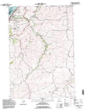
Petersburg Topo Map Oregon
To zoom in, hover over the map of Petersburg
USGS Topo Quad 45121e1 - 1:24,000 scale
| Topo Map Name: | Petersburg |
| USGS Topo Quad ID: | 45121e1 |
| Print Size: | ca. 21 1/4" wide x 27" high |
| Southeast Coordinates: | 45.5° N latitude / 121° W longitude |
| Map Center Coordinates: | 45.5625° N latitude / 121.0625° W longitude |
| U.S. States: | OR, WA |
| Filename: | o45121e1.jpg |
| Download Map JPG Image: | Petersburg topo map 1:24,000 scale |
| Map Type: | Topographic |
| Topo Series: | 7.5´ |
| Map Scale: | 1:24,000 |
| Source of Map Images: | United States Geological Survey (USGS) |
| Alternate Map Versions: |
Petersburg OR 1978, updated 1978 Download PDF Buy paper map Petersburg OR 1994, updated 1995 Download PDF Buy paper map Petersburg OR 2011 Download PDF Buy paper map Petersburg OR 2014 Download PDF Buy paper map |
| FStopo: | US Forest Service topo Petersburg is available: Download FStopo PDF Download FStopo TIF |
1:24,000 Topo Quads surrounding Petersburg
> Back to 45121e1 at 1:100,000 scale
> Back to 45120a1 at 1:250,000 scale
> Back to U.S. Topo Maps home
Petersburg topo map: Gazetteer
Petersburg: Dams
Seufert Dam elevation 41m 134′Petersburg: Falls
Cushing Falls elevation 42m 137′Petersburg: Islands
Memaloose Island elevation 26m 85′Petersburg: Populated Places
English (historical) elevation 265m 869′Fairbanks elevation 151m 495′
Petersburg elevation 97m 318′
Petersburg: Post Offices
Big Eddy Post Office (historical) elevation 263m 862′English Post Office (historical) elevation 265m 869′
Fairbanks Post Office (historical) elevation 151m 495′
Petersburg: Reservoirs
McDonald Reservoir elevation 306m 1003′Petersburg: Springs
Company Hollow Spring elevation 196m 643′Petersburg: Streams
Dry Creek elevation 298m 977′Eightmile Creek elevation 79m 259′
Fifteenmile Creek elevation 29m 95′
Fivemile Creek elevation 97m 318′
Spring Branch elevation 88m 288′
Petersburg: Summits
Signal Hill elevation 293m 961′Petersburg: Valleys
Company Hollow elevation 156m 511′Jameson Canyon elevation 288m 944′
Japanese Hollow elevation 252m 826′
Petersburg digital topo map on disk
Buy this Petersburg topo map showing relief, roads, GPS coordinates and other geographical features, as a high-resolution digital map file on DVD:


