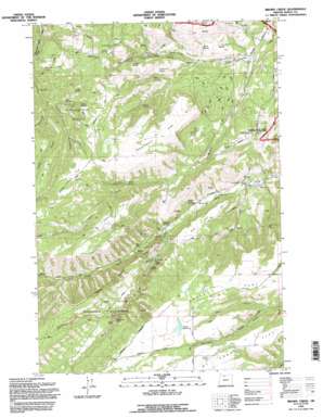
Brown Creek Topo Map Oregon
To zoom in, hover over the map of Brown Creek
USGS Topo Quad 45121e3 - 1:24,000 scale
| Topo Map Name: | Brown Creek |
| USGS Topo Quad ID: | 45121e3 |
| Print Size: | ca. 21 1/4" wide x 27" high |
| Southeast Coordinates: | 45.5° N latitude / 121.25° W longitude |
| Map Center Coordinates: | 45.5625° N latitude / 121.3125° W longitude |
| U.S. State: | OR |
| Filename: | o45121e3.jpg |
| Download Map JPG Image: | Brown Creek topo map 1:24,000 scale |
| Map Type: | Topographic |
| Topo Series: | 7.5´ |
| Map Scale: | 1:24,000 |
| Source of Map Images: | United States Geological Survey (USGS) |
| Alternate Map Versions: |
Brown Creek OR 1974, updated 1977 Download PDF Buy paper map Brown Creek OR 1994, updated 1996 Download PDF Buy paper map Brown Creek OR 2011 Download PDF Buy paper map Brown Creek OR 2014 Download PDF Buy paper map |
| FStopo: | US Forest Service topo Brown Creek is available: Download FStopo PDF Download FStopo TIF |
1:24,000 Topo Quads surrounding Brown Creek
> Back to 45121e1 at 1:100,000 scale
> Back to 45120a1 at 1:250,000 scale
> Back to U.S. Topo Maps home
Brown Creek topo map: Gazetteer
Brown Creek: Airports
Chenoweth Airpark elevation 169m 554′Pointers Airfield elevation 282m 925′
Brown Creek: Basins
Indian Hollow elevation 472m 1548′Brown Creek: Dams
Evans Dam elevation 653m 2142′Brown Creek: Falls
Mill Creek Falls elevation 467m 1532′Brown Creek: Flats
Dutch Flat elevation 663m 2175′Government Flat elevation 542m 1778′
Lubbing Flat elevation 614m 2014′
Mount Hood Flat elevation 656m 2152′
Oak Flat elevation 385m 1263′
Seward Flat elevation 568m 1863′
Thousand Acre Pasture elevation 541m 1774′
Brown Creek: Lakes
Ketchum Pond elevation 328m 1076′Liechti Pond elevation 638m 2093′
Liechti Pond Number Two elevation 691m 2267′
Pullens Pond elevation 252m 826′
Wassen Pond elevation 218m 715′
Brown Creek: Post Offices
Matney Post Office (historical) elevation 583m 1912′Brown Creek: Reservoirs
Evans Reservoir elevation 653m 2142′Trugg Reservoir elevation 308m 1010′
Wicks Reservoir elevation 278m 912′
Brown Creek: Slopes
Obrist Grade elevation 581m 1906′Suicide Grade elevation 356m 1167′
Brown Creek: Springs
Coon Spring elevation 378m 1240′Cotton Spring elevation 371m 1217′
Dunnigan Spring elevation 411m 1348′
Leniger Spring elevation 524m 1719′
Martin Spring elevation 473m 1551′
Miller Spring elevation 256m 839′
O'Connor Spring elevation 397m 1302′
Poe Spring elevation 285m 935′
Scheuter Spring elevation 515m 1689′
Sheep Spring elevation 366m 1200′
Slegman Spring elevation 310m 1017′
Twin Springs elevation 330m 1082′
Wetle Spring elevation 268m 879′
Brown Creek: Streams
Brown Creek elevation 141m 462′Dry Fork elevation 444m 1456′
Ladore Creek elevation 346m 1135′
North Fork Mill Creek elevation 227m 744′
South Fork Mill Creek elevation 227m 744′
Brown Creek: Summits
Wasco Butte elevation 711m 2332′Brown Creek: Valleys
Blackburn Canyon elevation 429m 1407′Lucky Canyon elevation 321m 1053′
Brown Creek digital topo map on disk
Buy this Brown Creek topo map showing relief, roads, GPS coordinates and other geographical features, as a high-resolution digital map file on DVD:


