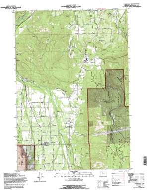
Parkdale Topo Map Oregon
To zoom in, hover over the map of Parkdale
USGS Topo Quad 45121e5 - 1:24,000 scale
| Topo Map Name: | Parkdale |
| USGS Topo Quad ID: | 45121e5 |
| Print Size: | ca. 21 1/4" wide x 27" high |
| Southeast Coordinates: | 45.5° N latitude / 121.5° W longitude |
| Map Center Coordinates: | 45.5625° N latitude / 121.5625° W longitude |
| U.S. State: | OR |
| Filename: | o45121e5.jpg |
| Download Map JPG Image: | Parkdale topo map 1:24,000 scale |
| Map Type: | Topographic |
| Topo Series: | 7.5´ |
| Map Scale: | 1:24,000 |
| Source of Map Images: | United States Geological Survey (USGS) |
| Alternate Map Versions: |
Parkdale OR 1974, updated 1977 Download PDF Buy paper map Parkdale OR 1994, updated 1996 Download PDF Buy paper map Parkdale OR 1994, updated 1996 Download PDF Buy paper map Parkdale OR 2011 Download PDF Buy paper map Parkdale OR 2014 Download PDF Buy paper map |
| FStopo: | US Forest Service topo Parkdale is available: Download FStopo PDF Download FStopo TIF |
1:24,000 Topo Quads surrounding Parkdale
> Back to 45121e1 at 1:100,000 scale
> Back to 45120a1 at 1:250,000 scale
> Back to U.S. Topo Maps home
Parkdale topo map: Gazetteer
Parkdale: Airports
Hanel Field elevation 495m 1624′Parkdale: Basins
Dukes Valley elevation 294m 964′Middle Valley elevation 464m 1522′
Parkdale: Canals
Central Lateral elevation 471m 1545′East Fork Main Canal elevation 504m 1653′
Highline Lateral elevation 333m 1092′
Mount Hood Canal elevation 468m 1535′
Parkdale: Flats
Long Prairie elevation 1106m 3628′Willow Flat elevation 340m 1115′
Parkdale: Parks
Toll Bridge County Park elevation 490m 1607′Ziba Dimmick State Park (historical) elevation 463m 1519′
Parkdale: Populated Places
Mount Hood elevation 468m 1535′Parkdale elevation 526m 1725′
Parkdale: Post Offices
Fir Post Office (historical) elevation 295m 967′Mount Hood Post Office (historical) elevation 468m 1535′
Mount Hood-Parkdale Post Office elevation 526m 1725′
Parkdale Post Office (historical) elevation 526m 1725′
Straightsburg Post Office (historical) elevation 238m 780′
Parkdale: Reservoirs
Aubert Reservoir elevation 468m 1535′Emil Creek Reservoir elevation 516m 1692′
Parkdale: Ridges
Booth Hill elevation 598m 1961′Middle Mountain elevation 757m 2483′
Surveyors Ridge elevation 1139m 3736′
Parkdale: Springs
Bear Wallow Springs elevation 404m 1325′Davis Spring elevation 241m 790′
English Spring elevation 237m 777′
Graham Spring elevation 472m 1548′
Lone Pine Spring elevation 222m 728′
Parkdale Cold Spring elevation 583m 1912′
Poplar Spring elevation 624m 2047′
Rogers Spring elevation 525m 1722′
Shelley Springs elevation 232m 761′
Tucker Spring elevation 233m 764′
Parkdale: Streams
Alder Creek elevation 508m 1666′Baldwin Creek elevation 365m 1197′
Collins Creek elevation 208m 682′
Emil Creek elevation 394m 1292′
Evans Creek elevation 472m 1548′
Graham Creek elevation 426m 1397′
Griswell Creek elevation 489m 1604′
Kershaw Creek elevation 225m 738′
Pine Creek elevation 222m 728′
Rogers Creek elevation 458m 1502′
Trout Creek elevation 314m 1030′
Wisehart Creek elevation 347m 1138′
Yellowjacket Creek elevation 538m 1765′
Parkdale: Summits
Bald Butte elevation 1147m 3763′Parkdale: Valleys
Hutson Gulch elevation 547m 1794′Parkdale digital topo map on disk
Buy this Parkdale topo map showing relief, roads, GPS coordinates and other geographical features, as a high-resolution digital map file on DVD:


