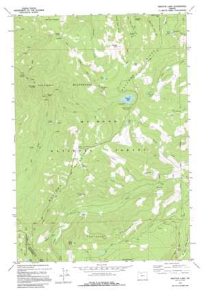
Wahtum Lake Topo Map Oregon
To zoom in, hover over the map of Wahtum Lake
USGS Topo Quad 45121e7 - 1:24,000 scale
| Topo Map Name: | Wahtum Lake |
| USGS Topo Quad ID: | 45121e7 |
| Print Size: | ca. 21 1/4" wide x 27" high |
| Southeast Coordinates: | 45.5° N latitude / 121.75° W longitude |
| Map Center Coordinates: | 45.5625° N latitude / 121.8125° W longitude |
| U.S. State: | OR |
| Filename: | o45121e7.jpg |
| Download Map JPG Image: | Wahtum Lake topo map 1:24,000 scale |
| Map Type: | Topographic |
| Topo Series: | 7.5´ |
| Map Scale: | 1:24,000 |
| Source of Map Images: | United States Geological Survey (USGS) |
| Alternate Map Versions: |
Wahtum Lake OR 1979, updated 1980 Download PDF Buy paper map Wahtum Lake OR 1979, updated 1995 Download PDF Buy paper map Wahtum Lake OR 1994, updated 1997 Download PDF Buy paper map Wahtum Lake OR 2011 Download PDF Buy paper map Wahtum Lake OR 2014 Download PDF Buy paper map |
| FStopo: | US Forest Service topo Wahtum Lake is available: Download FStopo PDF Download FStopo TIF |
1:24,000 Topo Quads surrounding Wahtum Lake
> Back to 45121e1 at 1:100,000 scale
> Back to 45120a1 at 1:250,000 scale
> Back to U.S. Topo Maps home
Wahtum Lake topo map: Gazetteer
Wahtum Lake: Falls
Tunnel Falls elevation 332m 1089′Wahtum Lake: Lakes
Black Lake elevation 1156m 3792′Hicks Lake elevation 1189m 3900′
Mud Lake elevation 1118m 3667′
Ottertail Lake elevation 1164m 3818′
Scout Lake elevation 1229m 4032′
Wahtum Lake elevation 1136m 3727′
Wahtum Lake: Parks
Indian Springs Campground (historical) elevation 1269m 4163′Wahtum Lake: Pillars
Indianhead Rock elevation 780m 2559′Wahtum Lake: Ridges
Waucoma Ridge elevation 1395m 4576′Wahtum Lake: Springs
Indian Springs elevation 1297m 4255′Smokey Spring elevation 1186m 3891′
Wahtum Lake: Streams
Buck Point Creek elevation 825m 2706′East Fork Eagle Creek elevation 339m 1112′
Indian Creek elevation 579m 1899′
Marco Creek elevation 568m 1863′
Midget Creek elevation 662m 2171′
No Name Creek elevation 587m 1925′
Opal Creek elevation 241m 790′
Simmons Creek elevation 1098m 3602′
Skipper Creek elevation 549m 1801′
Tumbledown Creek elevation 568m 1863′
Washout Creek elevation 702m 2303′
Wahtum Lake: Summits
Chinidere Mountain elevation 1419m 4655′Indian Mountain elevation 1492m 4895′
Raker Point elevation 1186m 3891′
Sawtooth Mountain elevation 1256m 4120′
Sunshine Rock elevation 1100m 3608′
Tomlike Mountain elevation 1332m 4370′
Wahtum Lake: Trails
Eagle Creek Trail elevation 979m 3211′Wahtum Lake digital topo map on disk
Buy this Wahtum Lake topo map showing relief, roads, GPS coordinates and other geographical features, as a high-resolution digital map file on DVD:


