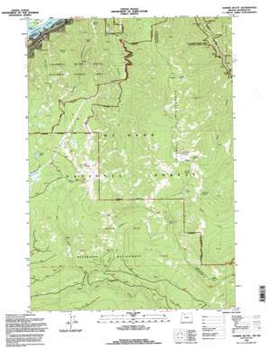
Tanner Butte Topo Map Oregon
To zoom in, hover over the map of Tanner Butte
USGS Topo Quad 45121e8 - 1:24,000 scale
| Topo Map Name: | Tanner Butte |
| USGS Topo Quad ID: | 45121e8 |
| Print Size: | ca. 21 1/4" wide x 27" high |
| Southeast Coordinates: | 45.5° N latitude / 121.875° W longitude |
| Map Center Coordinates: | 45.5625° N latitude / 121.9375° W longitude |
| U.S. States: | OR, WA |
| Filename: | o45121e8.jpg |
| Download Map JPG Image: | Tanner Butte topo map 1:24,000 scale |
| Map Type: | Topographic |
| Topo Series: | 7.5´ |
| Map Scale: | 1:24,000 |
| Source of Map Images: | United States Geological Survey (USGS) |
| Alternate Map Versions: |
Tanner Butte OR 1979, updated 1980 Download PDF Buy paper map Tanner Butte OR 1979, updated 1992 Download PDF Buy paper map Tanner Butte OR 1994, updated 1996 Download PDF Buy paper map Tanner Butte OR 2011 Download PDF Buy paper map Tanner Butte OR 2014 Download PDF Buy paper map |
| FStopo: | US Forest Service topo Tanner Butte is available: Download FStopo PDF Download FStopo TIF |
1:24,000 Topo Quads surrounding Tanner Butte
> Back to 45121e1 at 1:100,000 scale
> Back to 45120a1 at 1:250,000 scale
> Back to U.S. Topo Maps home
Tanner Butte topo map: Gazetteer
Tanner Butte: Bridges
Four One Half Mile Bridge elevation 219m 718′High Bridge elevation 199m 652′
Tanner Butte: Channels
Hamilton Island Reach elevation 7m 22′Warrendale Upper Range elevation 6m 19′
Tanner Butte: Falls
Elowah Falls elevation 164m 538′Loowit Falls elevation 222m 728′
Moffett Falls elevation 48m 157′
Punch Bowl Falls elevation 120m 393′
Tanner Creek Falls elevation 134m 439′
Wahclella Falls elevation 93m 305′
Wahe Falls elevation 206m 675′
Tanner Butte: Islands
Ives Island elevation 15m 49′Tanner Butte: Lakes
Dublin Lake elevation 1066m 3497′Palmer Lake elevation 970m 3182′
Thrush Pond elevation 1055m 3461′
Tanner Butte: Parks
John B Yeon State Park elevation 50m 164′Tanner Butte: Springs
Big Cedar Springs elevation 915m 3001′Tanner Spring elevation 1139m 3736′
Tanner Butte: Streams
Falls Creek elevation 406m 1332′Log Creek elevation 511m 1676′
Metasequoia Creek elevation 6m 19′
Moffett Creek elevation 23m 75′
Tish Creek elevation 133m 436′
West Branch Falls Creek elevation 449m 1473′
Tanner Butte: Summits
Eagle Butte elevation 1270m 4166′Mount Talapus elevation 1182m 3877′
Munra Point elevation 559m 1833′
Table Mountain elevation 1383m 4537′
Tanner Butte elevation 1353m 4438′
Wauneka Point elevation 794m 2604′
Tanner Butte: Trails
Eagle Tanner Trail elevation 893m 2929′Nesmith Point Trail elevation 953m 3126′
Tanner Butte Trail elevation 1231m 4038′
Tanner Cutoff Trail elevation 699m 2293′
Tanner Butte digital topo map on disk
Buy this Tanner Butte topo map showing relief, roads, GPS coordinates and other geographical features, as a high-resolution digital map file on DVD:


