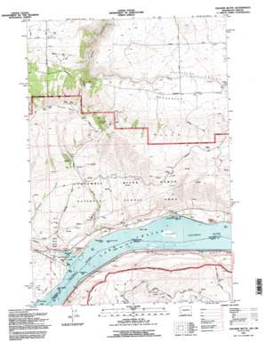
Stacker Butte Topo Map Washington
To zoom in, hover over the map of Stacker Butte
USGS Topo Quad 45121f1 - 1:24,000 scale
| Topo Map Name: | Stacker Butte |
| USGS Topo Quad ID: | 45121f1 |
| Print Size: | ca. 21 1/4" wide x 27" high |
| Southeast Coordinates: | 45.625° N latitude / 121° W longitude |
| Map Center Coordinates: | 45.6875° N latitude / 121.0625° W longitude |
| U.S. States: | WA, OR |
| Filename: | o45121f1.jpg |
| Download Map JPG Image: | Stacker Butte topo map 1:24,000 scale |
| Map Type: | Topographic |
| Topo Series: | 7.5´ |
| Map Scale: | 1:24,000 |
| Source of Map Images: | United States Geological Survey (USGS) |
| Alternate Map Versions: |
Stacker Butte WA 1974, updated 1977 Download PDF Buy paper map Stacker Butte WA 1974, updated 1977 Download PDF Buy paper map Stacker Butte WA 1994, updated 1995 Download PDF Buy paper map Stacker Butte WA 2011 Download PDF Buy paper map Stacker Butte WA 2014 Download PDF Buy paper map |
| FStopo: | US Forest Service topo Stacker Butte is available: Download FStopo PDF Download FStopo TIF |
1:24,000 Topo Quads surrounding Stacker Butte
> Back to 45121e1 at 1:100,000 scale
> Back to 45120a1 at 1:250,000 scale
> Back to U.S. Topo Maps home
Stacker Butte topo map: Gazetteer
Stacker Butte: Gaps
Fairbanks Gap elevation 208m 682′Stacker Butte: Islands
Browns Island elevation 50m 164′Stacker Butte: Lakes
Horsethief Lake elevation 50m 164′Stacker Butte: Parks
Avery Recreation Area elevation 57m 187′Horsethief Lake State Park elevation 51m 167′
Recreation Area elevation 57m 187′
Stacker Butte: Populated Places
Gooseneck elevation 485m 1591′Stacker Butte: Rapids
Fivemile Rapids (historical) elevation 50m 164′Tenmile Rapids (historical) elevation 50m 164′
The Dalles (historical) elevation 50m 164′
Stacker Butte: Ridges
Kaser Ridge elevation 381m 1250′Stacker Butte: Springs
Oak Spring elevation 748m 2454′Stacker Butte: Streams
Eightmile Creek elevation 54m 177′Fivemile Creek elevation 52m 170′
Stacker Butte: Summits
Horsethief Butte elevation 153m 501′Stacker Butte elevation 981m 3218′
Stacker Butte: Valleys
Stacker Canyon elevation 416m 1364′Stacker Butte digital topo map on disk
Buy this Stacker Butte topo map showing relief, roads, GPS coordinates and other geographical features, as a high-resolution digital map file on DVD:


