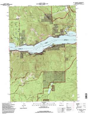
Mount Defiance Topo Map Oregon
To zoom in, hover over the map of Mount Defiance
USGS Topo Quad 45121f6 - 1:24,000 scale
| Topo Map Name: | Mount Defiance |
| USGS Topo Quad ID: | 45121f6 |
| Print Size: | ca. 21 1/4" wide x 27" high |
| Southeast Coordinates: | 45.625° N latitude / 121.625° W longitude |
| Map Center Coordinates: | 45.6875° N latitude / 121.6875° W longitude |
| U.S. States: | OR, WA |
| Filename: | o45121f6.jpg |
| Download Map JPG Image: | Mount Defiance topo map 1:24,000 scale |
| Map Type: | Topographic |
| Topo Series: | 7.5´ |
| Map Scale: | 1:24,000 |
| Source of Map Images: | United States Geological Survey (USGS) |
| Alternate Map Versions: |
Mt. Defiance OR 1979, updated 1980 Download PDF Buy paper map Mt. Defiance OR 1994, updated 1996 Download PDF Buy paper map Mount Defiance OR 2011 Download PDF Buy paper map Mount Defiance OR 2014 Download PDF Buy paper map |
| FStopo: | US Forest Service topo Mount Defiance is available: Download FStopo PDF Download FStopo TIF |
1:24,000 Topo Quads surrounding Mount Defiance
> Back to 45121e1 at 1:100,000 scale
> Back to 45120a1 at 1:250,000 scale
> Back to U.S. Topo Maps home
Mount Defiance topo map: Gazetteer
Mount Defiance: Areas
Old Wagon Road Historical Area elevation 115m 377′Mount Defiance: Capes
Collins Point elevation 24m 78′Mount Defiance: Channels
Cook Point Range Channel elevation 24m 78′Little White Salmon Range Channel elevation 24m 78′
Mount Defiance: Dams
Little White Salmon Hatchery Dam elevation 93m 305′Lower Green Point Dam elevation 953m 3126′
Upper Green Point Dam elevation 964m 3162′
Mount Defiance: Falls
Lancaster Falls elevation 145m 475′Warren Creek Falls elevation 100m 328′
Mount Defiance: Flats
Mill A Flat elevation 281m 921′Mount Defiance: Lakes
Bear Lake elevation 1190m 3904′Drano Lake elevation 24m 78′
Duck Lake elevation 226m 741′
East Lake elevation 235m 770′
Frog Lake elevation 133m 436′
Hidden Lake elevation 203m 666′
Home Lake elevation 195m 639′
Long Lake elevation 195m 639′
Martin Lake elevation 173m 567′
Middle Lake elevation 185m 606′
New Lake elevation 206m 675′
Twin Lakes elevation 247m 810′
Warren Lake elevation 1139m 3736′
Mount Defiance: Parks
Kingsley Reservoir County Park elevation 977m 3205′Lindsey Creek State Park elevation 214m 702′
Starvation Creek State Park elevation 54m 177′
Viento State Park elevation 107m 351′
Vinzenz Lausmann State Park elevation 268m 879′
Wygant State Park elevation 332m 1089′
Mount Defiance: Populated Places
Cook elevation 39m 127′Mount Defiance: Post Offices
Viento Post Office (historical) elevation 35m 114′Mount Defiance: Reservoirs
Green Point Lower Reservoir elevation 953m 3126′Green Point Upper Reservoir elevation 965m 3166′
Lindsey Pond elevation 27m 88′
Little White Salmon Fish Hatchery Reservoir elevation 93m 305′
Mount Defiance: Ridges
Viento Ridge elevation 887m 2910′Mount Defiance: Springs
Parker Springs elevation 880m 2887′Perham Creek Spring elevation 456m 1496′
White Horse Spring elevation 1099m 3605′
Mount Defiance: Streams
Cabin Creek elevation 24m 78′Collins Creek elevation 27m 88′
Dog Creek elevation 25m 82′
Lindsey Creek elevation 26m 85′
Little White Salmon River elevation 37m 121′
Perham Creek elevation 24m 78′
Rock Creek elevation 185m 606′
Starvation Creek elevation 27m 88′
Summit Creek elevation 67m 219′
Viento Creek elevation 26m 85′
Warren Creek elevation 26m 85′
Wonder Creek elevation 34m 111′
Mount Defiance: Summits
Augspurger Mountain elevation 962m 3156′Cook Hill elevation 880m 2887′
Dog Mountain elevation 858m 2814′
Mount Defiance elevation 1504m 4934′
Shellrock Mountain elevation 638m 2093′
Mount Defiance: Trails
Wygant Trail elevation 278m 912′Mount Defiance digital topo map on disk
Buy this Mount Defiance topo map showing relief, roads, GPS coordinates and other geographical features, as a high-resolution digital map file on DVD:


