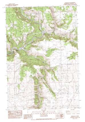
Wahkiacus Topo Map Washington
To zoom in, hover over the map of Wahkiacus
USGS Topo Quad 45121g1 - 1:24,000 scale
| Topo Map Name: | Wahkiacus |
| USGS Topo Quad ID: | 45121g1 |
| Print Size: | ca. 21 1/4" wide x 27" high |
| Southeast Coordinates: | 45.75° N latitude / 121° W longitude |
| Map Center Coordinates: | 45.8125° N latitude / 121.0625° W longitude |
| U.S. State: | WA |
| Filename: | o45121g1.jpg |
| Download Map JPG Image: | Wahkiacus topo map 1:24,000 scale |
| Map Type: | Topographic |
| Topo Series: | 7.5´ |
| Map Scale: | 1:24,000 |
| Source of Map Images: | United States Geological Survey (USGS) |
| Alternate Map Versions: |
Wahkiacus WA 1983, updated 1983 Download PDF Buy paper map Wahkiacus WA 2011 Download PDF Buy paper map Wahkiacus WA 2014 Download PDF Buy paper map |
1:24,000 Topo Quads surrounding Wahkiacus
> Back to 45121e1 at 1:100,000 scale
> Back to 45120a1 at 1:250,000 scale
> Back to U.S. Topo Maps home
Wahkiacus topo map: Gazetteer
Wahkiacus: Populated Places
Klickitat Springs elevation 150m 492′Swale elevation 330m 1082′
Wahkiacus elevation 163m 534′
Wahkiacus: Springs
Maddock Springs elevation 179m 587′Wahkiacus: Streams
Bowman Creek elevation 191m 626′Canyon Creek elevation 315m 1033′
Little Klickitat River elevation 175m 574′
Mill Creek elevation 257m 843′
Swale Creek elevation 169m 554′
Wahkiacus: Summits
Horseshoe Bend elevation 465m 1525′Wahkiacus: Valleys
Swale Canyon elevation 176m 577′Wahkiaous Canyon elevation 162m 531′
Wahkiacus digital topo map on disk
Buy this Wahkiacus topo map showing relief, roads, GPS coordinates and other geographical features, as a high-resolution digital map file on DVD:


