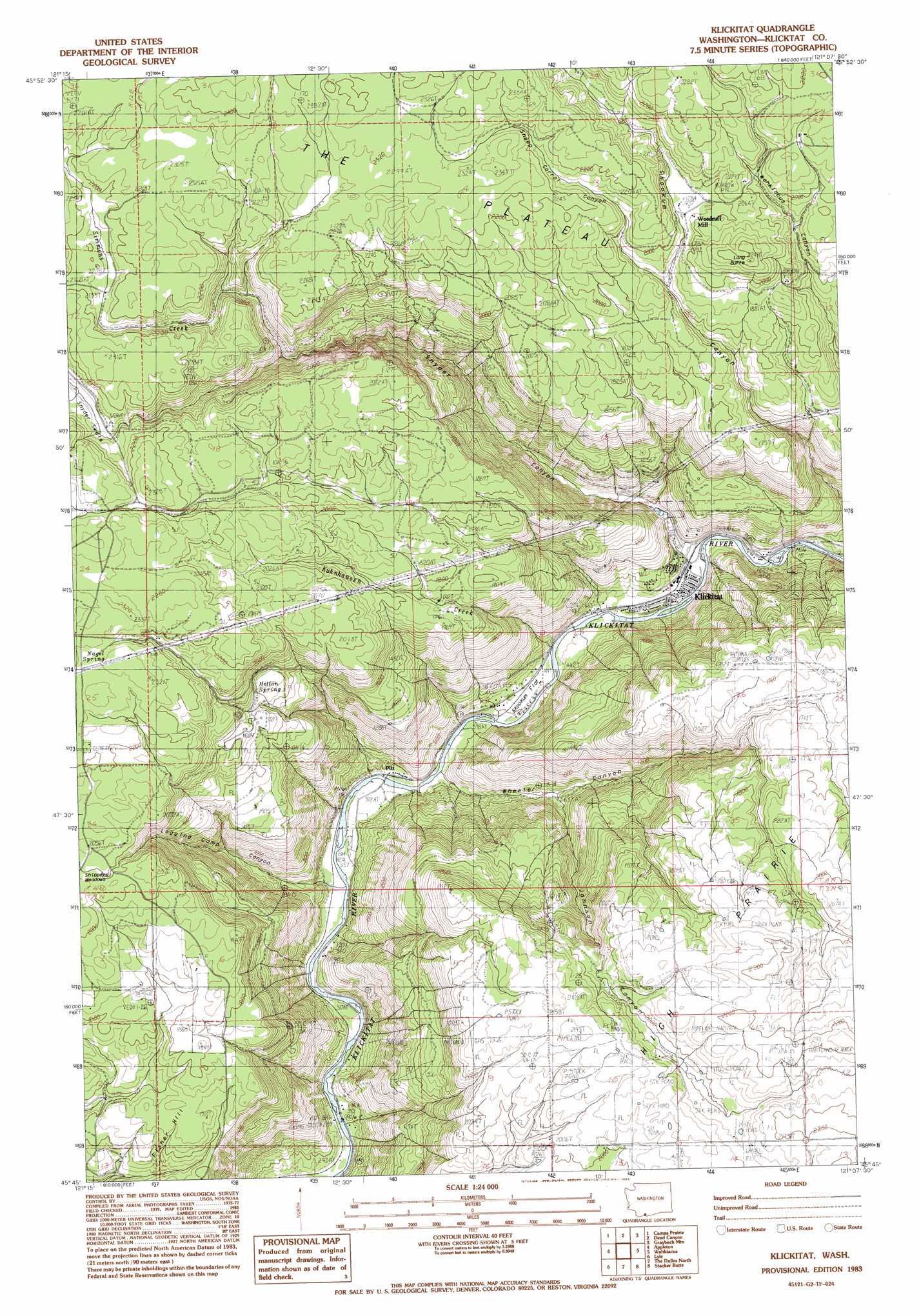
Klickitat Topo Map Washington
To zoom in, hover over the map of Klickitat
USGS Topo Quad 45121g2 - 1:24,000 scale
| Topo Map Name: | Klickitat |
| USGS Topo Quad ID: | 45121g2 |
| Print Size: | ca. 21 1/4" wide x 27" high |
| Southeast Coordinates: | 45.75° N latitude / 121.125° W longitude |
| Map Center Coordinates: | 45.8125° N latitude / 121.1875° W longitude |
| U.S. State: | WA |
| Filename: | o45121g2.jpg |
| Download Map JPG Image: | Klickitat topo map 1:24,000 scale |
| Map Type: | Topographic |
| Topo Series: | 7.5´ |
| Map Scale: | 1:24,000 |
| Source of Map Images: | United States Geological Survey (USGS) |
| Alternate Map Versions: |
Klickitat WA 1983, updated 1983 Download PDF Buy paper map Klickitat WA 2000, updated 2003 Download PDF Buy paper map Klickitat WA 2011 Download PDF Buy paper map Klickitat WA 2014 Download PDF Buy paper map |
| FStopo: | US Forest Service topo Klickitat is available: Download FStopo PDF Download FStopo TIF |
1:24,000 Topo Quads surrounding Klickitat
King Mountain |
Glenwood |
Outlet Falls |
Twin Buttes |
Hagerty Butte |
Quigley Butte |
Camas Prairie |
Dead Canyon |
Grayback Mountain |
White Pine Buttes |
Husum |
Appleton |
Klickitat |
Wahkiacus |
Centerville |
White Salmon |
Lyle |
The Dalles North |
Stacker Butte |
Wishram |
Ketchum Reservoir |
Brown Creek |
The Dalles South |
Petersburg |
Emerson |
> Back to 45121e1 at 1:100,000 scale
> Back to 45120a1 at 1:250,000 scale
> Back to U.S. Topo Maps home
Klickitat topo map: Gazetteer
Klickitat: Dams
Mark Res Dam elevation 644m 2112′Klickitat: Flats
High Prairie elevation 674m 2211′Shippeys Meadows elevation 613m 2011′
Skookum Flat elevation 128m 419′
Klickitat: Populated Places
Klickitat elevation 146m 479′Pitt elevation 120m 393′
Woodruff Mill elevation 604m 1981′
Klickitat: Springs
Hilton Spring elevation 512m 1679′Nagel Spring elevation 692m 2270′
Klickitat: Streams
Kuhnhausen Creek elevation 126m 413′Simmons Creek elevation 512m 1679′
Snyder Creek elevation 166m 544′
Klickitat: Summits
Fisher Hill elevation 510m 1673′Long Butte elevation 685m 2247′
Klickitat: Valleys
Johnson Canyon elevation 210m 688′Logging Camp Canyon elevation 110m 360′
Skookum Canyon elevation 150m 492′
Snyder Canyon elevation 137m 449′
Snyder Swale elevation 643m 2109′
Wheeler Canyon elevation 118m 387′
Klickitat digital topo map on disk
Buy this Klickitat topo map showing relief, roads, GPS coordinates and other geographical features, as a high-resolution digital map file on DVD: