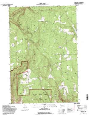
Appleton Topo Map Washington
To zoom in, hover over the map of Appleton
USGS Topo Quad 45121g3 - 1:24,000 scale
| Topo Map Name: | Appleton |
| USGS Topo Quad ID: | 45121g3 |
| Print Size: | ca. 21 1/4" wide x 27" high |
| Southeast Coordinates: | 45.75° N latitude / 121.25° W longitude |
| Map Center Coordinates: | 45.8125° N latitude / 121.3125° W longitude |
| U.S. State: | WA |
| Filename: | o45121g3.jpg |
| Download Map JPG Image: | Appleton topo map 1:24,000 scale |
| Map Type: | Topographic |
| Topo Series: | 7.5´ |
| Map Scale: | 1:24,000 |
| Source of Map Images: | United States Geological Survey (USGS) |
| Alternate Map Versions: |
Appleton WA 1983, updated 1983 Download PDF Buy paper map Appleton WA 1994, updated 1995 Download PDF Buy paper map Appleton WA 2011 Download PDF Buy paper map Appleton WA 2014 Download PDF Buy paper map |
| FStopo: | US Forest Service topo Appleton is available: Download FStopo PDF Download FStopo TIF |
1:24,000 Topo Quads surrounding Appleton
> Back to 45121e1 at 1:100,000 scale
> Back to 45120a1 at 1:250,000 scale
> Back to U.S. Topo Maps home
Appleton topo map: Gazetteer
Appleton: Dams
Graves Dam elevation 722m 2368′Appleton: Flats
Snyder Swale elevation 640m 2099′Appleton: Lakes
Waterhole elevation 760m 2493′Appleton: Populated Places
Appleton elevation 707m 2319′Klickitat Heights elevation 738m 2421′
Snowden elevation 710m 2329′
Appleton: Springs
Baker Spring elevation 772m 2532′Beaver Pond elevation 637m 2089′
Blove Spring elevation 744m 2440′
Conklin Spring elevation 718m 2355′
Curl Spring elevation 658m 2158′
Ellard Spring elevation 719m 2358′
McGowen Spring elevation 686m 2250′
Snyder Spring elevation 654m 2145′
Appleton: Streams
Mill Creek elevation 355m 1164′Appleton digital topo map on disk
Buy this Appleton topo map showing relief, roads, GPS coordinates and other geographical features, as a high-resolution digital map file on DVD:


