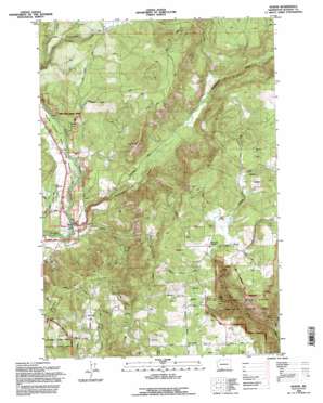
Husum Topo Map Washington
To zoom in, hover over the map of Husum
USGS Topo Quad 45121g4 - 1:24,000 scale
| Topo Map Name: | Husum |
| USGS Topo Quad ID: | 45121g4 |
| Print Size: | ca. 21 1/4" wide x 27" high |
| Southeast Coordinates: | 45.75° N latitude / 121.375° W longitude |
| Map Center Coordinates: | 45.8125° N latitude / 121.4375° W longitude |
| U.S. State: | WA |
| Filename: | o45121g4.jpg |
| Download Map JPG Image: | Husum topo map 1:24,000 scale |
| Map Type: | Topographic |
| Topo Series: | 7.5´ |
| Map Scale: | 1:24,000 |
| Source of Map Images: | United States Geological Survey (USGS) |
| Alternate Map Versions: |
Husum WA 1983, updated 1983 Download PDF Buy paper map Husum WA 1994, updated 1996 Download PDF Buy paper map Husum WA 2011 Download PDF Buy paper map Husum WA 2014 Download PDF Buy paper map |
| FStopo: | US Forest Service topo Husum is available: Download FStopo PDF Download FStopo TIF |
1:24,000 Topo Quads surrounding Husum
> Back to 45121e1 at 1:100,000 scale
> Back to 45120a1 at 1:250,000 scale
> Back to U.S. Topo Maps home
Husum topo map: Gazetteer
Husum: Airports
Port Elsner Airport elevation 299m 980′Husum: Dams
Spencer Reservoir Dam elevation 142m 465′Husum: Flats
McCoy Flat elevation 409m 1341′Husum: Populated Places
Gilmer elevation 416m 1364′Husum elevation 126m 413′
Laws Corner elevation 595m 1952′
Mountain Brook elevation 575m 1886′
Husum: Reservoirs
Spencer Reservoir elevation 142m 465′Husum: Streams
East Fork Major Creek elevation 226m 741′Hangman Creek elevation 307m 1007′
Indian Creek elevation 132m 433′
Kline Creek elevation 420m 1377′
Rattlesnake Creek elevation 120m 393′
West Fork Major Creek elevation 226m 741′
Husum digital topo map on disk
Buy this Husum topo map showing relief, roads, GPS coordinates and other geographical features, as a high-resolution digital map file on DVD:


