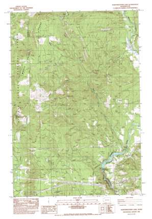
Northwestern Lake Topo Map Washington
To zoom in, hover over the map of Northwestern Lake
USGS Topo Quad 45121g5 - 1:24,000 scale
| Topo Map Name: | Northwestern Lake |
| USGS Topo Quad ID: | 45121g5 |
| Print Size: | ca. 21 1/4" wide x 27" high |
| Southeast Coordinates: | 45.75° N latitude / 121.5° W longitude |
| Map Center Coordinates: | 45.8125° N latitude / 121.5625° W longitude |
| U.S. State: | WA |
| Filename: | o45121g5.jpg |
| Download Map JPG Image: | Northwestern Lake topo map 1:24,000 scale |
| Map Type: | Topographic |
| Topo Series: | 7.5´ |
| Map Scale: | 1:24,000 |
| Source of Map Images: | United States Geological Survey (USGS) |
| Alternate Map Versions: |
Northwestern Lake WA 1983, updated 1983 Download PDF Buy paper map Northwestern Lake WA 1994, updated 1997 Download PDF Buy paper map Penny Ridge WA 2011 Download PDF Buy paper map Penny Ridge WA 2014 Download PDF Buy paper map |
| FStopo: | US Forest Service topo Northwestern Lake is available: Download FStopo PDF Download FStopo TIF |
1:24,000 Topo Quads surrounding Northwestern Lake
> Back to 45121e1 at 1:100,000 scale
> Back to 45120a1 at 1:250,000 scale
> Back to U.S. Topo Maps home
Northwestern Lake topo map: Gazetteer
Northwestern Lake: Dams
Condit Dam elevation 94m 308′Northwestern Lake: Flats
Mill B Flat elevation 333m 1092′Northwestern Lake: Gaps
McIlroy Saddle elevation 616m 2020′Northwestern Lake: Populated Places
B Z Corner elevation 198m 649′Northwestern Lake: Reservoirs
Northwestern Lake elevation 94m 308′Northwestern Lake: Ridges
Penny Ridge elevation 991m 3251′Whistling Ridge elevation 865m 2837′
Northwestern Lake: Streams
Buck Creek elevation 92m 301′Gilmer Creek elevation 212m 695′
Little Buck Creek elevation 97m 318′
Middle Fork Buck Creek elevation 1136m 3727′
Mill Creek elevation 121m 396′
North Fork Buck Creek elevation 1182m 3877′
South Fork Buck Creek elevation 1003m 3290′
Spring Creek elevation 91m 298′
Spring Creek elevation 104m 341′
Northwestern Lake: Summits
Bald Mountain elevation 498m 1633′Baldy Peak elevation 774m 2539′
Green Mountain elevation 427m 1400′
Little Baldy Peak elevation 855m 2805′
Monte Carlo elevation 1224m 4015′
Nestor Peak elevation 931m 3054′
Timberhead Mountain elevation 1111m 3645′
Underwood Mountain elevation 835m 2739′
Northwestern Lake: Swamps
Cedar Swamp elevation 620m 2034′Northwestern Lake: Trails
Homes Trail elevation 802m 2631′Little Baldy Trail elevation 1029m 3375′
Northwestern Lake: Valleys
McIlroy Canyon elevation 242m 793′McLlroy Canyon elevation 220m 721′
Northwestern Lake digital topo map on disk
Buy this Northwestern Lake topo map showing relief, roads, GPS coordinates and other geographical features, as a high-resolution digital map file on DVD:


