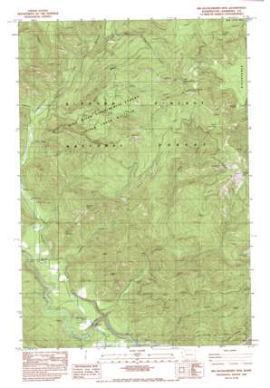
Big Huckleberry Mountain Topo Map Washington
To zoom in, hover over the map of Big Huckleberry Mountain
USGS Topo Quad 45121g7 - 1:24,000 scale
| Topo Map Name: | Big Huckleberry Mountain |
| USGS Topo Quad ID: | 45121g7 |
| Print Size: | ca. 21 1/4" wide x 27" high |
| Southeast Coordinates: | 45.75° N latitude / 121.75° W longitude |
| Map Center Coordinates: | 45.8125° N latitude / 121.8125° W longitude |
| U.S. State: | WA |
| Filename: | o45121g7.jpg |
| Download Map JPG Image: | Big Huckleberry Mountain topo map 1:24,000 scale |
| Map Type: | Topographic |
| Topo Series: | 7.5´ |
| Map Scale: | 1:24,000 |
| Source of Map Images: | United States Geological Survey (USGS) |
| Alternate Map Versions: |
Big Huckleberry Mtn WA 1983, updated 1983 Download PDF Buy paper map Big Huckleberry Mtn WA 1994, updated 1997 Download PDF Buy paper map Big Huckleberry Mountain WA 2011 Download PDF Buy paper map Big Huckleberry Mountain WA 2014 Download PDF Buy paper map |
| FStopo: | US Forest Service topo Big Huckleberry Mountain is available: Download FStopo PDF Download FStopo TIF |
1:24,000 Topo Quads surrounding Big Huckleberry Mountain
> Back to 45121e1 at 1:100,000 scale
> Back to 45120a1 at 1:250,000 scale
> Back to U.S. Topo Maps home
Big Huckleberry Mountain topo map: Gazetteer
Big Huckleberry Mountain: Springs
Cold Spring elevation 1166m 3825′Big Huckleberry Mountain: Streams
Bear Creek elevation 114m 374′Big Huckleberry Creek elevation 564m 1850′
Cedar Creek elevation 270m 885′
Eightmile Creek elevation 312m 1023′
Jimmy Creek elevation 212m 695′
Mouse Creek elevation 324m 1062′
Panther Creek elevation 114m 374′
South Fork Mouse Creek elevation 521m 1709′
Stub Creek elevation 295m 967′
Tenmile Creek elevation 367m 1204′
Twelvemile Creek elevation 452m 1482′
Big Huckleberry Mountain: Summits
Big Huckleberry Mountain elevation 1283m 4209′Gobblers Knob elevation 677m 2221′
Grassy Knoll elevation 1113m 3651′
Weigle Hill elevation 767m 2516′
Big Huckleberry Mountain: Trails
Brush Creek Trail elevation 585m 1919′Cedar Creek Trail elevation 841m 2759′
Huckleberry Trail elevation 855m 2805′
Big Huckleberry Mountain digital topo map on disk
Buy this Big Huckleberry Mountain topo map showing relief, roads, GPS coordinates and other geographical features, as a high-resolution digital map file on DVD:


