Camas Prairie Topo Map Washington
To zoom in, hover over the map of Camas Prairie
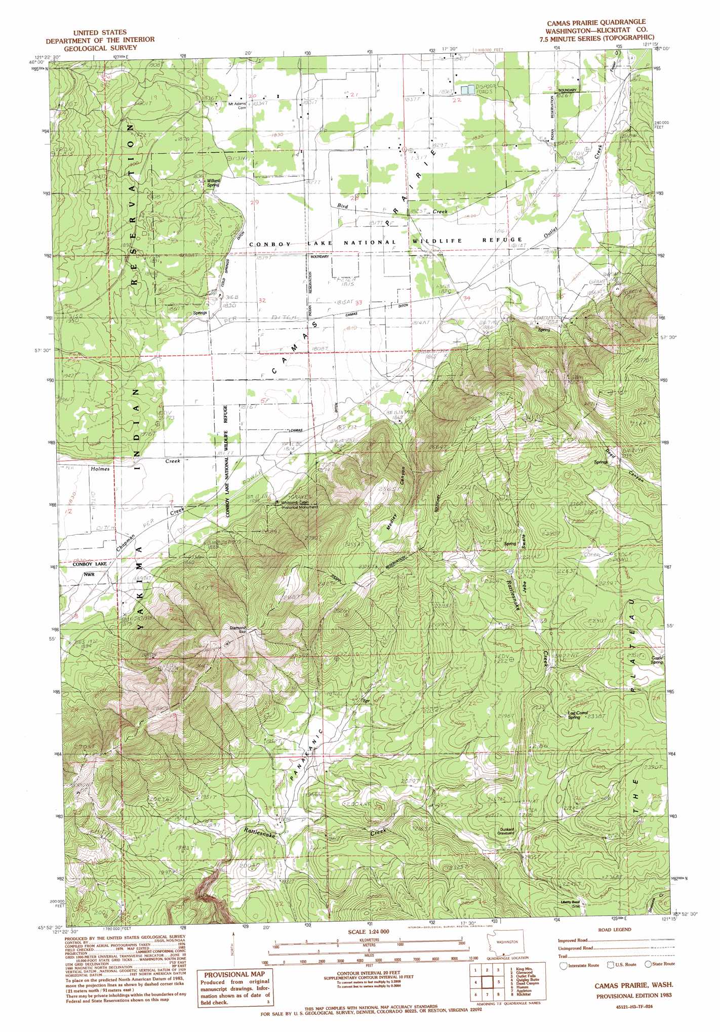
USGS Topo Quad 45121h3 - 1:24,000 scale
| Topo Map Name: | Camas Prairie |
| USGS Topo Quad ID: | 45121h3 |
| Print Size: | ca. 21 1/4" wide x 27" high |
| Southeast Coordinates: | 45.875° N latitude / 121.25° W longitude |
| Map Center Coordinates: | 45.9375° N latitude / 121.3125° W longitude |
| U.S. State: | WA |
| Filename: | o45121h3.jpg |
| Download Map JPG Image: | Camas Prairie topo map 1:24,000 scale |
| Map Type: | Topographic |
| Topo Series: | 7.5´ |
| Map Scale: | 1:24,000 |
| Source of Map Images: | United States Geological Survey (USGS) |
| Alternate Map Versions: |
Camas Prairie WA 1983, updated 1983 Download PDF Buy paper map Camas Prairie WA 2011 Download PDF Buy paper map Camas Prairie WA 2014 Download PDF Buy paper map |
1:24,000 Topo Quads surrounding Camas Prairie
Mount Adams West |
Mount Adams East |
Jungle Butte |
Signal Peak |
Poland Butte |
Trout Lake |
King Mountain |
Glenwood |
Outlet Falls |
Twin Buttes |
Guler Mountain |
Quigley Butte |
Camas Prairie |
Dead Canyon |
Grayback Mountain |
Northwestern Lake |
Husum |
Appleton |
Klickitat |
Wahkiacus |
Hood River |
White Salmon |
Lyle |
The Dalles North |
Stacker Butte |
> Back to 45121e1 at 1:100,000 scale
> Back to 45120a1 at 1:250,000 scale
> Back to U.S. Topo Maps home
Camas Prairie topo map: Gazetteer
Camas Prairie: Dams
Panakanic Water Works Dam elevation 591m 1938′Camas Prairie: Flats
Camas Prairie elevation 554m 1817′Panakanic Prairie elevation 577m 1893′
Camas Prairie: Lakes
Conboy Lake elevation 555m 1820′Camas Prairie: Parks
Conboy Lake National Wildlife Refuge elevation 554m 1817′Whitcomb Cabin elevation 572m 1876′
Camas Prairie: Springs
Castle Spring elevation 693m 2273′Log Corral Spring elevation 691m 2267′
Willard Spring elevation 559m 1833′
Camas Prairie: Streams
Bird Creek elevation 555m 1820′Chapman Creek elevation 555m 1820′
Cold Springs Ditch elevation 558m 1830′
Frasier Creek elevation 553m 1814′
Holmes Creek elevation 554m 1817′
Jebe Swale elevation 653m 2142′
Camas Prairie: Valleys
Medley Canyon elevation 572m 1876′Camas Prairie digital topo map on disk
Buy this Camas Prairie topo map showing relief, roads, GPS coordinates and other geographical features, as a high-resolution digital map file on DVD: