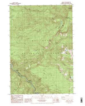
Three Lynx Topo Map Oregon
To zoom in, hover over the map of Three Lynx
USGS Topo Quad 45122b1 - 1:24,000 scale
| Topo Map Name: | Three Lynx |
| USGS Topo Quad ID: | 45122b1 |
| Print Size: | ca. 21 1/4" wide x 27" high |
| Southeast Coordinates: | 45.125° N latitude / 122° W longitude |
| Map Center Coordinates: | 45.1875° N latitude / 122.0625° W longitude |
| U.S. State: | OR |
| Filename: | o45122b1.jpg |
| Download Map JPG Image: | Three Lynx topo map 1:24,000 scale |
| Map Type: | Topographic |
| Topo Series: | 7.5´ |
| Map Scale: | 1:24,000 |
| Source of Map Images: | United States Geological Survey (USGS) |
| Alternate Map Versions: |
Three Lynx OR 1985, updated 1986 Download PDF Buy paper map Three Lynx OR 1985, updated 1986 Download PDF Buy paper map Three Lynx OR 1997, updated 1999 Download PDF Buy paper map Three Lynx OR 2011 Download PDF Buy paper map Three Lynx OR 2014 Download PDF Buy paper map |
| FStopo: | US Forest Service topo Three Lynx is available: Download FStopo PDF Download FStopo TIF |
1:24,000 Topo Quads surrounding Three Lynx
> Back to 45122a1 at 1:100,000 scale
> Back to 45122a1 at 1:250,000 scale
> Back to U.S. Topo Maps home
Three Lynx topo map: Gazetteer
Three Lynx: Flats
Tumala Meadow elevation 1081m 3546′Three Lynx: Gaps
The Narrows elevation 316m 1036′Three Lynx: Lakes
Huxley Lake elevation 778m 2552′Serene Lake elevation 1301m 4268′
Shining Lake elevation 1188m 3897′
Tumala Lakes elevation 1085m 3559′
Three Lynx: Populated Places
Three Lynx elevation 403m 1322′Three Lynx: Streams
Cat Creek elevation 327m 1072′Deer Creek elevation 329m 1079′
Dinner Creek elevation 326m 1069′
Grouse Creek elevation 347m 1138′
Monty Creek elevation 282m 925′
Plaza Creek elevation 677m 2221′
Pup Creek elevation 324m 1062′
Roaring River elevation 292m 958′
Shining Creek elevation 618m 2027′
South Fork Roaring River elevation 528m 1732′
Three Lynx Creek elevation 341m 1118′
Tumala Creek elevation 658m 2158′
Three Lynx: Summits
Grouse Point elevation 1367m 4484′Sheepshead Rock elevation 1361m 4465′
Tumala Mountain elevation 1435m 4708′
Three Lynx: Trails
Corral Springs Trail elevation 753m 2470′Dry Ridge Trail elevation 1001m 3284′
Fanton Plaza Trail elevation 1095m 3592′
Three Lynx digital topo map on disk
Buy this Three Lynx topo map showing relief, roads, GPS coordinates and other geographical features, as a high-resolution digital map file on DVD:


