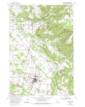
Molalla Topo Map Oregon
To zoom in, hover over the map of Molalla
USGS Topo Quad 45122b5 - 1:24,000 scale
| Topo Map Name: | Molalla |
| USGS Topo Quad ID: | 45122b5 |
| Print Size: | ca. 21 1/4" wide x 27" high |
| Southeast Coordinates: | 45.125° N latitude / 122.5° W longitude |
| Map Center Coordinates: | 45.1875° N latitude / 122.5625° W longitude |
| U.S. State: | OR |
| Filename: | o45122b5.jpg |
| Download Map JPG Image: | Molalla topo map 1:24,000 scale |
| Map Type: | Topographic |
| Topo Series: | 7.5´ |
| Map Scale: | 1:24,000 |
| Source of Map Images: | United States Geological Survey (USGS) |
| Alternate Map Versions: |
Molalla OR 1954, updated 1956 Download PDF Buy paper map Molalla OR 1954, updated 1971 Download PDF Buy paper map Molalla OR 1954, updated 1980 Download PDF Buy paper map Molalla OR 1954, updated 1985 Download PDF Buy paper map Molalla OR 2011 Download PDF Buy paper map Molalla OR 2014 Download PDF Buy paper map |
1:24,000 Topo Quads surrounding Molalla
> Back to 45122a1 at 1:100,000 scale
> Back to 45122a1 at 1:250,000 scale
> Back to U.S. Topo Maps home
Molalla topo map: Gazetteer
Molalla: Airports
Hutchinson Airfield elevation 105m 344′Mulino Airfield elevation 75m 246′
Molalla: Areas
Molalla Prairie elevation 99m 324′Molalla: Bridges
Dickey Bridge elevation 126m 413′Meadowbrook Bridge elevation 92m 301′
Wrights Bridge elevation 71m 232′
Molalla: Dams
C C Porter Dam elevation 146m 479′Molalla: Lakes
Big Rock Lake elevation 154m 505′Cedar Grove Lake elevation 146m 479′
Molalla: Parks
Feyer County Park elevation 111m 364′Wagonwheel Park elevation 71m 232′
Molalla: Populated Places
Liberal elevation 77m 252′Molalla elevation 115m 377′
Mulino elevation 74m 242′
Shady Dell elevation 108m 354′
Union Mills elevation 75m 246′
Molalla: Post Offices
Beaver Post Office (historical) elevation 208m 682′Liberal Post Office (historical) elevation 77m 252′
Meadowbrook Post Office (historical) elevation 111m 364′
Molalla Post Office elevation 115m 377′
Mulino Post Office elevation 74m 242′
Union Mills Post Office (historical) elevation 75m 246′
Molalla: Reservoirs
C C Porter Reservoir elevation 146m 479′Crescent Lake Reservoir elevation 62m 203′
Hillside Reservoir elevation 142m 465′
Molalla: Streams
Beaver Creek elevation 68m 223′Buckner Creek elevation 61m 200′
Cedar Creek elevation 74m 242′
Charman Creek elevation 68m 223′
Hooter Creek elevation 53m 173′
Little Cedar Creek elevation 83m 272′
Sorenson Creek elevation 129m 423′
Woodcock Creek elevation 92m 301′
Wright Creek (historical) elevation 92m 301′
Molalla digital topo map on disk
Buy this Molalla topo map showing relief, roads, GPS coordinates and other geographical features, as a high-resolution digital map file on DVD:


