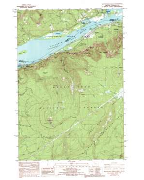
Multnomah Falls Topo Map Oregon
To zoom in, hover over the map of Multnomah Falls
USGS Topo Quad 45122e1 - 1:24,000 scale
| Topo Map Name: | Multnomah Falls |
| USGS Topo Quad ID: | 45122e1 |
| Print Size: | ca. 21 1/4" wide x 27" high |
| Southeast Coordinates: | 45.5° N latitude / 122° W longitude |
| Map Center Coordinates: | 45.5625° N latitude / 122.0625° W longitude |
| U.S. States: | OR, WA |
| Filename: | o45122e1.jpg |
| Download Map JPG Image: | Multnomah Falls topo map 1:24,000 scale |
| Map Type: | Topographic |
| Topo Series: | 7.5´ |
| Map Scale: | 1:24,000 |
| Source of Map Images: | United States Geological Survey (USGS) |
| Alternate Map Versions: |
Multnomah Falls OR 1986, updated 1986 Download PDF Buy paper map Multnomah Falls OR 1986, updated 1994 Download PDF Buy paper map Multnomah Falls OR 1994, updated 1997 Download PDF Buy paper map Multnomah Falls OR 2011 Download PDF Buy paper map Multnomah Falls OR 2014 Download PDF Buy paper map |
| FStopo: | US Forest Service topo Multnomah Falls is available: Download FStopo PDF Download FStopo TIF |
1:24,000 Topo Quads surrounding Multnomah Falls
> Back to 45122e1 at 1:100,000 scale
> Back to 45122a1 at 1:250,000 scale
> Back to U.S. Topo Maps home
Multnomah Falls topo map: Gazetteer
Multnomah Falls: Areas
Oneonta Gorge Botanical Area elevation 208m 682′Multnomah Falls: Bars
Multnomah Falls Bar elevation 6m 19′Multnomah Falls: Channels
McGowans Channel elevation 6m 19′Multnomah Falls Bar Range elevation 6m 19′
Multnomah Falls Upper Range elevation 6m 19′
Warrendale Lower Range elevation 6m 19′
Multnomah Falls: Dams
North Fork Dam elevation 918m 3011′Woodard Dam elevation 7m 22′
Multnomah Falls: Falls
Horsetail Falls elevation 179m 587′Multnomah Falls elevation 191m 626′
Oneonta Falls elevation 149m 488′
Wiesendanger Falls elevation 324m 1062′
Multnomah Falls: Flats
Latourell Prairie elevation 956m 3136′Wahclella Natural Park elevation 73m 239′
Multnomah Falls: Islands
Pierce Island elevation 10m 32′Skamania Island elevation 8m 26′
Multnomah Falls: Lakes
Franz Lake elevation 7m 22′Ridell Lake elevation 46m 150′
Multnomah Falls: Parks
Ainsworth State Park elevation 65m 213′McLoughlin State Park elevation 100m 328′
Multnomah Falls: Pillars
Saint Peters Dome elevation 342m 1122′Multnomah Falls: Populated Places
Dodson elevation 33m 108′Saint Cloud elevation 21m 68′
Skamania elevation 28m 91′
Warrendale elevation 20m 65′
Multnomah Falls: Post Offices
Oneonta Post Office (historical) elevation 14m 45′Warrendale Post Office (historical) elevation 20m 65′
Multnomah Falls: Ridges
Waespe Point elevation 339m 1112′Multnomah Falls: Springs
Wahkeena Spring elevation 361m 1184′Multnomah Falls: Streams
Bell Creek elevation 545m 1788′Butler Creek elevation 862m 2828′
Duncan Creek elevation 8m 26′
Horsetail Creek elevation 14m 45′
Indian Mary Creek elevation 9m 29′
Little Creek elevation 13m 42′
McCord Creek elevation 37m 121′
Multnomah Creek elevation 10m 32′
North Fork Gordon Creek elevation 763m 2503′
Oneonta Creek elevation 6m 19′
Tumalt Creek elevation 28m 91′
Woodard Creek elevation 6m 19′
Multnomah Falls: Summits
Archer Mountain elevation 604m 1981′Larch Mountain elevation 1203m 3946′
Nesmith Point elevation 1173m 3848′
Palmer Peak elevation 1195m 3920′
Sherrard Point elevation 1157m 3795′
Yeon Mountain elevation 1006m 3300′
Multnomah Falls: Trails
Cougar Trail elevation 683m 2240′Multnomah Falls: Valleys
Oneonta Gorge elevation 14m 45′Multnomah Falls digital topo map on disk
Buy this Multnomah Falls topo map showing relief, roads, GPS coordinates and other geographical features, as a high-resolution digital map file on DVD:


